


Get to know Ningnan County
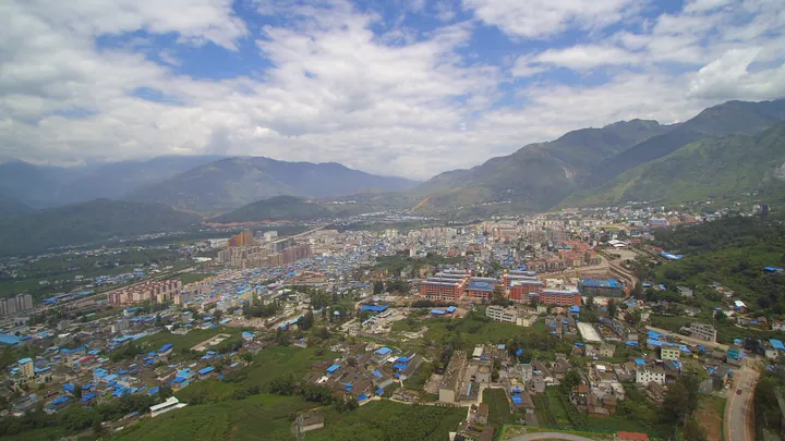
Photo adjustments
Full frame retained; proportionally resized and converted to WebP. No retouching or changes to the photographed subject. Card displays may crop the view.
- Administrative area
- County · 县
- Part of
- Liangshan Yi Autonomous Prefecture
- Chinese name
- 宁南县
- Local areas
- County guide
Area & population
- Area in the source
- 1,667.00 km²
- Population · 2020
- 184,293
- Administrative seat
- Ningyuan
Source: cited geographic source, as of the dates shown.
Springs and tea hills
Kaidilila Hot Springs (凯地里拉温泉), Jinzhong Mountain (金钟山) and Xingfu Tea Ridge (幸福茶岭) are among Ningnan's scenic places. The county's main waterways are the Jinsha and Heishui rivers (黑水河), with smaller mountain streams feeding the same river system. Ningnan was also a waystation on the Tea Horse Road (茶马古道) and Southern Silk Road (南方丝绸之路).
Mulberries and local tables
Sericulture extends across all thirteen towns, linking mulberry fields with silkworm rearing and silk production. The Silk-and-Mulberry Banquet (蚕桑宴), Buyi farmhouse meals (布依农家饭) and Yi-style Tuotuo meat (彝家坨坨肉) are named local foods. At the Buyi Third-Month Festival (布依族三月三), activities include catching fish in rice paddies and making ciba rice cakes (糍粑).
Sources for this guide
【美丽四川】走进大凉山——宁南 _四川风物_四川印象_四川省情网 · Sichuan Provincial Local Chronicles Office
四川·“畅游山水”体验民俗风情之旅 · Ministry of Culture and Tourism
Original English written from the listed sources and checked sentence by sentence against quoted extracts by a separate reviewer. Updated 2026-09-26.
Explore Ningnan County
Core places to explore, with English and Chinese names.
Ningnan County 宁南县
Plan your visit
Getting there
Ningnan County is about 100 km in a straight line from central Liangshan Yi Autonomous Prefecture. Search for 宁南县 in a map app to find stations and your accommodation.
Where to stay →More in Liangshan Yi Autonomous Prefecture
Sources & geographic information
Administrative names and parent areas: Official geographic directory · Reference date 2026-09-06.
Map data © OpenStreetMap contributors. Pins mark approximate centres, not entrances or boundaries.