


Get to know Ji'an Township
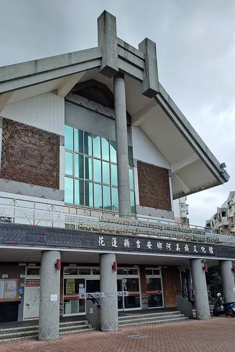
Photo adjustments
EXIF orientation normalized; resized without changing aspect ratio; converted to WebP. No subject edits.
- Administrative area
- Rural township · 鄉
- Part of
- Hualien County
- Chinese name
- 吉安鄉
- Local areas
- Rural township guide
Area & population
- Area in the source
- 65.26 km²
Source: cited geographic source, as of the dates shown.
Qingxiu Temple
The wooden main hall has a pyramidal roof and surrounding corridors. At the garden entrance, a purification basin and a stone pillar inscribed Baidu Stone (百度石) recall worshippers’ preparations and prayers. Eighty-eight stone Buddhas line a wall, representing a miniature version of the Shikoku (四國) pilgrimage that immigrants could undertake without travelling to Japan.
Cihui Temple
Cihui Temple has a double-eaved roof decorated with ceramic appliqué and glazed pottery. Inside, a statue of the Golden Mother of the Jade Pool (瑤池金母) stands beneath a layered, recessed ceiling. Steps on either side lead to Lingxiao Hall (凌霄寶殿) behind the main hall. Sheng'an Temple (勝安宮) is separated from Cihui by just a wall.
Sources for this guide
吉安慶修院-花蓮旅遊網 · Hualien County Government
慈惠堂-花蓮旅遊網 · Hualien County Government
Original English written from the listed sources and checked sentence by sentence against quoted extracts by a separate reviewer. Updated 2026-09-27.
Explore Ji'an Township
Core places to explore, with English and Chinese names.
Ji'an Township 吉安鄉
Plan your visit
Getting there
Ji'an Township is about 4 km in a straight line from central Hualien County. Search for 吉安鄉 in a map app to find stations and your accommodation.
Where to stay →More in Hualien County
Sources & geographic information
Administrative names and parent areas: Official geographic directory · Reference date 2026-09-06.
Map data © OpenStreetMap contributors. Pins mark approximate centres, not entrances or boundaries.