


Get to know Fengbin Township
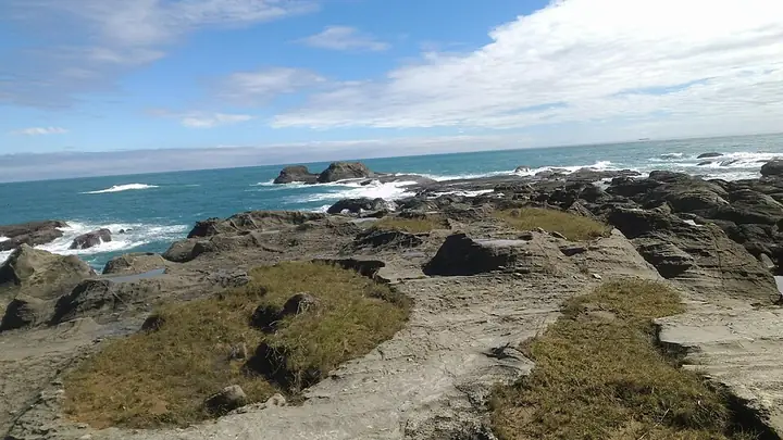
Photo adjustments
Full-frame source proportionally resized and converted to WebP for display. No subject alteration. Source-supplied marks and edits remain; cards may crop the view.
- Administrative area
- Rural township · 鄉
- Part of
- Hualien County
- Chinese name
- 豐濱鄉
- Local areas
- Rural township guide
Area & population
- Area in the source
- 162.40 km²
Source: cited geographic source, as of the dates shown.
Rock platforms and rice terraces
Shitiping (石梯坪) has wave-cut platforms, potholes and layered rocky shores, with tuff among its visible rock formations. At Xinshe, rice terraces overlook the sea, placing fields, mountains and ocean in the same view. Baji Lookout (芭崎眺望台), on a high point of the highway, looks across Jiqi Bay (磯崎灣) and the surrounding headlands.
Flying fish and black beans
Flying fish are smoked over longan or acacia wood, or slowly grilled fresh. At Dagangkou (大港口), Amis growers cultivate black beans and turn them into fermented beans and black-bean sauce. Local wild vegetables also feature in soups cooked with pork.
Sources for this guide
豐濱鄉-花蓮旅遊網 · Hualien County Government
Original English written from the listed sources and checked sentence by sentence against quoted extracts by a separate reviewer. Updated 2026-09-27.
Explore Fengbin Township
Core places to explore, with English and Chinese names.
Places to explore around Fengbin Township
Plan your visit
Getting there
Fengbin Township is about 45 km in a straight line from central Hualien County. Search for 豐濱鄉 in a map app to find stations and your accommodation.
Where to stay →Build your route
Start with Shitiping Coastal Terraces. The linked place guides have entrance and visit details.
Continue with Hualien County →More in Hualien County
Sources & geographic information
Administrative names and parent areas: Official geographic directory · Reference date 2026-09-06.
Photo: Shitiping Coastal Terraces · Thouyutim · CC BY-SA 4.0. Full-frame source proportionally resized and converted to WebP for display. No subject alteration. Source-supplied marks and edits remain; cards may crop the view.

Map data © OpenStreetMap contributors. Pins mark approximate centres, not entrances or boundaries.