


Get to know Guangfu Township
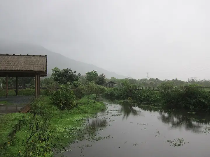
Photo adjustments
Full-frame source proportionally resized and converted to WebP for display. No subject alteration. Source-supplied marks and edits remain; cards may crop the view.
- Administrative area
- Rural township · 鄉
- Part of
- Hualien County
- Chinese name
- 光復鄉
- Local areas
- Rural township guide
Area & population
- Area in the source
- 157.11 km²
Source: cited geographic source, as of the dates shown.
Forests and sugar works
Dalongdafu Forest Park (大農大富平地森林園區) has broad woodland paths and grassy spaces for walking and cycling. The Hualien Sugar Factory (花蓮觀光糖廠), founded in 1921, retains Japanese-period wooden dormitories and railway tracks once used to transport sugar cane. Its ice treats use the factory’s own cane sugar, with flavours including red bean and taro.
Red glutinous rice
At Tafalong (太巴塱), red glutinous rice (紅糯米) is a traditional crop with dark-red grains and a distinctive aroma. Harvested once a year, it is sold as grain and made into products such as mochi and fermented rice. Stone hotpot (石頭火鍋) is another food associated with local indigenous restaurants.
Sources for this guide
光復鄉-花蓮旅遊網 · Hualien County Government
Original English written from the listed sources and checked sentence by sentence against quoted extracts by a separate reviewer. Updated 2026-09-27.
Explore Guangfu Township
Core places to explore, with English and Chinese names.
Places to explore around Guangfu Township
Plan your visit
Getting there
Guangfu Township is about 40 km in a straight line from central Hualien County. Search for 光復鄉 in a map app to find stations and your accommodation.
Where to stay →Build your route
Start with Mataian Wetland. The linked place guides have entrance and visit details.
Continue with Hualien County →More in Hualien County
Sources & geographic information
Administrative names and parent areas: Official geographic directory · Reference date 2026-09-06.
Photo: Mataian Wetland · Bellenion · CC BY-SA 3.0. Full-frame source proportionally resized and converted to WebP for display. No subject alteration. Source-supplied marks and edits remain; cards may crop the view.

Map data © OpenStreetMap contributors. Pins mark approximate centres, not entrances or boundaries.