


Get to know Cijin District
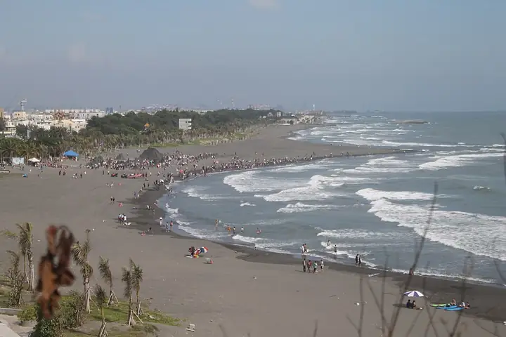
Photo adjustments
Full-frame source proportionally resized and converted to WebP for display. No subject alteration. Source-supplied marks and edits remain; cards may crop the view.
- Administrative area
- District · 區
- Part of
- Kaohsiung City
- Chinese name
- 旗津區
- Local areas
- District guide
Area & population
- Area in the source
- 1.46 km²
Source: cited geographic source, as of the dates shown.
From the terminal to the shore
Cijin Ferry Terminal (旗津輪渡站) retains its distinctive black roof and a facade finished with glazed tiles reproducing its older brick colour. Inside, transparent display panels expose the terminal’s seismic damping walls. In its second waiting room, the I-Center (旗津深度旅遊中心) provides local maps and displays creative products by young local makers. The Star Tunnel (星空隧道), reached through lanes off Miaoqian Road, has luminous star paintings inside and leads out to waves striking the coastal rocks.
Lighthouse views
From the viewing platform at the base of Kaohsiung Lighthouse (高雄燈塔), the view takes in harbour shipping, the Cijin settlement and distant mountains.
Sources for this guide
旗津輪渡站新貌 開啟海岸輕旅行路線 - 高雄畫刊-高雄市政府新聞局 · Kaohsiung City Government Information Bureau
Original English written from the listed sources and checked sentence by sentence against quoted extracts by a separate reviewer. Updated 2026-09-27.
Explore Cijin District
Core places to explore, with English and Chinese names.
Places to explore around Cijin District
Cijin Beach in Kaohsiung's Cijin District · 高雄旗津区旗津海滩 Source-recorded photograph date: 2015-07-25 03:04:29.Cijin District旗津
Cijin is a long coastal district at the mouth of Kaohsiung’s harbour. The ferry arrival brings you into a neighbourhood of temples, food streets and seafront paths. Cihou Fort adds defensive history through its brickwork…
Read the place guide →Cijin Beach on the coast of Kaohsiung · 高雄旗津海岸的旗津海滩 Source-recorded photograph date: 2015-07-25 03:04:29.Cijin Old Street and Coast旗津老街与海岸
Cijin is a long, narrow coastal district beside the entrance to Kaohsiung Harbour.
Read the place guide →Plan your visit
Getting there
Cijin District is about 6 km in a straight line from central Kaohsiung City. Search for 旗津區 in a map app to find stations and your accommodation.
Where to stay →Build your route
Cijin District and Cijin Old Street and Coast are both listed here. The linked place guides have entrance and visit details.
Continue with Kaohsiung City →More in Kaohsiung City
Sources & geographic information
Administrative names and parent areas: Official geographic directory · Reference date 2026-09-06.
Photo: Cijin District · ironypoisoning · CC BY-SA 2.0. Full-frame source proportionally resized and converted to WebP for display. No subject alteration. Source-supplied marks and edits remain; cards may crop the view.

Photo: Cijin Old Street and Coast · ironypoisoning · CC BY-SA 2.0. Full-frame source proportionally resized and converted to WebP for display. No subject alteration. Source-supplied marks and edits remain; cards may crop the view.
Map data © OpenStreetMap contributors. Pins mark approximate centres, not entrances or boundaries.