


Get to know Fengyuan District
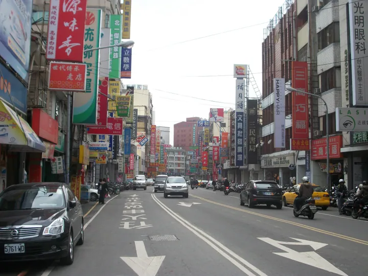
Photo adjustments
Full frame retained; proportionally resized and converted to WebP. No retouching or changes to the photographed subject. Card displays may crop the view.
- Administrative area
- District · 區
- Part of
- Taichung City
- Chinese name
- 豐原區
- Local areas
- District guide
Area & population
- Area in the source
- 41.18 km²
Source: cited geographic source, as of the dates shown.
Former railway and riverside park
The Houfeng cycle route (后豐鐵馬道) links Fengyuan with Houli, using a former railway corridor that includes Tunnel No. 9 (九號隧道) and Hualiang Steel Bridge (花梁鋼橋). Its landmarks extend beyond Fengyuan. Huludun Park (葫蘆墩公園), beside the river in Fengyuan, was one of the venues for the 2018 flower exposition.
Miso and the temple market
Taiwan Miso Brewing Culture Museum (臺灣味噌釀造文化館) explains how miso is made and offers related food experiences. Miaodong Night Market (廟東夜市) sits beside Ciji Temple, with older food businesses around Zhongzheng Road (中正路), Boai Street (博愛街), Fuxing Road (復興路) and Xinyi Street (信義街). Fengyuan railway station provides the district’s rail access.
Sources for this guide
〖宅.在台中|丰原区〗 · Taichung Tourism and Travel Bureau
Fengyuan District · Wikipedia contributors · CC BY-SA 4.0
Original English written from the listed sources and checked sentence by sentence against quoted extracts by a separate reviewer. Updated 2026-09-30.
Explore Fengyuan District
Core places to explore, with English and Chinese names.
Fengyuan District 豐原區
Plan your visit
Getting there
Fengyuan District is about 10 km in a straight line from central Taichung City. Search for 豐原區 in a map app to find stations and your accommodation.
Where to stay →More in Taichung City
Sources & geographic information
Administrative names and parent areas: Official geographic directory · Reference date 2026-09-06.
Some facts checked against Fengyuan District — Wikipedia contributors, CC BY-SA 4.0.
Map data © OpenStreetMap contributors. Pins mark approximate centres, not entrances or boundaries.