


Get to know Qingshui District
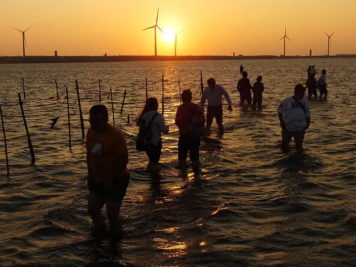
Photo adjustments
Full-frame source proportionally resized and converted to WebP for display. No subject alteration. Source-supplied marks and edits remain; cards may crop the view.
- Administrative area
- District · 區
- Part of
- Taichung City
- Chinese name
- 清水區
- Local areas
- District guide
Area & population
- Area in the source
- 64.17 km²
Source: cited geographic source, as of the dates shown.
Archaeology on the hill
Excavated pottery at Niumatou is predominantly red or brown cord-marked ware, associated with central Taiwan’s middle Neolithic culture. The park displays archaeological finds and preserves shrine remains where they stood. Former military facilities now provide exhibition space. On the approach from the old shrine path, the Qingshui Earthquake Memorial (清水震災紀念碑) commemorates those killed in the 1935 earthquake.
Temple decoration
Ziyunyan Temple (紫雲巖), locally called Guanyin Pavilion (觀音亭), is dedicated to Guanyin (觀音). Golden-yellow roof tiles contrast with the building’s predominantly red colour. Carved dragon columns decorate the temple, and murals tell stories of loyalty, filial piety and moral conduct. A fishpond lies behind the temple.
Sources for this guide
牛罵頭遺址文化園區-童樂Q臺中 · Education Bureau of Taichung City Government
紫雲巖-童樂Q臺中 · Education Bureau of Taichung City Government
Original English written from the listed sources and checked sentence by sentence against quoted extracts by a separate reviewer. Updated 2026-09-27.
Explore Qingshui District
Core places to explore, with English and Chinese names.
Places to explore around Qingshui District
Plan your visit
Getting there
Qingshui District is about 20 km in a straight line from central Taichung City. Search for 清水區 in a map app to find stations and your accommodation.
Where to stay →Build your route
Start with Gaomei Wetlands. The linked place guides have entrance and visit details.
Continue with Taichung City →More in Taichung City
Sources & geographic information
Administrative names and parent areas: Official geographic directory · Reference date 2026-09-06.
Photo: Gaomei Wetlands · lienyuan lee · CC BY 3.0. Full-frame source proportionally resized and converted to WebP for display. No subject alteration. Source-supplied marks and edits remain; cards may crop the view.

Map data © OpenStreetMap contributors. Pins mark approximate centres, not entrances or boundaries.