


Get to know Wufeng District
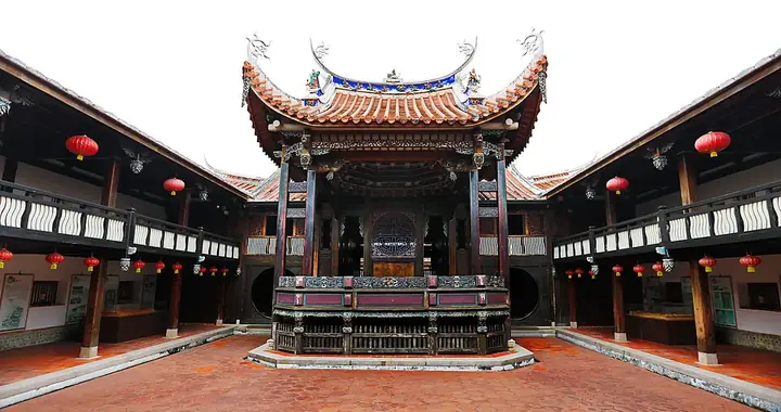
Photo adjustments
Full-frame source proportionally resized and converted to WebP for display. No subject alteration. Source-supplied marks and edits remain; cards may crop the view.
- Administrative area
- District · 區
- Part of
- Taichung City
- Chinese name
- 霧峰區
- Local areas
- District guide
Area & population
- Area in the source
- 98.00 km²
Source: cited geographic source, as of the dates shown.
The preserved fault
The Chelungpu Fault Preservation Hall (車籠埔斷層保存館) protects part of the earthquake fault site. Its curved enclosure uses 82 precast concrete panels, each twelve metres high, without a conventional beam-and-column system. The landscape itself forms part of the interpretation, alongside explanations of earthquake science.
Survival and rebuilding
The Image Gallery (影像館) reuses Guangfu Junior High School’s (光復國中) former sports centre, one of the buildings that did not collapse. Photographs and audiovisual records recall the earthquake’s human impact. The Reconstruction Hall (重建記錄館) presents documents and achievements from government and community rebuilding efforts, while the Disaster Prevention Hall (防災教育館) focuses on preparedness.
Sources for this guide
921地震教育園區 · National Museum of Natural Science
Original English written from the listed sources and checked sentence by sentence against quoted extracts by a separate reviewer. Updated 2026-09-27.
Explore Wufeng District
Core places to explore, with English and Chinese names.
Places to explore around Wufeng District
Plan your visit
Getting there
Wufeng District is about 9 km in a straight line from central Taichung City. Search for 霧峰區 in a map app to find stations and your accommodation.
Where to stay →Build your route
Start with Wufeng Lin Family Gongbaodi Estate. The linked place guides have entrance and visit details.
Continue with Taichung City →More in Taichung City
Sources & geographic information
Administrative names and parent areas: Official geographic directory · Reference date 2026-09-06.
Photo: Wufeng Lin Family Gongbaodi Estate · Mk2010 · CC BY-SA 4.0. Full-frame source proportionally resized and converted to WebP for display. No subject alteration. Source-supplied marks and edits remain; cards may crop the view.
.jpg)
Map data © OpenStreetMap contributors. Pins mark approximate centres, not entrances or boundaries.