


Get to know Lop County
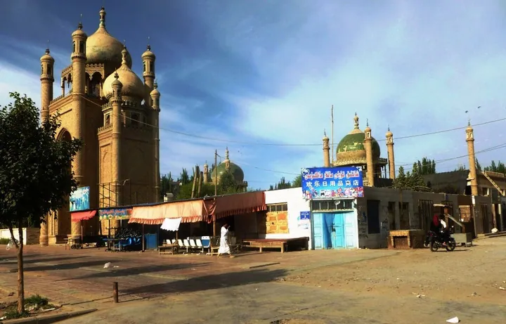
Photo adjustments
Full frame retained; proportionally resized and converted to WebP. No retouching or changes to the photographed subject. Card displays may crop the view.
- Administrative area
- County · 县
- Part of
- Hotan Prefecture
- Chinese name
- 洛浦县
- Local areas
- County guide
Area & population
- Area in the source
- 14,287.00 km²
- Population · 2020
- 286,900
- Administrative seat
- Lop Town
Source: cited geographic source, as of the dates shown.
A stupa within a square court
The ruins comprise a square courtyard, a central round stupa and temple remains outside the enclosure. The mud-brick stupa stands about nine metres high on a cross-shaped base with steps on all four sides. The complex faces roughly south, with traces of a gate in the southern wall. The site became a national key cultural relic protection unit in June 2001.
Wetland meeting dunes
Yulongwan Desert Park (玉龙湾沙漠乐园) lies in Duolu Town (多鲁镇), centred on Buerkumu Lake (布尔库木湖). Wetlands occupy the western part, dunes and lakes alternate through the middle, and larger expanses of dunes lie to the east. Attractions include sand sliding, desert off-road driving and camel riding.
Sources for this guide
热瓦克佛寺_文化古迹_旅游观光_洛浦县人民政府网 · Lop County People’s Government
洛浦期待与您相遇_风景名胜_旅游观光_洛浦县人民政府网 · Lop County People’s Government
Original English written from the listed sources and checked sentence by sentence against quoted extracts by a separate reviewer. Updated 2026-09-27.
Explore Lop County
Core places to explore, with English and Chinese names.
Lop County 洛浦县
Plan your visit
Getting there
Lop County is about 25 km in a straight line from central Hotan Prefecture. Search for 洛浦县 in a map app to find stations and your accommodation.
Where to stay →More in Hotan Prefecture
Sources & geographic information
Administrative names and parent areas: Official geographic directory · Reference date 2026-09-06.
Map data © OpenStreetMap contributors. Pins mark approximate centres, not entrances or boundaries.