


Get to know Yutian County
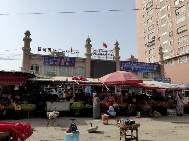
Photo adjustments
Full frame retained; proportionally resized and converted to WebP. No retouching or changes to the photographed subject. Card displays may crop the view.
- Administrative area
- County · 县
- Part of
- Hotan Prefecture
- Chinese name
- 于田县
- Local areas
- County guide
Area & population
- Area in the source
- 39,094.83 km²
- Population · 2020
- 257,038
- Administrative seat
- Mughalla (Keriya)
Source: cited geographic source, as of the dates shown.
An old village and its successor
Darya Boyi’s name means “beside the great river”. Its traditional bazi houses (笆子房) use poplar frames, woven tamarisk walls and mud mixed with reeds; a single piece of poplar bark forms a door. Residents completed relocation to a new village in 2019. The old settlement retains traditional houses and poplar woodland. Kumaiqi (库麦其) is dough baked beneath sand heated by poplar charcoal.
A personal collection
The Kurban Tulum Memorial Hall (库尔班·吐鲁木纪念馆) stands in Tuogerigazi Township (托格日尕孜乡). Completed in November 2016, it contains a relief portrait, more than fifty historical photographs and over one hundred objects used by Kurban Tulum, alongside artworks and documentary material.
Sources for this guide
时光相册丨在照片里读懂达里雅布依的“一步千年”-新华网 · Xinhua News Agency
库尔班·吐鲁木纪念馆-新疆于田县人民政府网 · Hotan Government Portal, via Yutian County Government
Original English written from the listed sources and checked sentence by sentence against quoted extracts by a separate reviewer. Updated 2026-09-27.
Explore Yutian County
Core places to explore, with English and Chinese names.
Places to explore around Yutian County
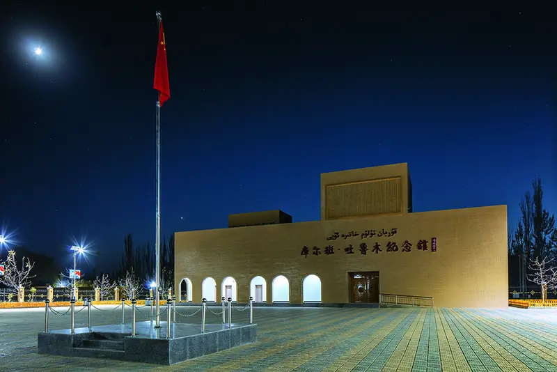 Kurban Tulum Memorial Hall ·
 Plan your visit
Getting there
Yutian County is about 160 km in a straight line from central Hotan Prefecture. Search for 于田县 in a map app to find stations and your accommodation.
Where to stay →Build your route
Start with Kurban Tulum Memorial Hall. The linked place guides have entrance and visit details.
Continue with Hotan Prefecture →More in Hotan Prefecture
Sources & geographic information
Administrative names and parent areas: Official geographic directory · Reference date 2026-09-06.
Photo: Kurban Tulum Memorial Hall · Source photographer · License not provided. EXIF orientation normalized; resized without changing aspect ratio; converted to WebP. No subject edits.
Map data © OpenStreetMap contributors. Pins mark approximate centres, not entrances or boundaries.