


Get to know Dörbiljin County

- Administrative area
- County · 县
- Part of
- Tacheng Prefecture
- Chinese name
- 额敏县
- Local areas
- County guide
Area & population
- Area in the source
- 9,157.81 km²
- Population · 2020
- 188,642
- Administrative seat
- Dörbiljin (Emin) Town
Source: cited geographic source, as of the dates shown.
Excavated objects and a cultural park
Yemili Ancient City Ruins (也迷里古城遗址) lie in the eastern part of the county. The exhibition hall displays nearly a hundred excavated objects in about seven categories, including stone, wooden, bronze and jade artefacts. Yemili Cultural Park (也迷里文化园), next to the hall, was completed in 2023.
Flowers, yurts and valley views
At Haihang Grassland, in Kalayemule Town (喀拉也木勒镇), summer flowers bloom among the grasses. Views extend across distant mountains and river valleys, with cattle and sheep on the grassland. The town has developed the Damei Valley (大美谷地) and Sky Flower Fields (空中花海) viewing areas, with eighteen yurts, resting pavilions and observation platforms. The Wild Fruit Forest Scenic Area (野果林景区) combines streams, grassland and woodland, with waterfalls and unusually shaped rocks and trees.
Sources for this guide
多元化发展 让额敏旅游绽放独特魅力-新华网 · Zhonghongwang Xinjiang, republished by Xinhuanet
Original English written from the listed sources and checked sentence by sentence against quoted extracts by a separate reviewer. Updated 2026-09-27.
Explore Dörbiljin County
Core places to explore, with English and Chinese names.
Places to explore around Dörbiljin County
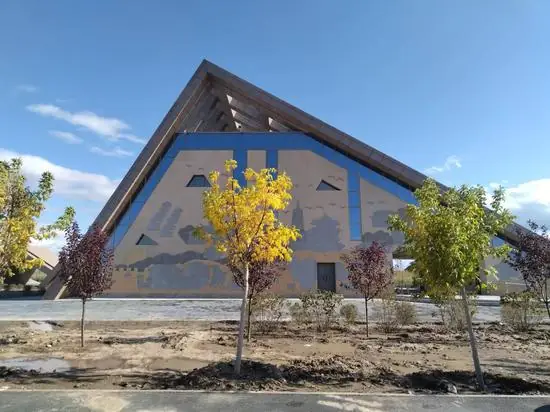 Emin Yemili Grassland ·
 Plan your visit
Getting there
Dörbiljin County is about 50 km in a straight line from central Tacheng Prefecture. Search for 额敏县 in a map app to find stations and your accommodation.
Where to stay →Build your route
Start with Emin Yemili Grassland. The linked place guides have entrance and visit details.
Continue with Tacheng Prefecture →More in Tacheng Prefecture
Sources & geographic information
Administrative names and parent areas: Official geographic directory · Reference date 2026-09-06.
Photo: Emin Yemili Grassland · Source photographer · License not provided. EXIF orientation normalized; resized without changing aspect ratio; converted to WebP. No subject edits.
Map data © OpenStreetMap contributors. Pins mark approximate centres, not entrances or boundaries.