


Get to know Tacheng Prefecture

Photo adjustments
Full frame retained; proportionally resized and converted to WebP. No retouching or changes to the photographed subject. Card displays may crop the view.
- Administrative area
- Prefecture · 地区
- Part of
- Xinjiang
- Chinese name
- 塔城地区
- Local areas
- 7 local areas
Area & population
- Area in the source
- 98,824.00 km²
- Population · 2020
- 992,444
- Administrative seat
- Tacheng
Source: cited geographic source, as of the dates shown.
Explore Tacheng Prefecture
Core places to explore, with English and Chinese names.
Tacheng 塔城
Wusu Foshan National Forest Park 佛山国家森林公园
Hoboksar Ancient City Site 和布克赛尔古城遗址
Tacheng Red Building Museum 塔城红楼博物馆
Tacheng Accordion Museum 手风琴博物馆
Anjihai Grand Canyon Viewing Area 安集海大峡谷正规开放观景区
Lujiaowan Scenic Area 鹿角湾
Barluk Mountain Grassland Area 巴尔鲁克山正规开放草原区
Emin Yemili Grassland 额敏也迷里草原
Tacheng 塔城市
Wusu 乌苏市
Shawan 沙湾市
Dörbiljin County 额敏县
Toli County 托里县
Yumin County 裕民县
Hoboksar Mongol Autonomous County 和布克赛尔蒙古自治县
Places to explore around Tacheng Prefecture
 The Red Building courtyard in Tacheng · 塔城红楼 Photograph date recorded by the source: 26 July 2023, 07:31:20.
Tacheng塔城
Tacheng developed as a trading town near Central Asia, with a cultural history shaped by several communities and languages. The regional museum in the Red Building introduces that history, while the accordion museum offers a…
Read the place guide →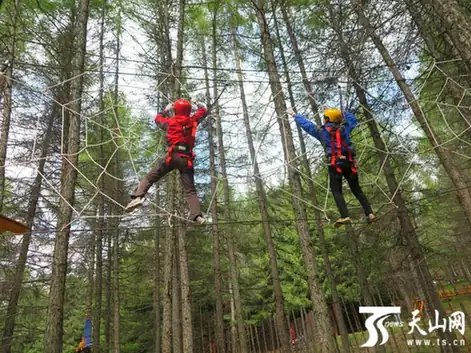 Wusu Foshan National Forest Park · 佛山国家森林公园
Wusu Foshan National Forest Park佛山国家森林公园
Wusu Foshan National Forest Park (乌苏佛山国家森林公园) is a state-listed forest park in the middle section of the Tianshan range, in Wusu City, Tacheng Prefecture, Xinjiang.
Read the place guide → AI illustration · AI 示意图(仅供参考,非该地点实拍)
Hoboksar Ancient City Site和布克赛尔古城遗址
The ancient city site in Hoboksar Mongol Autonomous County (和布克赛尔古城遗址) is a walled site about five kilometres east of the county seat, in Tacheng Prefecture, Xinjiang.
Read the place guide →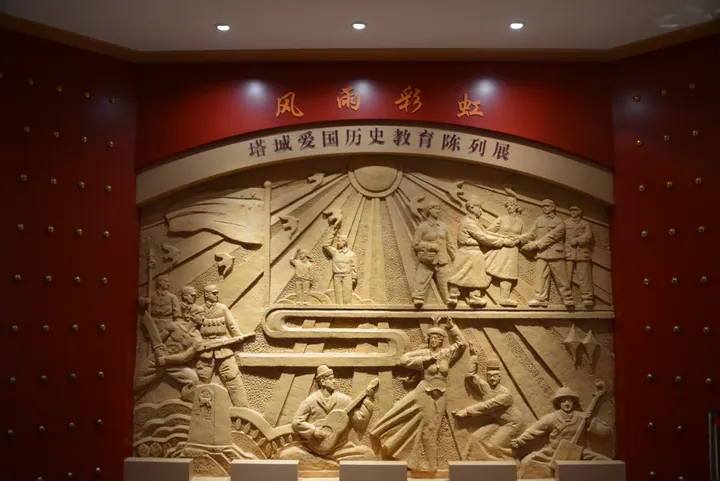 An exhibition wall relief inside the Tacheng Red Building Museum, Tacheng · 塔城市塔城红楼博物馆内《风雨彩虹》塔城爱国历史教育陈列展浮雕 Source-recorded photograph date: 2023-07-25 12:02:38.
Tacheng Red Building Museum塔城红楼博物馆
Tacheng Red Building Museum (塔城红楼博物馆) is the museum of Tacheng Prefecture, housed in a Russian-style building of 1914 in Tacheng City, Xinjiang.
Read the place guide →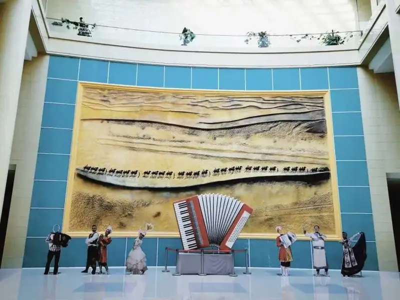 Tacheng Accordion Museum · 手风琴博物馆
Tacheng Accordion Museum手风琴博物馆
The Accordion Museum (手风琴博物馆) in Tacheng City, Xinjiang, holds more than a thousand accordions from more than ten countries in a 500-square-metre display hall.
Read the place guide →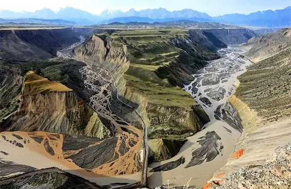 Anjihai Grand Canyon Viewing Area · 安集海大峡谷正规开放观景区
Anjihai Grand Canyon Viewing Area安集海大峡谷正规开放观景区
The Anjihai Grand Canyon (安集海大峡谷) is a deeply cut, multi-coloured river valley in the Anjihai River basin on the northern flank of the Tianshan, in Shawan City and Wusu City, Tacheng Prefecture, Xinjiang.
Read the place guide →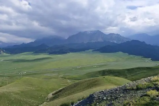 Lujiaowan Scenic Area · 鹿角湾
Lujiaowan Scenic Area鹿角湾
Lujiaowan (鹿角湾, 'Antler Bay') is a mountain grassland and scenic area at the foot of the Tianshan about seventy kilometres south-west of the Shawan urban area, in Shawan City, Tacheng Prefecture, Xinjiang.
Read the place guide → Barluk Mountain Grassland Area · 巴尔鲁克山正规开放草原区
Barluk Mountain Grassland Area巴尔鲁克山正规开放草原区
Barluk Mountain (巴尔鲁克山) is a relatively isolated range in Yumin and Toli counties, Tacheng Prefecture, Xinjiang, whose western end forms the border with Kazakhstan.
Read the place guide →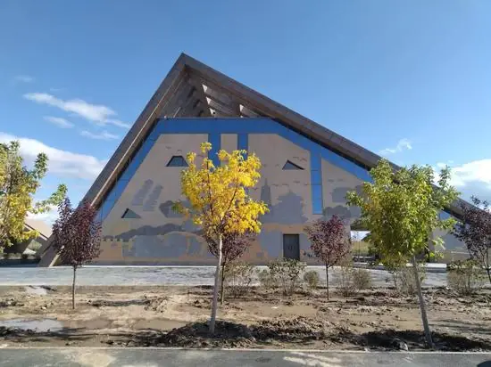 Emin Yemili Grassland · 额敏也迷里草原
Emin Yemili Grassland额敏也迷里草原
Emin County (额敏县) is a river-valley pasture in Tacheng Prefecture, Xinjiang, set among the Wurkashar, Barluk and Tarbahatai ranges, whose name derives from the older name 也迷里 (Yemili).
Read the place guide →Local life & food
Tacheng Prefecture local specialties
塔城地区特色美食 · 11 specialties to discover
 Tacheng cheese buns 塔城奶酪包AI dish illustration / AI 菜品示意图
The bread is soft against a richer dairy filling, which may be sweet or more savoury according to the style.
Source ↗Read the dish guide →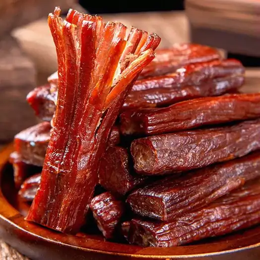 Tacheng Air-Dried Meat 塔城风干肉
Tacheng Air-Dried Meat (塔城风干肉) is mutton cured by salting and drying, made in Tacheng (塔城), Xinjiang.
Read the dish guide →Photo adjustments
EXIF orientation normalized; resized without changing aspect ratio; converted to WebP. No subject edits.
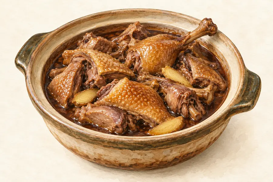 Tacheng Flying Goose 塔城飞鹅AI illustration · AI 示意图(仅供参考,非实拍)
Tacheng Flying Goose (塔城飞鹅) is the local name for a goose raised in Tacheng Prefecture (塔城地区), Xinjiang, and for the goose dishes cooked there.
Read the dish guide →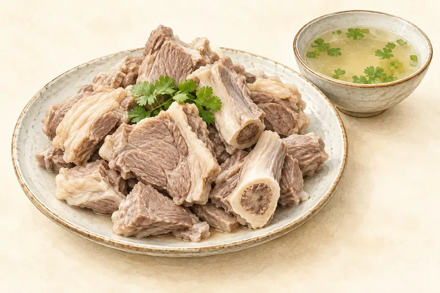 Yumin Bashibai Lamb 裕民巴什拜羊AI illustration · AI 示意图(仅供参考,非实拍)
Yumin Bashibai Lamb (裕民巴什拜羊) is meat from the Bashibai sheep associated with Yumin County (裕民) in the Tacheng region (塔城). An official account describes its evenly distributed fat and fresh flavour without a strong mutton smell.
Read the dish guide → Big-plate chicken 大盘鸡
Tender potatoes thicken the savory, often spicy sauce, while bone-in chicken and chewy noodles create a substantial meal.
Source ↗Read the dish guide →.jpg)
Photo adjustments
EXIF orientation applied where present; resized proportionally to at most 640 px on the long edge and encoded as WebP. No crop, retouching, recoloring or subject changes.
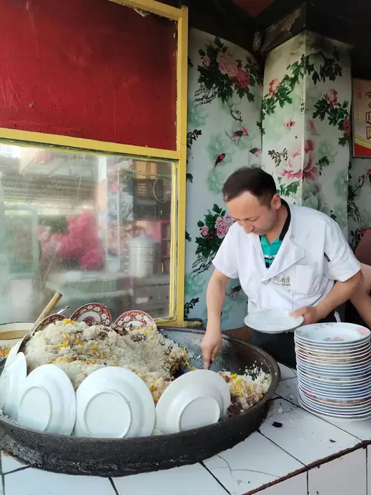 Wusu Pilaf 乌苏抓饭
Wusu Pilaf (乌苏抓饭) is listed among the local specialties of Tacheng Prefecture, Xinjiang. It is grouped here with rice & congee; retain the complete Chinese name when comparing local menus.
Read the dish guide →Photo adjustments
EXIF orientation normalized; resized without changing aspect ratio; converted to WebP. No subject edits.
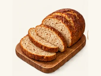 Russian-Style Lieba Bread 俄罗斯列巴AI dish illustration · AI 菜品示意图
Russian-Style Lieba Bread (俄罗斯列巴) is the staple wheat loaf of China's Russian ethnic group (俄罗斯族), whose largest community lives in Xinjiang, with Tacheng Prefecture (塔城地区) among its main areas of settlement.
Read the dish guide →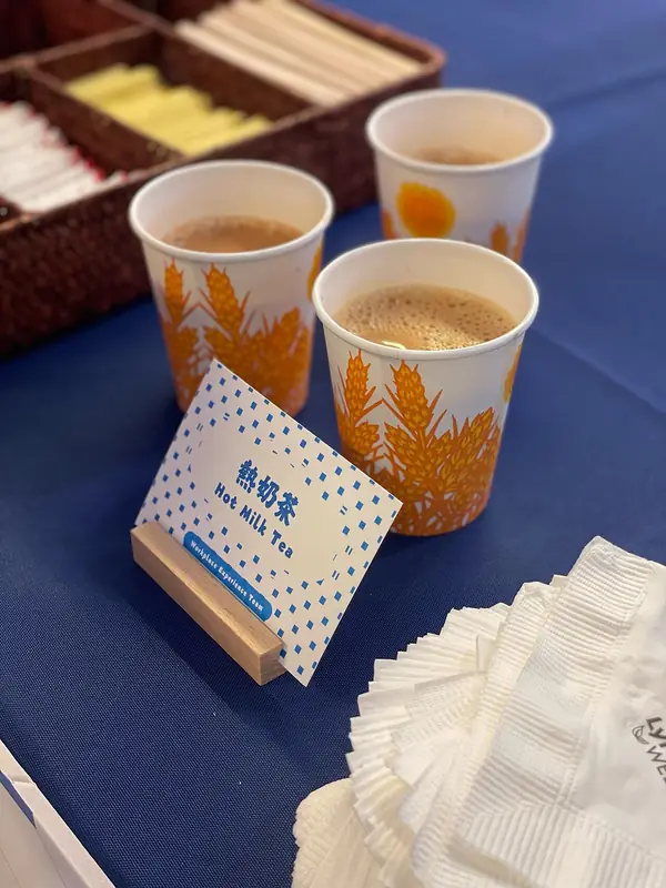 Salted Milk Tea 奶茶
Salted Milk Tea (奶茶) is brick tea mixed with boiled milk, hot water and salt. The Keketuohai Scenic Area Management Committee in Altay calls it the most important item of Kazakh food and drink, and in Ürümqi (乌鲁木齐) Xinjiang milk tea (新疆奶茶) is one of the common drinks.
Read the dish guide →
Photo adjustments
EXIF orientation normalized; resized without changing aspect ratio; converted to WebP. No subject edits.
More dishes from across Xinjiang are in the Xinjiang food guide.
Counties & districts in Tacheng Prefecture
7 areas belong directly to Tacheng Prefecture.
7 areas
Tacheng 塔城市
Tacheng, also known as Qoqek (Uyghur: چۆچەك; Kazakh: شاۋەشەك) and historically as Chuguchak (Russian: Чугучак), is a county-level city and the administrative seat of Tacheng Prefecture, in northern Ili Kazakh…
Explore the area →County-level cityWusu 乌苏市
Wusu, officially Usu, is a county-level city with more than 100,000 residents in Xinjiang, China. It is a part of Tacheng Prefecture of Ili Kazakh Autonomous Prefecture.
Explore the area →County-level cityShawan 沙湾市
Shawan, also transliterated from Chinese to Uyghur as Savan, is a county-level city situated in the north of the Xinjiang Uyghur Autonomous Region under the administration of the Tacheng Prefecture.
Explore the area →CountyDörbiljin County 额敏县
Emin County also known as Dörbiljin County (Uyghur: دۆربىلجىن ناھىيىسى; Kazakh: ءدوربىلجىن اۋدانى), is a county situated in the north of the Xinjiang Uyghur Autonomous Region and is under the administration…
Explore the area →Show fewer areas
Toli County 托里县
Toli County is a county situated in the north of the Xinjiang Uyghur Autonomous Region and is under the administration of the Tacheng Prefecture.
Explore the area →CountyYumin County 裕民县
Yumin County, also known as Qagantokay County, is a county of Tacheng Prefecture in the Xinjiang Uyghur Autonomous Region of China, bordering Kazakhstan's regions of East Kazakhstan and Almaty.
Explore the area →Autonomous countyHoboksar Mongol Autonomous County 和布克赛尔蒙古自治县
Hoboksar Mongol Autonomous County, sometimes referred to by the historic name Hefeng County (和丰县; Héfēng Xiàn), is an autonomous county for Mongols in the middle-north of Xinjiang Uyghur Autonomous Region…
Explore the area →No areas match this name.
Plan your visit
Getting there
Search for 塔城地区 in a map app to find stations and your accommodation.
Where to stay →Build your route
Tacheng and Wusu Foshan National Forest Park are both listed here. The linked place guides have entrance and visit details.
Continue with Xinjiang →More in Xinjiang
Sources & geographic information
Administrative names and parent areas: Official geographic directory · Reference date 2026-09-06.
Background text adapted from Tacheng Prefecture — Wikipedia contributors, under CC BY-SA 4.0. Text has been shortened and reorganized; source revision 1370097136.
Photo: Tacheng · HaziiDozen · CC BY-SA 4.0. Full frame retained; proportionally resized and converted to WebP. No retouching or changes to the photographed subject. Card displays may crop the view.

Photo: Wusu Foshan National Forest Park · Source photographer · License not provided. EXIF orientation normalized; resized without changing aspect ratio; converted to WebP. No subject edits.
Photo: Tacheng Red Building Museum · HaziiDozen · CC BY-SA 4.0. Full frame retained; proportionally resized and converted to WebP. No retouching or changes to the photographed subject. Card displays may crop the view.

Photo: Tacheng Accordion Museum · Source photographer · License not provided. EXIF orientation normalized; resized without changing aspect ratio; converted to WebP. No subject edits.
Photo: Anjihai Grand Canyon Viewing Area · Source photographer · License not provided. EXIF orientation normalized; resized without changing aspect ratio; converted to WebP. No subject edits.
Photo: Lujiaowan Scenic Area · Source photographer · License not provided. EXIF orientation normalized; resized without changing aspect ratio; converted to WebP. No subject edits.
Photo: Barluk Mountain Grassland Area · Source photographer · License not provided. EXIF orientation normalized; resized without changing aspect ratio; converted to WebP. No subject edits.
Photo: Emin Yemili Grassland · Source photographer · License not provided. EXIF orientation normalized; resized without changing aspect ratio; converted to WebP. No subject edits.
Map data © OpenStreetMap contributors. Pins mark approximate centres, not entrances or boundaries.