


Get to know Yumin County
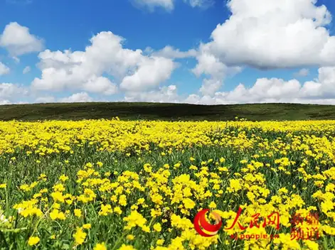
Photo adjustments
EXIF orientation normalized; resized without changing aspect ratio; converted to WebP. No subject edits.
- Administrative area
- County · 县
- Part of
- Tacheng Prefecture
- Chinese name
- 裕民县
- Local areas
- County guide
Area & population
- Area in the source
- 6,101.98 km²
- Population · 2020
- 50,819
- Administrative seat
- Qarabura
Source: cited geographic source, as of the dates shown.
Woodland and upland pasture
The Barluk Scenic Area (巴尔鲁克景区) lies forty-five kilometres from the county seat, along the northern foot of the mountain range. Shady slopes carry spruce woods, while birch grows among rocky outcrops on sunnier slopes. Tuerjialiao Grassland (吐尔加辽草原), beside the Tasiti River Valley (塔斯提河谷), occupies rolling hills. Its name is translated as the pasture of nobles. Wild peas, strawberries and alfalfa grow among its grasses.
A flower design in town
Jinyu Ecological Park (锦裕生态公园) began construction in 2013. Its name combines characters from Jinzhou (锦州), which funded its construction through assistance, and Yumin. A 2022 improvement programme added flower fields whose overall design resembles a butterfly viewed from above. The park includes areas for children’s play, flower displays and historical exhibitions.
Sources for this guide
裕民县A级景区基本情况_旅游信息公开_重点领域公开_法定主动公开内容_政府信息公开_裕民县人民政府网站 · Yumin County Culture, Radio, Television and Tourism Bureau
Original English written from the listed sources and checked sentence by sentence against quoted extracts by a separate reviewer. Updated 2026-09-27.
Explore Yumin County
Core places to explore, with English and Chinese names.
Places to explore around Yumin County
 Barluk Mountain Grassland Area ·
 Plan your visit
Getting there
Yumin County is about 60 km in a straight line from central Tacheng Prefecture. Search for 裕民县 in a map app to find stations and your accommodation.
Where to stay →Build your route
Start with Barluk Mountain Grassland Area. The linked place guides have entrance and visit details.
Continue with Tacheng Prefecture →More in Tacheng Prefecture
Sources & geographic information
Administrative names and parent areas: Official geographic directory · Reference date 2026-09-06.
Photo: Barluk Mountain Grassland Area · Source photographer · License not provided. EXIF orientation normalized; resized without changing aspect ratio; converted to WebP. No subject edits.
Map data © OpenStreetMap contributors. Pins mark approximate centres, not entrances or boundaries.