


Get to know Wusu
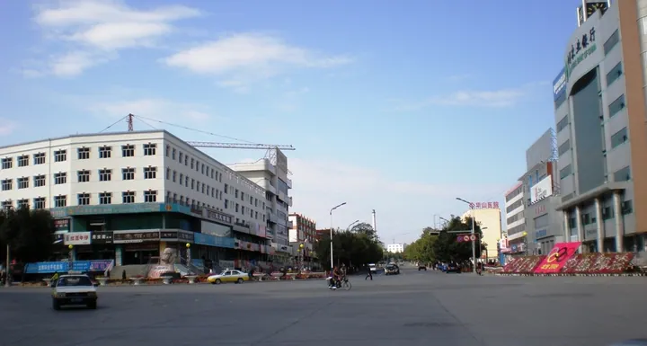
Photo adjustments
Full frame retained; proportionally resized and converted to WebP. No retouching or changes to the photographed subject. Card displays may crop the view.
- Administrative area
- County-level city · 县级市
- Part of
- Tacheng Prefecture
- Chinese name
- 乌苏市
- Local areas
- County-level city guide
Area & population
- Area in the source
- 14,394.12 km²
- Population · 2020
- 262,906
- Administrative seat
- Xinshiqu Subdistrict
Source: cited geographic source, as of the dates shown.
Three sections of a forest park
Wusu Foshan National Forest Park (乌苏佛山国家森林公园) grew out of a park established by the local forest farm. It became a regional forest park in 1995 and a national forest park in 2008. Its three principal sections are Daifuseng (待甫僧), Bayingou (巴音沟) and Wulansadeke (乌兰萨德克). The snow-mountain Buddha formation stands at an elevation of 3,946 metres.
The woodland-meadow boundary
Daifuseng is sixty kilometres from the city. Its ecological garden occupies the meeting point of forest and grassland: woodland lies to the south, with planted secondary forest below the natural belt, while alpine meadow extends northward. The garden includes areas for pine seedlings, strawberries, wild vegetables, medicinal plants and red deer.
Sources for this guide
乌苏佛山国家森林公园(4A)_景区介绍_走进乌苏_乌苏市人民政府网站 · Wusu Culture, Sports, Radio, Television and Tourism Bureau
待甫僧_自然地理_走进乌苏_乌苏市人民政府网站 · Wusu Municipal Government
Original English written from the listed sources and checked sentence by sentence against quoted extracts by a separate reviewer. Updated 2026-09-27.
Explore Wusu
Core places to explore, with English and Chinese names.
Places to explore around Wusu
 Wusu Foshan National Forest Park ·
 Plan your visit
Getting there
Wusu is about 290 km in a straight line from central Tacheng Prefecture. Search for 乌苏市 in a map app to find stations and your accommodation.
Where to stay →Build your route
Start with Wusu Foshan National Forest Park. The linked place guides have entrance and visit details.
Continue with Tacheng Prefecture →More in Tacheng Prefecture
Sources & geographic information
Administrative names and parent areas: Official geographic directory · Reference date 2026-09-06.
Photo: Wusu Foshan National Forest Park · Source photographer · License not provided. EXIF orientation normalized; resized without changing aspect ratio; converted to WebP. No subject edits.
Map data © OpenStreetMap contributors. Pins mark approximate centres, not entrances or boundaries.