


Get to know Lancang Lahu Autonomous County
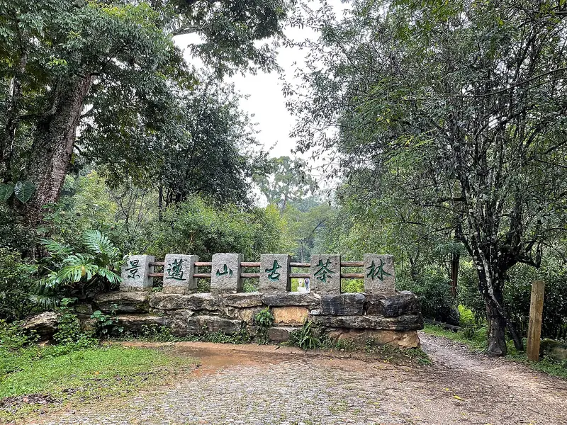
Photo adjustments
Full frame retained; EXIF orientation normalized, proportionally resized to at most 800 pixels and converted to WebP. No generated pixels or subject changes. Cards may crop the display.
- Administrative area
- Autonomous county · 自治县
- Part of
- Pu'er
- Chinese name
- 澜沧拉祜族自治县
- Local areas
- Autonomous county guide
Area & population
- Area in the source
- 8,807.00 km²
- Population · 2020 census
- 441,455
Source: cited geographic source, as of the dates shown.
Tea forests and villages
The Cultural Landscape of Old Tea Forests of Jingmai Mountain entered the World Heritage List in 2023. Its landscape combines five ancient tea forests, three protective forests and nine traditional villages. Wengji (翁基) and Nuogan (糯干) are among the villages, with stilt houses and Dai and Bulang traditions. Paths through the tea forests, village lanes and tea-making activities connect the landscape with the people who cultivate it.
Lahu life and local crops
Lancang’s established communities include Lahu, Wa, Hani, Dai and Bulang peoples. Lahu festivals include Kuota, the Spring Festival (扩塔), and Apeng Alongni, the Gourd Festival (阿朋阿龙尼). Tea, sugar cane and coffee are grown in this predominantly mountainous county; the Lancang River (澜沧江) passes through its territory.
Sources for this guide
澜沧简介-澜沧县人民政府网 · Lancang County Government
世遗景迈 · 幸福澜沧-澜沧县人民政府网 · Lancang County Government
Original English written from the listed sources and checked sentence by sentence against quoted extracts by a separate reviewer. Updated 2026-09-30.
Explore Lancang Lahu Autonomous County
Core places to explore, with English and Chinese names.
Places to explore around Lancang Lahu Autonomous County
 Jingmai Mountain Ancient Tea Forests · 景迈山古茶林
Jingmai Mountain Ancient Tea Forests景迈山古茶林
Jingmai’s tea landscape combines cultivated tea trees beneath taller forest with long-established Dai and Bulang villages. Dapingzhang provides an accessible introduction to the tea-forest structure, while Nuogan and Wengji…
Read the place guide →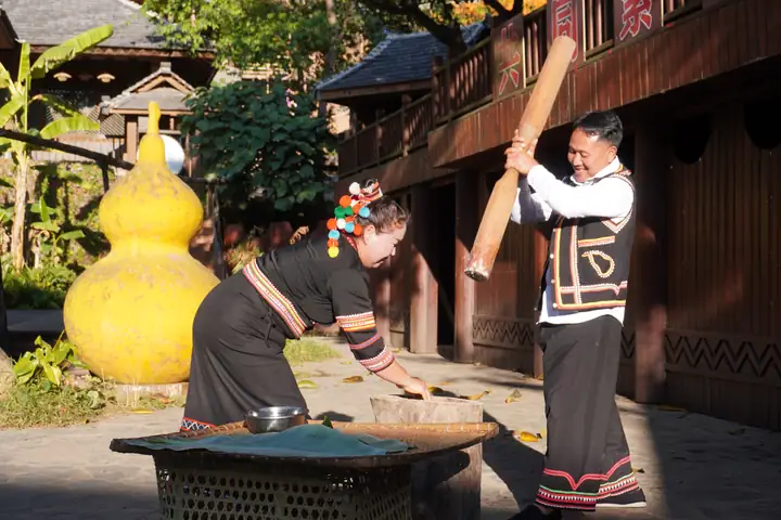 Laodabao Music Village · 老达保音乐小镇
Laodabao Music Village老达保音乐小镇
Laodabao (老达保), in Lancang Lahu Autonomous County, Pu'er, is a Lahu village known as the 'Music Village' for its role as an inheritance site of the national intangible-heritage oral epic 牡帕密帕 (Mupa Mipa).
Read the place guide →Plan your visit
Getting there
Lancang Lahu Autonomous County is about 110 km in a straight line from central Pu'er. Search for 澜沧拉祜族自治县 in a map app to find stations and your accommodation.
Where to stay →Build your route
Jingmai Mountain Ancient Tea Forests and Laodabao Music Village are both listed here. The linked place guides have entrance and visit details.
Continue with Pu'er →More in Pu'er
Sources & geographic information
Administrative names and parent areas: Official geographic directory · Reference date 2026-09-06.
Photo: Jingmai Mountain Ancient Tea Forests · Tcchang0825 · CC0. EXIF orientation normalized; resized without changing aspect ratio; converted to WebP. No subject edits.

Photo: Laodabao Music Village · Source photographer · License not provided. EXIF orientation normalized; resized without changing aspect ratio; converted to WebP. No subject edits.
Map data © OpenStreetMap contributors. Pins mark approximate centres, not entrances or boundaries.