


Get to know Menglian Dai, Lahu and Va Autonomous County
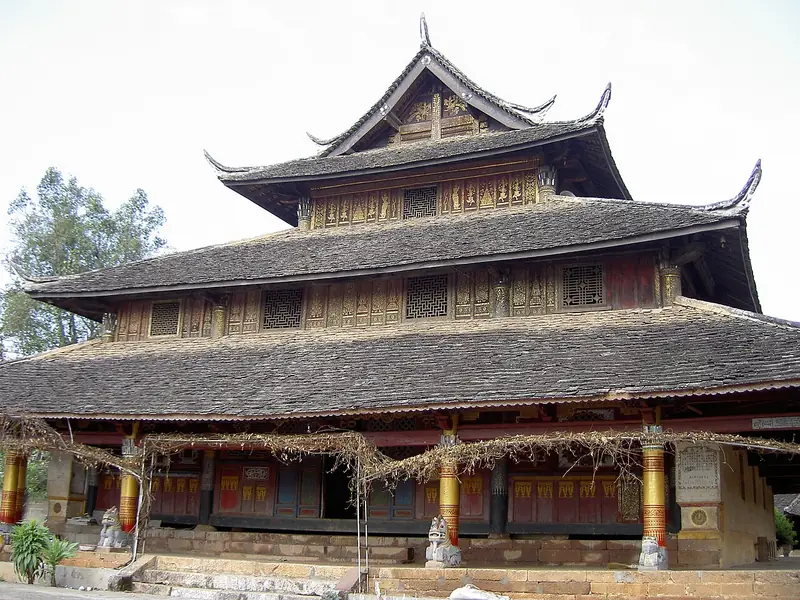
Photo adjustments
Full frame retained; EXIF orientation normalized, proportionally resized to at most 800 pixels and converted to WebP. No generated pixels or subject changes. Cards may crop the display.
- Administrative area
- Autonomous county · 自治县
- Part of
- Pu'er
- Chinese name
- 孟连傣族拉祜族佤族自治县
- Local areas
- Autonomous county guide
Area & population
- Area in the source
- 1,957.00 km²
- Population · 2020 census
- 144,693
- Administrative seat
- Nayun
Source: cited geographic source, as of the dates shown.
Nayun and the former chieftain’s office
Nayun Ancient Town (娜允古镇) preserves a Dai townscape. The Menglian Xuanfu Office (孟连宣抚司署), the former local chieftain’s administrative complex, is a nationally protected cultural heritage site. Its ceremonial music and dance, together with Dai white-elephant and horse-deer dances, entered the fifth national intangible cultural heritage list. Dai water-splashing, Lahu gourd and Wa new-rice festivals are among the county’s traditions.
Coffee, avocado and tea
Menglian’s warm subtropical conditions support coffee, avocados, macadamia nuts and rubber. Named coffee estates include Mangzhang (芒掌), Mangmao (芒冒), Laizhuke (来珠克) and Qiao’an (桥安). Tea is another local crop, with Nayun Hongzhen (娜允红珍) and Yami Hong (雅咪红) among its regional black-tea brands.
Sources for this guide
孟连简介-孟连傣族拉祜族佤族自治县人民政府 · Menglian County Government
自然地理-孟连傣族拉祜族佤族自治县人民政府 · Menglian County Government
Original English written from the listed sources and checked sentence by sentence against quoted extracts by a separate reviewer. Updated 2026-09-30.
Explore Menglian Dai, Lahu and Va Autonomous County
Core places to explore, with English and Chinese names.
Places to explore around Menglian Dai, Lahu and Va Autonomous County
 Nayun Ancient Town ·
 Plan your visit
Getting there
Menglian Dai, Lahu and Va Autonomous County is about 150 km in a straight line from central Pu'er. Search for 孟连傣族拉祜族佤族自治县 in a map app to find stations and your accommodation.
Where to stay →Build your route
Start with Nayun Ancient Town. The linked place guides have entrance and visit details.
Continue with Pu'er →More in Pu'er
Sources & geographic information
Administrative names and parent areas: Official geographic directory · Reference date 2026-09-06.
Photo: Nayun Ancient Town · Source photographer · License not provided. EXIF orientation normalized; resized without changing aspect ratio; converted to WebP. No subject edits.
Map data © OpenStreetMap contributors. Pins mark approximate centres, not entrances or boundaries.