

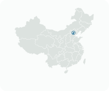
Get to know Mentougou District
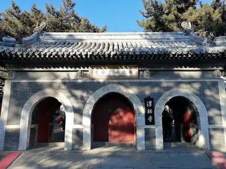
Photo adjustments
Resized and WebP compressed; subject not altered.
- Administrative area
- District · 市辖区
- Part of
- Beijing
- Chinese name
- 门头沟区
- Local areas
- District guide
Area & population
- Area in the source
- 1,321.00 km²
- Population · 2020
- 392,606
Source: cited geographic source, as of the dates shown.
Setting and landscape
The district stretches about 62 kilometres east to west and 34 kilometres north to south. More than 160 peaks in the western mountains stand around 1,500 metres; besides Mount Ling they include Mount Baihua (百花山), Zhuaji Mountain (髽髻山) and Mount Miaofeng (妙峰山). The land drops to 73 metres at Tu'erzhuang (兔儿庄) in the south-east, and more than 300 valleys cut between the ridges.
The Yongding River (永定河) runs for over 100 kilometres through the district, falling from 373 to 73 metres, so its current is fast. Its largest tributary here, the Qingshui River (清水河), rises on Mount Ling and Mount Baihua. Winter is long, around 169 days a year, and the Zhaitang (斋堂) area in the west is cooler than the eastern plain.
History
About 10,000 years ago the people known as Donghulin Man (东胡林人) settled on loess terraces in the Qingshui valley, where a necklace of small shells has been found. In 250 the Wei general Liu Jing (刘靖) diverted the Yongding at Sanjiadian (三家店) to irrigate land around the city of Ji, which the district government calls the first large water-control project in Beijing's history.
Tanzhe Temple (潭柘寺) was founded in 316 under the Western Jin, first as Jiafu Temple (嘉福寺); its name refers to the dragon pool behind it and the cudrania trees in front. Jietai Temple (戒台寺) dates from the Tang, but its layout is largely Liao, and the district government describes it as the temple with the most complete group of Liao relics in northern China, including its pagodas, stone sutra pillars and ordination platform.
At the Longquanwu (龙泉务) kiln site, Liao three-colour ware sherds and coal residue were found. A Ming revenue register, the Wanli Kuaijilu (万历会计录), lists more than 70 coal pits here owned by the Qianqing Palace alone, and from the Ming and Qing onward most of the glazed ware used in Beijing came from Mentougou. In 1451 a garrison was set up at Yanhekou (沿河口) to hold 17 passes on the western approaches, and the general Qi Jiguang (戚继光) later added wall and watchtowers. In 1938 the anti-Japanese government of Wanping County, the earliest people's government in the Beijing area, was set up at Dongzhaitang village (东斋堂村). The district took its present name in May 1958.
Highlights
- Tanzhe Temple 潭柘寺: Founded in 316 as Jiafu Temple; named for its dragon pool and cudrania trees.
- Jietai Temple 戒台寺: Tang foundation with a largely Liao layout, pagodas and ordination platform.
- Mount Ling 灵山: At 2,303 metres, called the first peak of the capital.
- Mount Miaofeng 妙峰山: One of the high peaks of the district's western mountains.
Sources for this guide
历史沿革_历史沿革_北京市门头沟区人民政府 · Mentougou District People's Government, Beijing
地理概况_地理概况_北京市门头沟区人民政府 · Mentougou District People's Government, Beijing
Original English written from the listed sources and checked sentence by sentence against quoted extracts by a separate reviewer. Updated 2026-09-25.
Explore Mentougou District
Core places to explore, with English and Chinese names.
Places to explore around Mentougou District
Tanzhe TempleTanzhe Temple潭柘寺
Tanzhe Temple occupies a mountain setting in Mentougou, with a long Buddhist history expressed mainly through buildings surviving from the Ming and Qing periods. Its principal halls form several north–south sequences, and the…
Read the place guide →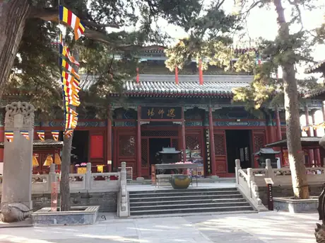 Jietai Temple · 戒台寺
Jietai Temple戒台寺
Jietai Temple on Ma’an Mountain is closely associated with Buddhist ordination. Its central attraction is the large square bluestone altar in Jietan Hall, built in tiers with carved decoration and surrounding niches. The altar’s…
Read the place guide → Cuandixia · 爨底下. Photo: 2008-05-01.
Cuandixia爨底下
Cuandixia is a mountain village near Zhaitang in Mentougou, known for its Ming- and Qing-style courtyard houses. Stone-paved lanes and steep stairways connect buildings fitted to the slope, making the village’s layout as…
Read the place guide →Plan your visit
Getting there
Mentougou District is about 25 km in a straight line from central Beijing. Search for 门头沟区 in a map app to find stations and your accommodation.
Where to stay →Build your route
Tanzhe Temple and Jietai Temple are about 6 km apart in a straight line. The linked place guides have entrance and visit details.
Continue with Beijing →More in Beijing
Sources & geographic information
Administrative names and parent areas: Official geographic directory · Reference date 2026-09-06.
Photo: Tanzhe Temple · Yumeto · CC BY-SA 4.0. Resized and WebP compressed; subject not altered.

Photo: Jietai Temple · N509FZ · CC BY-SA 4.0. Resized and WebP compressed; subject not altered.
.JPG)
Photo: Cuandixia · xiaojiecha · CC BY 2.0. Converted to WebP and resized without changing the subject or cropping the source frame.

Map data © OpenStreetMap contributors. Pins mark approximate centres, not entrances or boundaries.