


Get to know Liangjiang New Area
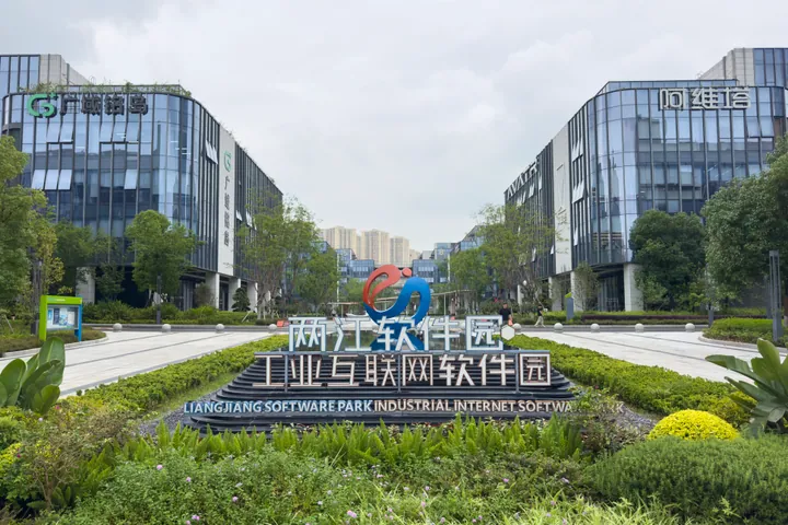
Photo adjustments
Full frame retained; proportionally resized and converted to WebP. No retouching or changes to the photographed subject. Card displays may crop the view.
- Administrative area
- District · 市辖区
- Part of
- Chongqing
- Chinese name
- 两江新区
- Local areas
- District guide
Area & population
- Area in the source
- 1,360.00 km²
Source: cited geographic source, as of the dates shown.
History
The State Council approved the Chongqing Liangjiang New Area on 5 May 2010 and it was launched on 18 June that year, first as an economic zone run by a management committee rather than a regular district government. In 2016 it took over the functions of the Chongqing Northern New Area (北部新区). In November 2025 Jiangbei and Yubei districts were abolished and their land, apart from five towns of Yubei, became the new district together with three subdistricts and two towns of Beibei. The new district was formally inaugurated on 25 January 2026.
Setting and landscape
The district government describes an area of about 1,360 square kilometres with 31 subdistricts and 11 towns, wrapped by the Yangtze and Jialing and flanked by four ranges: Zhongliang (中梁山), Longwangdong (龙王洞山), Tongluo (铜锣山) and Mingyue (明月山). It has 124 kilometres of riverfront. Chinese Wikipedia notes that the area is one of the few large stretches of flat land in the hills of eastern Sichuan and western Hunan.
What to see
The government's list of city landmarks here includes Jiangbeizui (江北嘴), Guanyinqiao (观音桥), Zhaomu Mountain (照母山) and Chongqing Central Park (重庆中央公园), as well as the Chongqing Grand Theatre (重庆大剧院), the Sichuan opera theatre, the science and technology museum and Longxing football stadium. The district counts ten 4A scenic areas.
Hongen Temple Forest Park (鸿恩寺森林公园) covers 1,100 mu on Longji Mountain (龙脊山) and opened on 1 May 2009. Its seven-storey Hongen Pavilion (鸿恩阁) has a viewing deck 466 metres above sea level that looks over the north side of the Yuzhong Peninsula (渝中半岛), and the gardens hold more than fifty kinds of osmanthus.
Longxing (龙兴) is a Chongqing historic and cultural town in the Longsheng new-town area (龙盛新城). Chongqing News counts more than seventy heritage sites in the old town, among them temples, fortified villages, ancestral halls and street houses.
Getting oriented
Chongqing Jiangbei International Airport (江北国际机场) and Chongqing North Station (重庆北站) are both in the district. Chinese Wikipedia lists the metro loop line and lines 3, 4, 5, 6, 9, 10 and 15 among those serving it.
Highlights
- Hongen Pavilion 鸿恩阁: Seven-storey pavilion on Longji Mountain with a viewing deck at 466 metres.
- Longxing old town 龙兴古镇: Chongqing historic and cultural town with more than seventy heritage sites.
- Chongqing Grand Theatre 重庆大剧院: Named by the district government among its cultural landmarks.
Sources for this guide
两江新区区情简介 - 重庆市两江新区人民政府 · Liangjiang New Area People's Government, Chongqing
两江新区 - 维基百科,自由的百科全书 · Wikipedia (Chinese) · CC BY-SA 4.0
鸿恩寺森林公园 - 维基百科,自由的百科全书 · Wikipedia (Chinese) · CC BY-SA 4.0
有一种旅行叫去古镇走一走 · Chongqing News (cqnews.net)
两江新区推介城市更新政策及机会清单 · Liangjiang New Area (liangjiang.gov.cn)
Original English written from the listed sources and checked sentence by sentence against quoted extracts by a separate reviewer. Updated 2026-09-25.
Explore Liangjiang New Area
Core places to explore, with English and Chinese names.
Places to explore around Liangjiang New Area
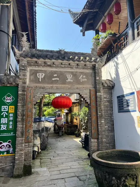 Longxing Ancient Town · 龙兴古镇
Longxing Ancient Town龙兴古镇
Longxing rewards attention to individual buildings along Canglong Street. Liu Family Courtyard combines a shopfront with successive domestic halls behind high fire walls; carved wooden windows and railings reveal the household’s…
Read the place guide →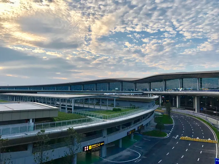 Terminal 3 of Chongqing Jiangbei International Airport · 重庆江北国际机场T3航站楼 Source-recorded photograph date: 8 January 2019 (original upload date).
Jiangbei International Airport重庆江北国际机场
Jiangbei Airport is a practical gateway with an important distinction between its terminal buildings and the T3B satellite concourse. Passengers assigned to T3B still complete departure formalities in T3A, then use the internal…
Read the place guide →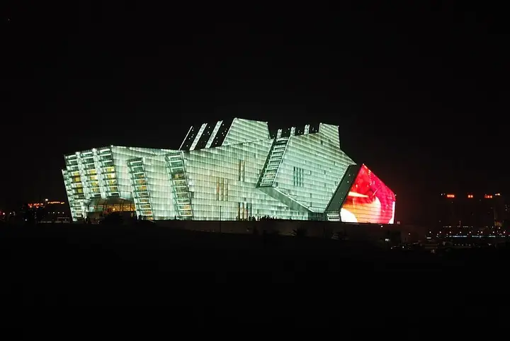 Chongqing Grand Theatre illuminated at night · 重庆大剧院夜景 Photograph date recorded by the source: 30 June 2010.
Chongqing Grand Theatre重庆大剧院
Chongqing Grand Theatre presents a faceted, emerald-glass profile at Jiangbeizui, its angular blocks recalling a ship at the river’s edge. The building contains a large theatre and a smaller auditorium, making an evening…
Read the place guide →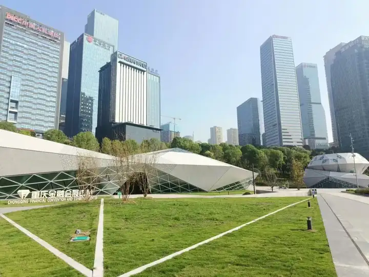 Jiangbeizui Riverside Park · 江北嘴江滩公园
Jiangbeizui Riverside Park江北嘴江滩公园
Jiangbeizui Riverside Park follows the north-bank waterfront around the meeting of Chongqing's rivers. Its central section passes the Jiangbei end of Qiansimen Bridge and the Grand Theatre, with paths at different heights above…
Read the place guide →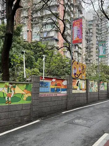 Beicang Creative District · 北仓文创街区
Beicang Creative District北仓文创街区
Beicang Creative District is a converted 1960s textile warehouse at Guanyinqiao, in territory that was Jiangbei District until a November 2025 reform folded it into the newly created Liangjiang New Area, Chongqing.
Read the place guide →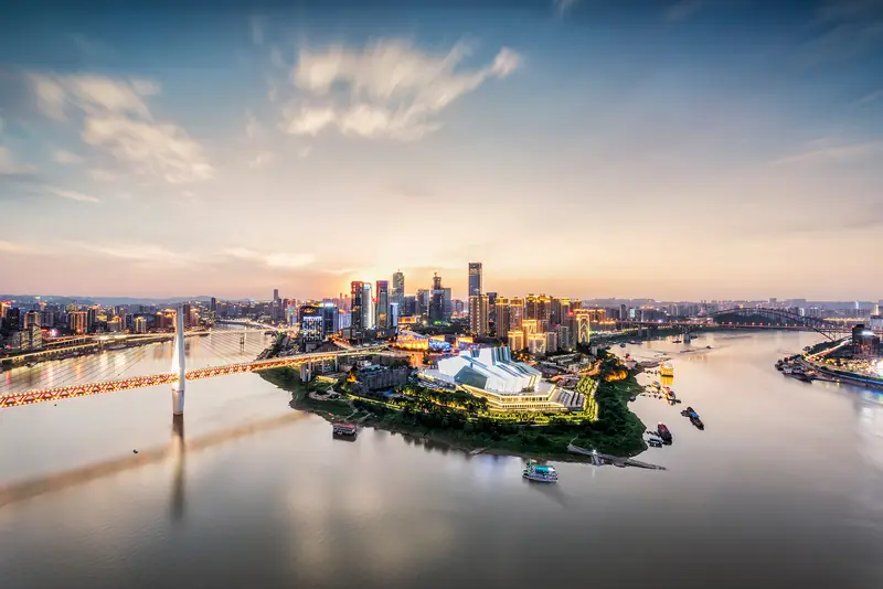 Jiangbeizui Riverfront · 江北嘴江岸
Jiangbeizui Riverfront江北嘴江岸
Jiangbeizui is the riverbank district at the confluence of the Yangtze and Jialing rivers, in territory that was Jiangbei District until a November 2025 reform folded it into the newly created Liangjiang New Area, Chongqing, redeveloped since 2002 from a former river-port old town into a financial-services district of high-rises.
Read the place guide →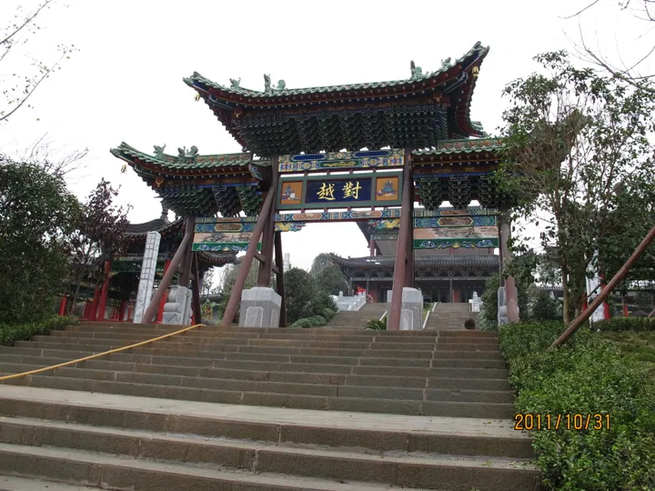 An ornate Chinese-style memorial gate and staircase inside Chongqing Garden Expo Park, Liangjiang New Area. · 重庆市两江新区重庆园博园内牌楼及台阶。 Source-recorded photograph date: Taken on 31 October 2011.
Chongqing Garden Expo Park重庆园博园
Hilly lakeside garden park in Liangjiang New Area, built for the 2011 garden expo, with 127 exhibition gardens and a cleaned-up Longjing Lake.
Read the place guide →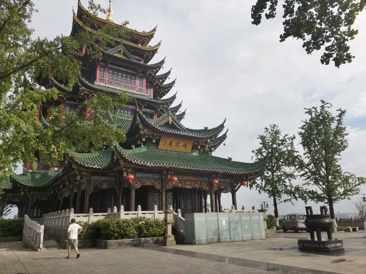 Hong'en Pavilion, the seven-storey pagoda at the summit of Hong'en Temple Forest Park, Liangjiang New Area, Chongqing. · 重庆市两江新区鸿恩寺森林公园龙脊山顶七层仿古建筑鸿恩阁。 Source-recorded photograph date: 2020-07-18 16:55:35.
Hong'en Temple Forest Park鸿恩寺森林公园
Hilltop city park in Jiangbei, Chongqing, opened in 2009, known for its osmanthus and the seven-storey Hong'en Pavilion viewing deck.
Read the place guide →Plan your visit
Getting there
Liangjiang New Area is about 6 km in a straight line from central Chongqing. Search for 两江新区 in a map app to find stations and your accommodation.
Where to stay →Build your route
Longxing Ancient Town and Jiangbei International Airport are about 15 km apart in a straight line. The linked place guides have entrance and visit details.
Continue with Chongqing →More in Chongqing
Sources & geographic information
Administrative names and parent areas: Official geographic directory · Reference date 2026-09-06.
Official administrative update
Official administrative update
Liangjiang New Area People’s Government: current district profile
Some facts checked against 两江新区 — Wikipedia contributors, CC BY-SA 4.0.
Some facts checked against 鸿恩寺森林公园 — Wikipedia contributors, CC BY-SA 4.0.
Photo: Longxing Ancient Town · Source photographer · License not provided. EXIF orientation normalized; resized without changing aspect ratio; converted to WebP. No subject edits.
Photo: Jiangbei International Airport · Juukeihc at English Wikipedia · CC BY 4.0. Full frame retained; proportionally resized and converted to WebP. No retouching or changes to the photographed subject. Card displays may crop the view.

Photo: Chongqing Grand Theatre · Oliver Ren · Oliver Ren — Chongqing_Grand_Theatre_01.jpg — CC BY-SA 3.0 · CC BY-SA 3.0. The exact downloaded source bytes are separately retained and hashed. Prepared JPEG is proportionally reduced to a maximum 720-pixel long edge; full frame retained, no subject alteration. Final website rendition: full frame retained, proportionally resized to at most 720 pixels and converted to WebP. No additional retouching or subject alteration. Card displays may crop the view.

Photo: Jiangbeizui Riverside Park · Source photographer · License not provided. EXIF orientation normalized; resized without changing aspect ratio; converted to WebP. No subject edits.
Photo: Beicang Creative District · Source photographer · License not provided. EXIF orientation normalized; resized without changing aspect ratio; converted to WebP. No subject edits.
Photo: Jiangbeizui Riverfront · Source photographer · License not provided. EXIF orientation normalized; resized without changing aspect ratio; converted to WebP. No subject edits.
Photo: Chongqing Garden Expo Park · Nyx Ning · CC BY-SA 3.0. Full frame retained; proportionally resized and converted to WebP. No retouching or changes to the photographed subject. Card displays may crop the view.

Photo: Hong'en Temple Forest Park · HMGiovanniV · CC BY-SA 4.0. Full frame retained; proportionally resized and converted to WebP. No retouching or changes to the photographed subject. Card displays may crop the view.

Map data © OpenStreetMap contributors. Pins mark approximate centres, not entrances or boundaries.