


Get to know Wulong District
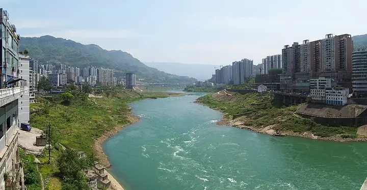
Photo adjustments
Full frame retained; resized proportionally to a maximum dimension of 960 pixels and converted to WebP quality 88. No crop, retouch, generated elements, or subject alteration. Final website rendition: full frame retained, proportionally resized to at most 720 pixels and converted to WebP. No additional retouching or subject alteration. Card displays may crop the view.
- Administrative area
- District · 市辖区
- Part of
- Chongqing
- Chinese name
- 武隆区
- Local areas
- District guide
Area & population
- Area in the source
- 2,872.00 km²
- Population · 2010
- 351,000
Source: cited geographic source, as of the dates shown.
Setting and landscape
Pengshui (彭水县) lies to the east, Fuling (涪陵区) and Nanchuan (南川区) to the west, and Fengdu (丰都县) to the north. Elevations range from 160 to 2,033 metres, and the district government notes a subtropical monsoon climate with marked differences in climate between low and high ground. The district is in the Wuling Mountains (武陵山区), and the first road out of the county town came only with the Sichuan–Hunan highway (川湘公路) in the Republican period.
History
The district government dates Wulong to 619, the second year of the Tang Wude reign, and glosses the name as "martial and prosperous" (威武兴隆). It was a county under Fuling just before Chongqing became a municipality, and became a district in November 2016. The Western Han tomb found at Guankou (关口西汉一号墓) in 2023 yielded more than 600 objects; the district government calls it the earliest precisely dated Western Han tomb found in China so far. Other old sites include the Tukan site (土坎遗址) and the tomb of Zhangsun Wuji (长孙无忌墓) at Jiangkou (江口).
What to see
The Wulong Karst (武隆喀斯特) has three parts: the Three Natural Bridges (天生三桥), the Qingkou sinkholes (箐口天坑) and Furong Cave (芙蓉洞). It was inscribed as part of the South China Karst World Heritage site in June 2007. The Three Natural Bridges area at Xiannüshan (仙女山镇) takes in the Tianlong, Qinglong and Heilong bridges, the Qinglong and Shenying sinkholes and the Longshui Gorge fissure (龙水峡地缝).
Furong Cave, beside the Furong River (芙蓉江) at Jiangkou, is 2,700 metres long, with more than 70 kinds of cave deposits. The Qingkou group at Houping (后坪乡) has five sinkholes, which Chinese Wikipedia describes as the only sinkhole group known to have been cut by surface water. Fairy Mountain (仙女山) is a national forest park.
Food and local products
The district government lists Yangjiao dried tofu (羊角豆干), bowl mutton (碗碗羊肉), Yangjiao aged vinegar (羊角老醋), Wulong sweet-potato noodles (武隆苕粉), Xiannü black tea (仙女红茶) and laoying tea (老鹰茶) as local products.
Highlights
- Three Natural Bridges 天生三桥: Tianlong, Qinglong and Heilong bridges at Xiannüshan, part of the Wulong Karst World Heritage area.
- Furong Cave 芙蓉洞: A 2,700-metre cave beside the Furong River with more than 70 kinds of deposits.
- Fairy Mountain 仙女山: A national forest park.
- Yangjiao dried tofu 羊角豆干: Listed by the district government among Wulong's local products.
Sources for this guide
武隆概况_重庆市武隆区人民政府 · Wulong District People's Government, Chongqing
武隆区 - 维基百科,自由的百科全书 · Wikipedia (Chinese) · CC BY-SA 4.0
武隆喀斯特 - 维基百科,自由的百科全书 · Wikipedia (Chinese) · CC BY-SA 4.0
Original English written from the listed sources and checked sentence by sentence against quoted extracts by a separate reviewer. Updated 2026-09-25.
Explore Wulong District
Core places to explore, with English and Chinese names.
Places to explore around Wulong District
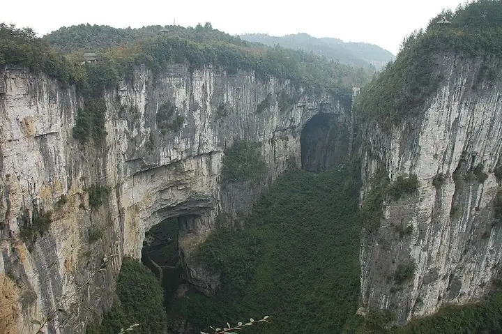 Natural bridge and karst gorge at Wulong Three Natural Bridges · 武隆天生三桥自然石桥与峡谷 Photograph date recorded by the source: November 2008.
Wulong Three Natural Bridges武隆天生三桥
The Three Natural Bridges form a sequence of large limestone arches within Wulong’s karst landscape. Named Tianlong, Qinglong and Heilong, the bridges span spaces cut into the rock by water and collapse. Their different shapes…
Read the place guide →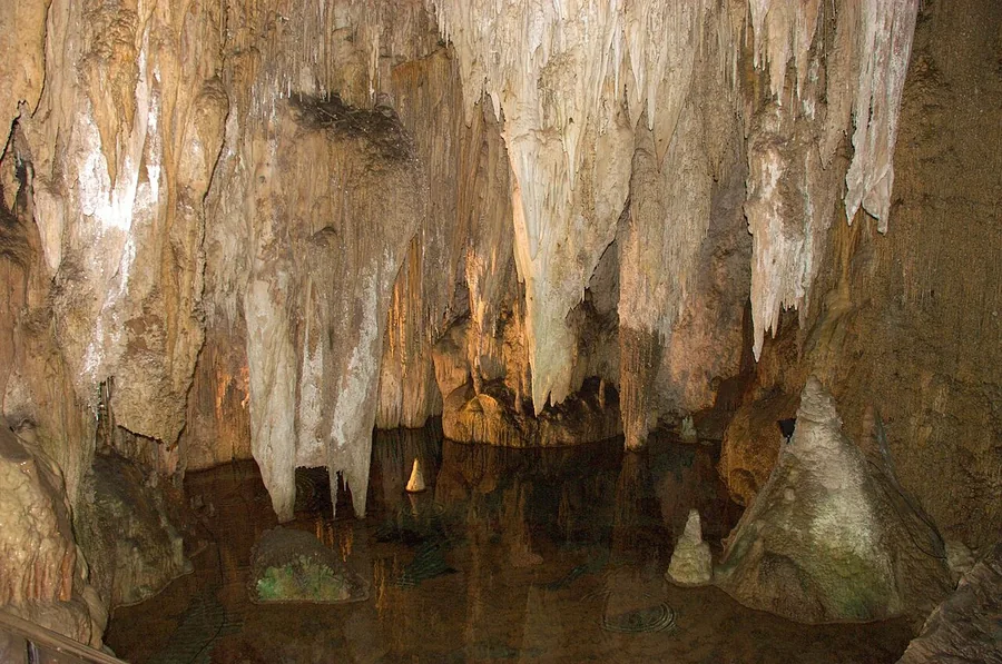 Limestone formations inside Furong Cave in Wulong, photographed in November 2008.
Furong Cave芙蓉洞
Furong Cave opens above the Furong River in Wulong, with large chambers and mineral formations ranging from a broad stone waterfall to coral-like projections. The contrast between smooth draped deposits and finer clustered…
Read the place guide →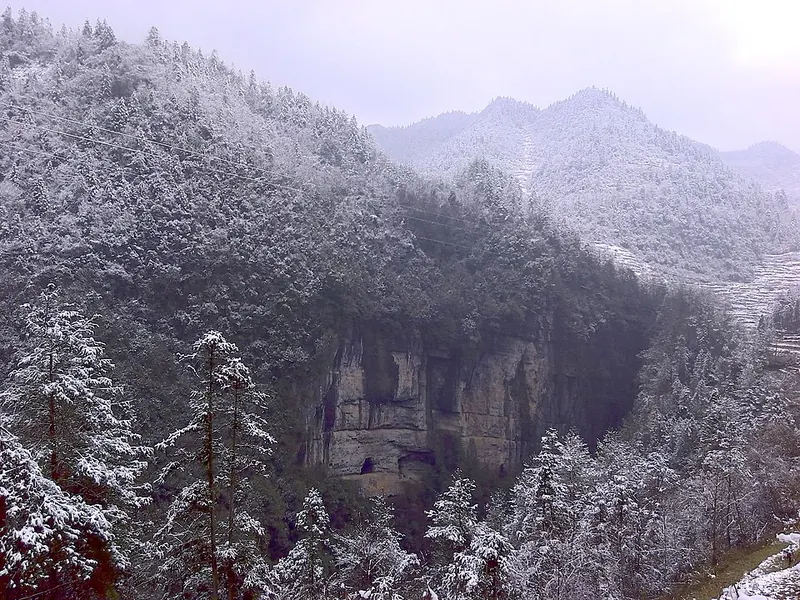 Niubizidong Tiankeng in winter, Wulong Karst · 武隆喀斯特 Photograph date recorded by the source: 2017-04-07.
Wulong Karst武隆喀斯特
Wulong Karst is a group of separate landscapes rather than one continuous park entrance. The Three Natural Bridges show limestone on a monumental outdoor scale, while Furong Cave reveals mineral formations inside the rock. The…
Read the place guide →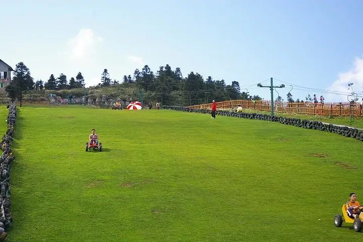 Grass slope at Fairy Mountain, Wulong · 武隆仙女山草坡 Photograph date recorded by the source: Taken on 4 October 2009.
Fairy Mountain仙女山
Fairy Mountain combines broad upland meadow with dense woodland above Wulong. The Great Grassland is the signature scene: low rolling ground and open pasture framed by forest, very different from the deep karst pits elsewhere in…
Read the place guide →Natural stone bridge and karst gorge at Wulong Three Natural Bridges · 武隆天生三桥石桥与峡谷. Source-recorded photograph date: 2008-11.Three Natural Bridges天生三桥
Three karst rock arches and two sinkholes over the Yangshui River in Wulong, Chongqing, part of the South China Karst World Heritage Site.
Read the place guide →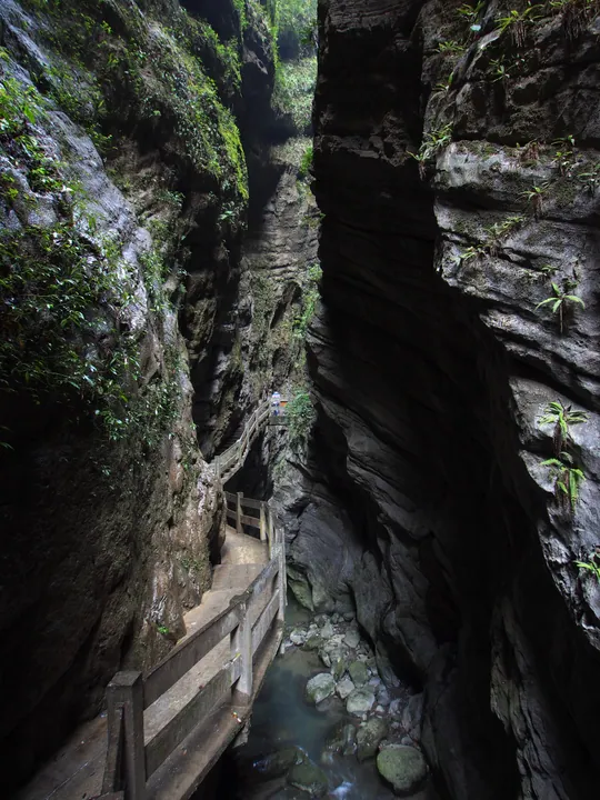 Narrow limestone canyon slot with a wooden walkway at Longshuixia Canyon, Wulong District · 重庆市武隆区龙水峡地缝景区内的峡谷栈道 Source-recorded photograph date: Taken on 12 April 2015.
Longshui Gorge Fissure龙水峡地缝
Longshuixia Difeng is a karst fissure gorge 4 kilometres long in Wulong District, Chongqing, within the Tianshengsanqiao component area of the Wulong Karst UNESCO World Natural Heritage Site. It was established as a national AAAA-grade scenic area.
Read the place guide →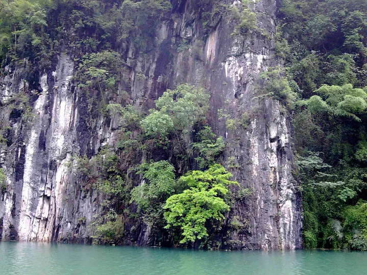 Karst cliffs along the Furong River in Wulong District · 武隆区芙蓉江喀斯特峡谷 Source-recorded photograph date: Taken on 8 June 2010.
Furong River芙蓉江
Largest tributary of the Wu River, whose last 35 km in Wulong form a national scenic area of karst gorges and a reservoir lake.
Read the place guide →Local life & food
Wulong District local specialties
武隆区特色美食 · 7 specialties to discover
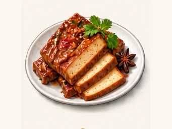 Yangjiao spiced dried tofu 羊角豆干AI illustration · AI 示意图
The tofu has a compact, chewy bite and concentrated soy-and-spice flavor, quite unlike soft tofu pudding. Thin slicing makes its firmness easier to appreciate.
Source ↗Read the dish guide →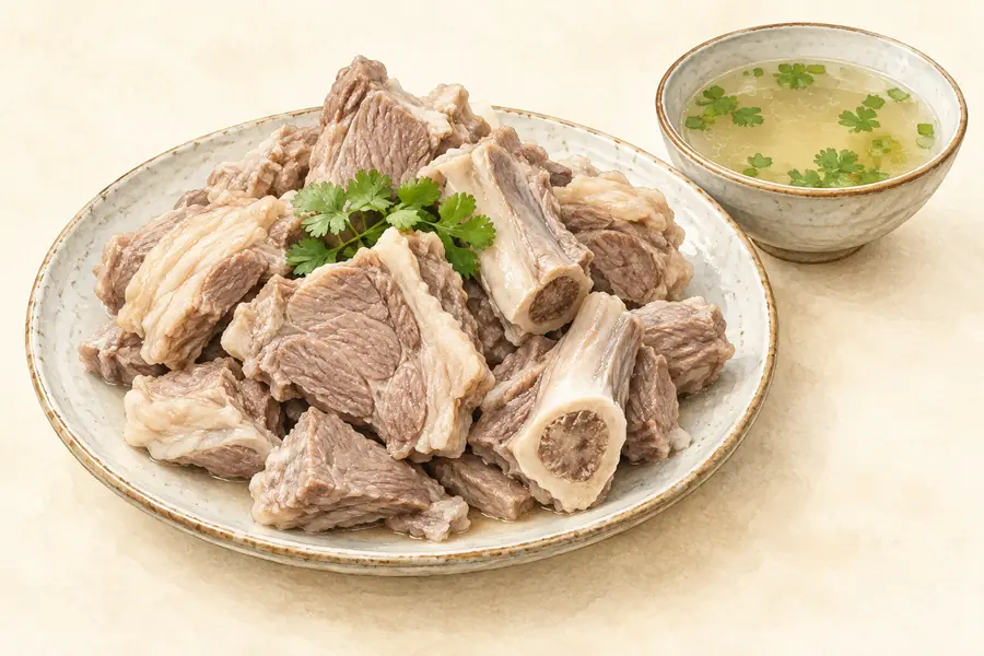 Wulong Mutton by the Bowl 武隆碗碗羊肉AI illustration · AI 示意图(仅供参考,非实拍)
Wulong Mutton by the Bowl (武隆碗碗羊肉) is a traditional snack from Yangjiao Town (羊角镇) in Wulong District, Chongqing: local goat meat portioned into single bowls, a way of selling it that gave the dish its name.
Read the dish guide → Wulong Sweet Potato Starch Noodles 武隆苕粉
Wulong Sweet Potato Starch Noodles (武隆苕粉) are noodles made from sweet-potato starch in Wulong District (武隆), Chongqing, registered as a Chinese geographical-indication product and made by a method on Chongqing's municipal intangible heritage list.
Read the dish guide →Photo adjustments
EXIF orientation normalized; resized without changing aspect ratio; converted to WebP. No subject edits.
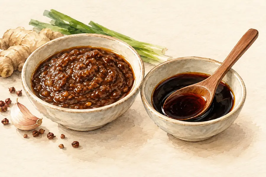 Yangjiao Aged Vinegar 羊角老醋AI illustration · AI 示意图(仅供参考,非实拍)
Yangjiao Aged Vinegar (羊角老醋) is a grain vinegar brewed in Yangjiao (羊角镇) in Wulong District (武隆区), Chongqing, with more than forty Chinese medicinal herbs and local spring water.
Read the dish guide →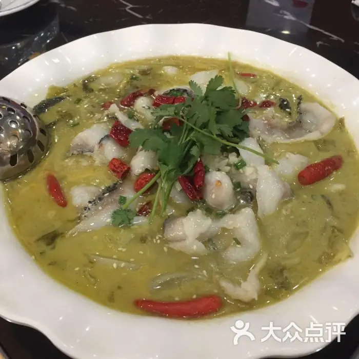 Jiangkou Sour-Soup Fish 江口鱼
Jiangkou Sour-Soup Fish (江口鱼) is fish boiled for a couple of minutes in a sour broth of long-fermented pickles, named after Jiangkou town (江口镇) in eastern Wulong District (武隆区), Chongqing, where the Wu River (乌江) meets the Furong River (芙蓉江).
Read the dish guide →Photo adjustments
EXIF orientation normalized; resized without changing aspect ratio; converted to WebP. No subject edits.
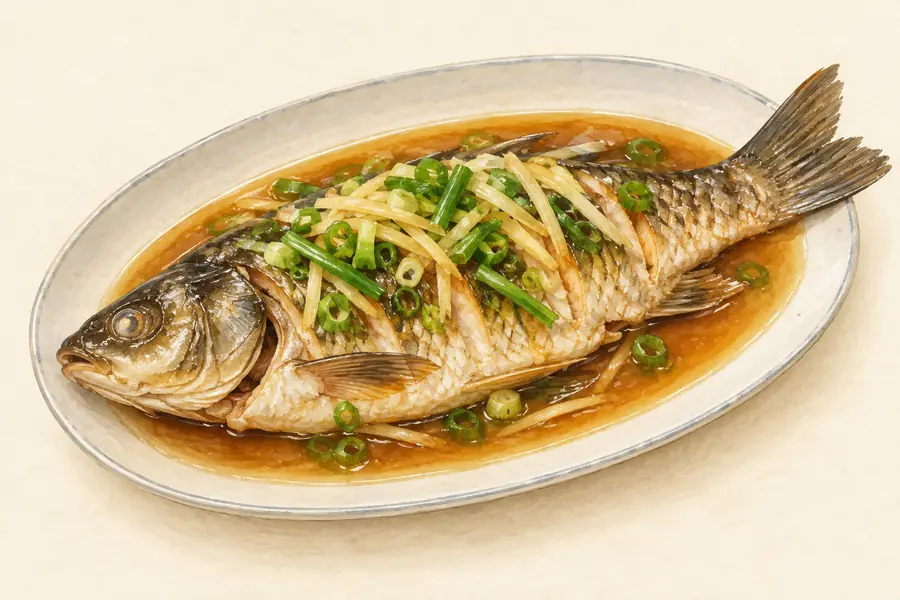 Wujiang River Fish 乌江鱼AI illustration · AI 示意图(仅供参考,非实拍)
Wujiang River Fish (乌江鱼) is listed among the local specialties of Wulong District, Chongqing. The name includes 鱼 (fish).
Read the dish guide → High-Mountain Cured Pork 高山腊肉
High-Mountain Cured Pork (高山腊肉) is the smoked cured pork of the uplands of Wulong District (武隆区), Chongqing.
Read the dish guide →
Photo adjustments
EXIF orientation normalized; resized without changing aspect ratio; converted to WebP. No subject edits.
More dishes from across Chongqing are in the Chongqing food guide.
Plan your visit
Getting there
Wulong District is about 115 km in a straight line from central Chongqing. Search for 武隆区 in a map app to find stations and your accommodation.
Where to stay →Build your route
Wulong Three Natural Bridges and Furong Cave are about 25 km apart in a straight line. The linked place guides have entrance and visit details.
Continue with Chongqing →More in Chongqing
Sources & geographic information
Administrative names and parent areas: Official geographic directory · Reference date 2026-09-06.
Some facts checked against 武隆区 — Wikipedia contributors, CC BY-SA 4.0.
Some facts checked against 武隆喀斯特 — Wikipedia contributors, CC BY-SA 4.0.
Photo: Wulong Three Natural Bridges · Brookqi · Brookqi — Wulongtianshengsanqiao.JPG — Public domain · Public domain. The exact downloaded source bytes are separately retained and hashed. Prepared JPEG is proportionally reduced to a maximum 720-pixel long edge; full frame retained, no subject alteration. Final website rendition: full frame retained, proportionally resized to at most 720 pixels and converted to WebP. No additional retouching or subject alteration. Card displays may crop the view.


Photo: Furong Cave · Brookqi · Public domain (author dedication). Proportionally resized and converted to WebP without cropping, retouching or changing the photographed subject.


Photo: Wulong Karst · Speleologist · CC BY-SA 4.0. Full frame retained; proportionally resized and converted to WebP. No retouching or changes to the photographed subject. Card displays may crop the view.

Photo: Fairy Mountain · 杨志强Zhiqiang · CC BY-SA 3.0. The exact downloaded source bytes are separately retained and hashed. Prepared JPEG is proportionally reduced to a maximum 720-pixel long edge; full frame retained, no subject alteration. Final website rendition: full frame retained, proportionally resized to at most 720 pixels and converted to WebP. No additional retouching or subject alteration. Card displays may crop the view.
.jpg)
Photo: Three Natural Bridges · Brookqi · Public domain. Full source framing retained; proportionally resized and converted to WebP. No retouching or subject alteration. Card displays may crop the view.
Photo: Longshui Gorge Fissure · rheins · CC BY 3.0. Full frame retained; proportionally resized and converted to WebP. No retouching or changes to the photographed subject. Card displays may crop the view.

Photo: Furong River · Nyx Ning · CC BY-SA 3.0. Full frame retained; proportionally resized and converted to WebP. No retouching or changes to the photographed subject. Card displays may crop the view.

Map data © OpenStreetMap contributors. Pins mark approximate centres, not entrances or boundaries.