


Get to know Yunyang County

Photo adjustments
Full-frame source proportionally resized and converted to WebP for display. No subject alteration. Source-supplied marks and edits remain; cards may crop the view.
- Administrative area
- County · 县
- Part of
- Chongqing
- Chinese name
- 云阳县
- Local areas
- County guide
Area & population
- Area in the source
- 3,634.00 km²
- Population · 2010
- 912,900
Source: cited geographic source, as of the dates shown.
History
In 314 BC the Qin, having conquered the Ba state, set up Quren County (朐忍县) here. In 568 the seat moved to Tangkou (汤口), today's Yunyang town, and the county was renamed Yun'an (云安). It became Yunyang Prefecture (云阳州) in 1283 and was reduced to Yunyang County in 1373 under the Ming.
What to see
The Zhang Fei Temple (张飞庙), also called the Zhang Huanhou Temple (张桓侯庙), was founded at the end of the Shu Han kingdom to honour the Three Kingdoms general Zhang Fei (张飞). Local tradition says his head is buried here and his body in Langzhong (阆中). It first stood at the foot of Feifeng Mountain (飞凤山) on the south bank, opposite the old county town. Because of the Three Gorges project, the temple was moved using its original materials to Long'an village in Panshi (盘石镇), still facing the new county town across the river, and reopened on 19 July 2003. It has been a national key protected site since 2001 and holds several hundred pieces of writing, calligraphy, paintings and carved steles.
Longgang (云阳龙缸) is a national 5A scenic area in Qingshui Tujia Township (清水土家族乡) in the south-east, 68 kilometres from the county town. Its karst landscape of sinkholes, rock peaks, caves and underground rivers centres on the Longgang tiankeng, an oval pit 335 metres deep that the Chongqing government ranks third in China for depth. A glass walkway, the Cloud-End Corridor Bridge (云端廊桥), projects 26.68 metres from a cliff above a drop of more than 700 metres. Other named sights include Da'an Cave (大安洞), the Qishan grassland (岐山草原) and the Shisun River (石笋河).
Panshi Fortress (磐石城), also called Mopan Zhai (磨盘寨), is a flat-topped rock of 3.5 hectares with sheer cliffs on all sides, standing above the new county town with water on three sides.
Food and local products
Fresh noodles are one of Yunyang's main industries, and noodles made in the county are sold throughout China.
Highlights
- Zhang Fei Temple 张飞庙: Shu Han memorial temple moved above the Three Gorges reservoir and reopened in 2003.
- Longgang 云阳龙缸: 5A karst area around a 335-metre-deep tiankeng.
- Cloud-End Corridor Bridge 云端廊桥: Glass walkway projecting 26.68 metres over a 700-metre cliff at Longgang.
- Panshi Fortress 磐石城: Cliff-bound flat-topped rock above the new county town.
Sources for this guide
云阳龙缸景区_重庆市人民政府网 · Chongqing Municipal People's Government
云阳县 - 维基百科,自由的百科全书 · Wikipedia (Chinese) · CC BY-SA 4.0
张桓侯庙 - 维基百科,自由的百科全书 · Wikipedia (Chinese) · CC BY-SA 4.0
Original English written from the listed sources and checked sentence by sentence against quoted extracts by a separate reviewer. Updated 2026-09-25.
Explore Yunyang County
Core places to explore, with English and Chinese names.
Places to explore around Yunyang County
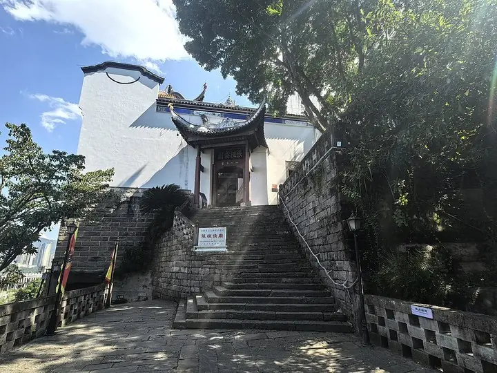 Zhang Fei Temple entrance in Yunyang · 云阳张飞庙入口 Photograph date recorded by the source: 9 October 2025, 12:39:38.
Zhang Fei Temple张飞庙
Yunyang’s Zhang Fei Temple joins the commemoration of a military hero with an unusually rich literary collection. Stone inscriptions and carved calligraphy give the halls a character beyond the figure of Zhang Fei, while Dujuan…
Read the place guide →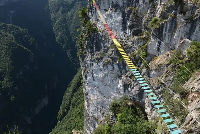 Yunyang Longgang · 云阳龙缸
Yunyang Longgang云阳龙缸
Longgang in Yunyang's Qingshui area is a karst destination centred on a deep, steep-walled sinkhole.
Read the place guide →Local life & food
Yunyang County local specialties
云阳县特色美食 · 6 specialties to discover
 Yunyang Paper-Thin Walnut Rice Cake 云阳桃片糕AI illustration · AI 示意图(仅供参考,非实拍)
Yunyang Paper-Thin Walnut Rice Cake (云阳桃片糕) is a sliced cake of glutinous rice, sugar and walnut from Yunyang County (云阳县) in north-eastern Chongqing.
Read the dish guide →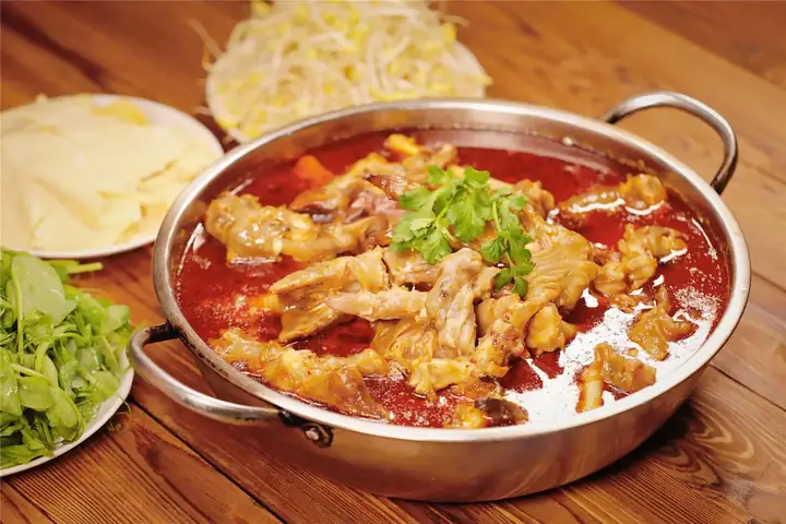 Yunyang Goat Trotters 云阳羊脚脚
Yunyang Goat Trotters (云阳羊脚脚) are goat feet stewed for hours and served in a red-oil hot pot in Yunyang County (云阳县), Chongqing.
Read the dish guide →Photo adjustments
EXIF orientation normalized; resized without changing aspect ratio; converted to WebP. No subject edits.
 Yunyang Baomian Wontons 云阳包面AI illustration · AI 示意图(仅供参考,非实拍)
Yunyang Baomian Wontons (云阳包面) are the pork-filled wontons of Yunyang County (云阳县), Chongqing. Elsewhere these are known as huntun (馄饨) or chaoshou (抄手); in Yunyang everyone calls them baomian (包面).
Read the dish guide →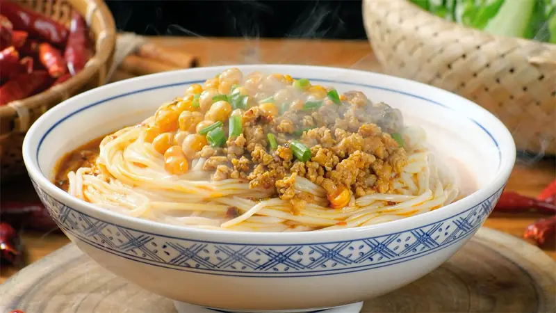 Yunyang Noodles 云阳面条
Yunyang Noodles (云阳面条) are the noodles of Yunyang County (云阳县), in the heart of the Three Gorges reservoir area of Chongqing. There the day often starts with a bowl of Yunyang zaomian (云阳早面), 'Yunyang morning noodles'.
Read the dish guide →Photo adjustments
EXIF orientation normalized; resized without changing aspect ratio; converted to WebP. No subject edits.
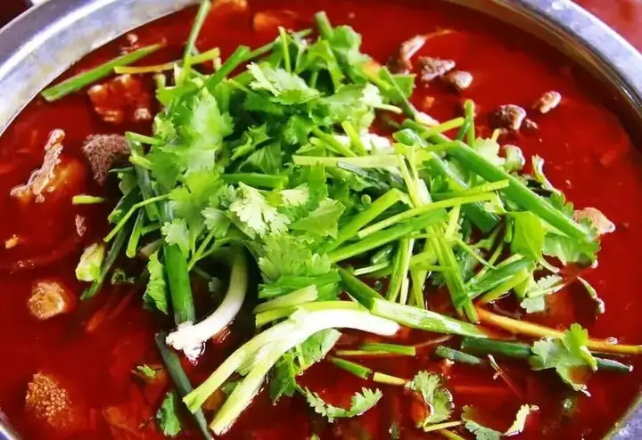 Yun'an Lamb Offal Soup 云安羊杂
Yun'an Lamb Offal Soup (云安羊杂) is a red-oil pot of stewed offal from Yun'an ancient town (云安古镇) in Yunyang County (云阳县), Chongqing.
Read the dish guide →Photo adjustments
EXIF orientation normalized; resized without changing aspect ratio; converted to WebP. No subject edits.
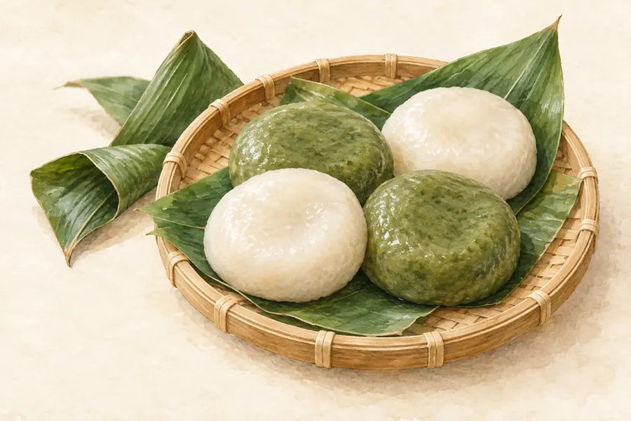 Yunyang Leaf-Wrapped Sticky Rice Buns 云阳叶儿粑AI illustration · AI 示意图(仅供参考,非实拍)
Yunyang Leaf-Wrapped Sticky Rice Buns (云阳叶儿粑) is listed among the local specialties of Yunyang County, Chongqing. It is grouped here with street food & snacks; retain the complete Chinese name when comparing local menus.
Read the dish guide →More dishes from across Chongqing are in the Chongqing food guide.
Plan your visit
Getting there
Yunyang County is about 260 km in a straight line from central Chongqing. Search for 云阳县 in a map app to find stations and your accommodation.
Where to stay →Build your route
Zhang Fei Temple and Yunyang Longgang are both listed here. The linked place guides have entrance and visit details.
Continue with Chongqing →More in Chongqing
Sources & geographic information
Administrative names and parent areas: Official geographic directory · Reference date 2026-09-06.
Some facts checked against 云阳县 — Wikipedia contributors, CC BY-SA 4.0.
Some facts checked against 张桓侯庙 — Wikipedia contributors, CC BY-SA 4.0.
Photo: Zhang Fei Temple · STW932 · STW932 — Zhang Fei Temple 02.jpg — CC0 · CC0. The exact downloaded source bytes are separately retained and hashed. Prepared JPEG is proportionally reduced to a maximum 720-pixel long edge; full frame retained, no subject alteration. Final website rendition: full frame retained, proportionally resized to at most 720 pixels and converted to WebP. No additional retouching or subject alteration. Card displays may crop the view.

Photo: Yunyang Longgang · Source photographer · License not provided. EXIF orientation normalized; resized without changing aspect ratio; converted to WebP. No subject edits.
Map data © OpenStreetMap contributors. Pins mark approximate centres, not entrances or boundaries.