


Get to know Zhangye

Photo adjustments
Full frame retained; proportionally resized and converted to WebP. No retouching or changes to the photographed subject. Card displays may crop the view.
- Administrative area
- Prefecture-level city · 地级市
- Part of
- Gansu
- Chinese name
- 张掖市
- Local areas
- 6 local areas
Area & population
- Area in the source
- 42,000.00 km²
- Population · 2010
- 1,199,515
- Administrative seat
- Ganzhou District
Source: cited geographic source, as of the dates shown.
Setting and landscape
The corridor runs between the Qilian range to the south and the Heli (合黎) and Longshou (龙首山) mountains to the north, and is crossed by the Hei River (黑河) and its tributary the Shandan River (山丹河). Summers are short and hot and winters long and severe, while the Qilian highlands have an alpine climate.
History
People have lived here for more than 4,000 years. The Han founded Zhangye commandery in 111 BC, naming it for the aim to “stretch the state’s arm to reach the Western Regions” (张国臂掖,以通西域); the Western Wei renamed it Ganzhou in 554 after a sweet spring. Three branches of the Silk Road met here, and the city counts Zhang Qian’s (张骞) mission to the west, Huo Qubing’s (霍去病) defeat of the Xiongnu and Marco Polo’s stay among its history. Zhangye was also the main Hexi battlefield of the Red Army’s Western Route Army, remembered at the Western Route Army Memorial Hall (中国工农红军西路军纪念馆), a national first-grade museum. Yugur folk songs (裕固族民歌) from Sunan Yugur Autonomous County (肃南裕固族自治县), sung by a people who speak a Turkic and a Mongolic language, were on the first national intangible heritage list in 2006.
What to see
The Zhangye Danxia (张掖七彩丹霞), 40 km west of the city in Linze (临泽县) and Sunan counties, is a national 5A scenic area and a World Geopark: bands of purple-red, grey-green and yellow-green mudstone and shale, Cretaceous red beds carved by water and wind. The Giant Buddha Temple (张掖大佛寺), a Western Xia royal temple in the southwest of the old city, holds what the city’s tourism bureau calls Asia’s largest indoor reclining Buddha, of clay over wood. The Mati Temple Grottoes (马蹄寺石窟群), 65 km south of the city in Sunan County, date from the Northern Liang and spread over seven sites with more than 70 niches.
Food and local products
Zhangye grows a lot of wheat, so its snacks are mostly made of dough. Saozi noodles (臊子面), served in a thickened broth with floating diamonds of tofu, are the favourite breakfast; xiaofan (小饭) mixes small pieces of dough, meat and tofu with red beans and starch sheets; and cuoyuzi (搓鱼子) are hand-rolled, fish-shaped noodles of buckwheat, highland barley or wheat flour.
Getting oriented
The city government sits in Ganzhou District (甘州区). The Lanzhou–Xinjiang Railway (兰新铁路), the Lanzhou–Xinjiang high-speed railway (兰新高铁) and the Lianyungang–Khorgas Expressway (连霍高速) cross the prefecture, and Zhangye has its own airport.
Highlights
- Zhangye Danxia 张掖七彩丹霞: Banded Cretaceous red beds in Linze and Sunan counties; a national 5A scenic area and World Geopark.
- Giant Buddha Temple 张掖大佛寺: Western Xia royal temple in the southwest of the old city with a large indoor clay reclining Buddha.
- Mati Temple Grottoes 马蹄寺石窟群: Northern Liang grottoes in Sunan County, seven sites with more than 70 niches.
- Cuoyuzi 搓鱼子: Hand-rolled, fish-shaped noodles of buckwheat, highland barley or wheat flour.
Sources for this guide
张掖市人民政府>> 张掖市概况 · Zhangye Municipal People's Government
张掖市人民政府>> 【5A】张掖七彩丹霞景区 · Zhangye Municipal Bureau of Culture, Radio, Television and Tourism (city portal)
张掖市人民政府>> 【4A】张掖大佛寺景区 · Zhangye Municipal Bureau of Culture, Radio, Television and Tourism (city portal)
张掖市人民政府>> 【4A】马蹄石窟群旅游景区 · Zhangye Municipal Bureau of Culture, Radio, Television and Tourism (city portal)
张掖市 - 维基百科,自由的百科全书 · Wikipedia (Chinese) · CC BY-SA 4.0
裕固族民歌 - 中国非物质文化遗产网·中国非物质文化遗产数字博物馆 · China Intangible Cultural Heritage Network (ihchina.cn)
甘肃甘州-张掖风味小吃 · Ganzhou District People's Government (district gazetteer office)
Original English written from the listed sources and checked sentence by sentence against quoted extracts by a separate reviewer. Updated 2026-09-30.
Explore Zhangye
Core places to explore, with English and Chinese names.
Zhangye National Geopark 张掖国家地质公园
Giant Buddha Temple 张掖大佛寺
Zhangye 张掖
Pingshanhu Grand Canyon 平山湖大峡谷
Mati Temple Grottoes 马蹄寺石窟群
Zhangye Wooden Pagoda Temple 张掖木塔寺
Zhangye Rainbow Mountains 张掖七彩丹霞
Shandan Horse Ranch Scenic Area 山丹军马场正规开放旅游区
Zhangye National Wetland Park 张掖国家湿地公园
Binggou Danxia Scenic Area 冰沟丹霞
Barsi Snow Mountain Viewing Area 巴尔斯雪山开放观景区
Mati Temple Grottoes 马蹄寺石窟
Wenshu Temple Grottoes 文殊寺石窟
Red Army Western Route Army Memorial Hall 中国工农红军西路军纪念馆
Ganzhou District 甘州区
Sunan Yugur Autonomous County 肃南裕固族自治县
Minle County 民乐县
Linze County 临泽县
Gaotai County 高台县
Shandan County 山丹县
Places to explore around Zhangye
 Zhangye Danxia Geopark · 张掖七彩丹霞
Zhangye National Geopark张掖国家地质公园
Zhangye’s geopark contains several distinct landscapes at the northern foot of the Qilian Mountains. Qicai Danxia is known for coloured layers folded across rounded hills; Binggou is more strongly defined by upright red-rock…
Read the place guide →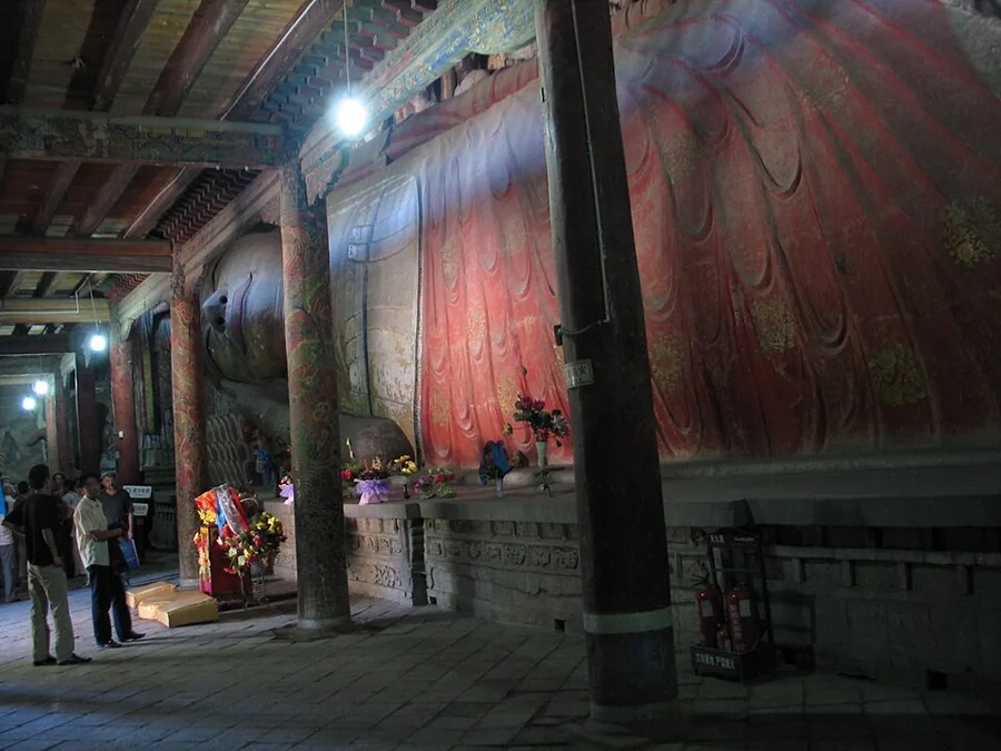 The reclining Buddha inside the Giant Buddha Temple (Dafo Si), Zhangye, Gansu.
Giant Buddha Temple张掖大佛寺
Zhangye’s Great Buddha Temple centres on an enormous reclining clay Buddha inside a broad timber hall. Figures of disciples and other attendants surround the main image, creating a much fuller religious scene than a single…
Read the place guide → Shanxi Guild Hall in Zhangye, photographed in January 2014 · 张掖山西会馆 Photograph date recorded by the source: 2 January 2014, 10:04:54.
Zhangye张掖
Zhangye is an oasis city in the Hexi Corridor, with the Qilian foothills providing a backdrop to excursions beyond its urban core. The reclining Buddha at Dafo Temple gives the city centre a distinctive architectural and…
Read the place guide → AI illustration; an interpretive view, not a photograph. AI 示意图,非景点实拍。
Pingshanhu Grand Canyon平山湖大峡谷
Pingshanhu’s red and ochre rock has been cut into a maze of towers, walls and deep channels. The rim viewpoints reveal the large pattern, while the authorised lower route changes the scale to narrow passages and tall rock faces…
Read the place guide → Cliffside cave temples at Mati Temple Grottoes · 马蹄寺石窟群 Photograph date recorded by the source: 11 September 2012, 04:30:17.
Mati Temple Grottoes马蹄寺石窟群
The Mati grottoes occupy several separate cliff complexes in the Qilian foothills. The best-known North Temple section stacks the Thirty-three Heavens caves vertically, linked by narrow internal passages and stairs. Qianfodong…
Read the place guide →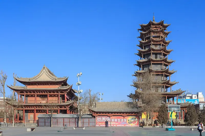 Zhangye Wooden Pagoda Temple (张掖木塔寺), Zhangye. Photograph: "Zhangye Wanshou Si 2014.01.02 11-25-58".
Zhangye Wooden Pagoda Temple张掖木塔寺
Zhangye’s Wooden Pagoda is the most recognisable survivor of Wanshou Temple. The present tower was rebuilt in 1926 and combines masonry in its lower levels with timber eaves and more extensive timberwork above. Its stacked roofs…
Read the place guide →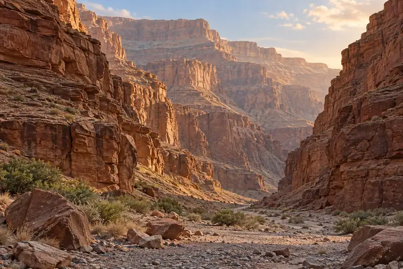 AI illustration · AI 示意图(仅供参考,非该地点实拍)
Zhangye Rainbow Mountains张掖七彩丹霞
Zhangye's Rainbow Mountains display bands of colour across rounded hills in the dry landscape west of the city.
Read the place guide → Shandan Horse Ranch Scenic Area · 山丹军马场正规开放旅游区
Shandan Horse Ranch Scenic Area山丹军马场正规开放旅游区
Shandan horse ranch (山丹军马场), presented today as the Shandan horse ranch tourist area, is a grassland and horse-breeding estate in the middle of the Hexi Corridor on the Damaying grassland at the northern foot of the Qilian Mountains, in Shandan County, Zhangye, Gansu.
Read the place guide →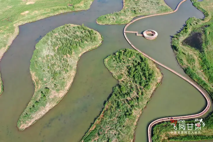 Zhangye National Wetland Park · 张掖国家湿地公园
Zhangye National Wetland Park张掖国家湿地公园
Zhangye National Wetland Park (张掖国家湿地公园) is a wetland park on the low ground north of the Zhangye urban area in Ganzhou District, Zhangye, Gansu, formed where meltwater from the Qilian Mountains collects — a park that is itself part of the Zhangye Heihe Wetland National Nature Reserve.
Read the place guide →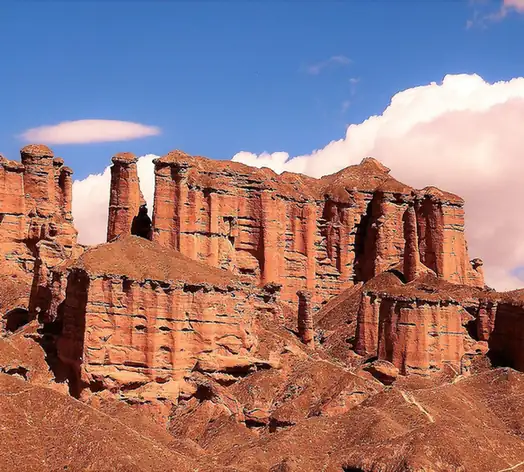 Binggou Danxia Scenic Area · 冰沟丹霞
Binggou Danxia Scenic Area冰沟丹霞
Binggou Danxia (冰沟丹霞) is a danxia landform area in Sunan Yugur Autonomous County, Zhangye, Gansu, and one of the main scenic areas of the Zhangye Danxia National Geopark.
Read the place guide →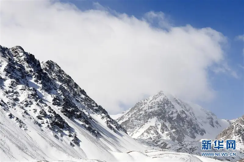 Barsi Snow Mountain Viewing Area · 巴尔斯雪山开放观景区
Barsi Snow Mountain Viewing Area巴尔斯雪山开放观景区
Barsi Snow Mountain (巴尔斯雪山) is a snow-mountain scenic area in Xichahe village, Dahe township, Sunan Yugur Autonomous County, Zhangye, Gansu, on the middle section of the Qilian Mountains' northern slope.
Read the place guide →Cliffside Buddhist cave-temple architecture at Mati Temple Grottoes, Gansu · 甘肃马蹄寺石窟崖壁建筑. Source-recorded photograph date: 2012-09-11 04:30:17.Mati Temple Grottoes马蹄寺石窟
Buddhist cave temples begun under the Northern Liang in the Qilian foothills of Sunan, Gansu, with a 42 m five-tier cave and 37 caves in seven groups.
Read the place guide →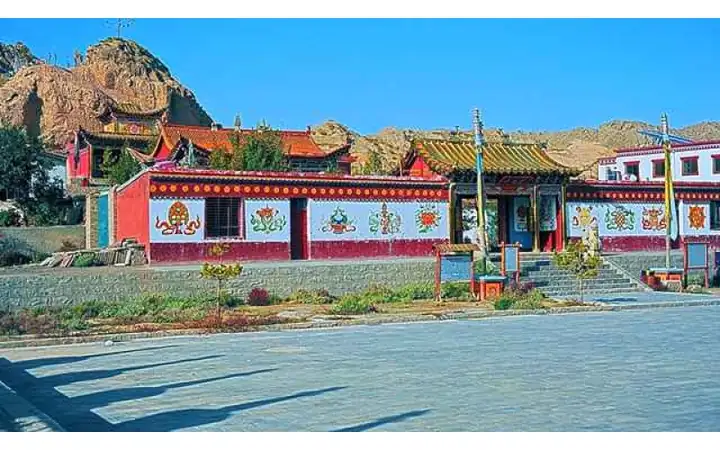 Wenshu Temple Grottoes · 文殊寺石窟
Wenshu Temple Grottoes文殊寺石窟
Wenshu Temple cave complex (文殊寺石窟群), also called Wenshu Mountain caves, is a Buddhist cave site on Wenshu Mountain in Qifeng Tibetan township, Sunan Yugur Autonomous County, Zhangye, Gansu, more than 20 km from both Jiuquan and Jiayuguan.
Read the place guide → Red Army Western Route Army Memorial Hall · 中国工农红军西路军纪念馆
Red Army Western Route Army Memorial Hall中国工农红军西路军纪念馆
The Memorial Hall of the Chinese Workers' and Peasants' Red Army's Western Route Army (中国工农红军西路军纪念馆) is a memorial museum in the county town of Gaotai County, Zhangye, Gansu, on the site of the former Gaotai Martyrs' Cemetery.
Read the place guide →Local life & food
Zhangye local specialties
张掖市特色美食 · 10 specialties to discover
 Zhangye beef tiny-noodle soup 张掖牛肉小饭AI illustration · AI 示意图
The soup is meaty and warming, while tiny dough pieces provide a soft, lightly chewy texture. The name's 'small rice' wording does not mean the base must be rice grains.
Source ↗Read the dish guide → Zhangye fish-shaped noodles 张掖搓鱼子AI illustration · AI 示意图
The thick middle gives each piece a satisfying chew, while the ends are softer. The fish-like name describes their shape.
Source ↗Read the dish guide → Siba steamed layered bread 临泽四坝蒸饼AI dish illustration / AI 菜品示意图
The bread is soft and filling, with aroma supplied by its dough and seasonings. It is different from a dry crisp flatbread.
Source ↗Read the dish guide → Spinach Noodles in Thick Chicken Broth 臊面AI illustration · AI 示意图(仅供参考,非实拍)
Spinach Noodles in Thick Chicken Broth (臊面) are the saomian of Zhangye (张掖) in Gansu, called Ganzhou saomian (甘州臊面) on the city government's food pages: fine noodles made with spinach juice and served in a thickened chicken broth under a set of toppings.
Read the dish guide → Shandan chaobola 山丹炒拨拉AI illustration · AI 示意图
The result is strongly savory, with browned edges and a mix of tender and chewy textures depending on the cuts.
Source ↗Read the dish guide →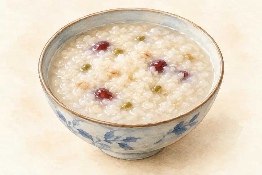 Thick Broth with Fried Dough Twists 糊饽AI illustration · AI 示意图(仅供参考,非实拍)
Thick Broth with Fried Dough Twists (糊饽) is listed among the local specialties of Zhangye, Gansu. It is grouped here with regional dishes & banquets; retain the complete Chinese name when comparing local menus.
Read the dish guide → Braised Chicken with Dough Rolls 卷子鸡AI illustration · AI 示意图(仅供参考,非实拍)
Braised Chicken with Dough Rolls (卷子鸡) is a local dish of Zhangye (张掖), a city in the middle of the Hexi Corridor (河西走廊) in Gansu.
Read the dish guide → Ganzhou Cold Noodle Sheets 甘州面皮AI illustration · AI 示意图(仅供参考,非实拍)
Ganzhou Cold Noodle Sheets (甘州面皮) is listed among the local specialties of Zhangye, Gansu. The term 面 points to noodles or flour-based food.
Read the dish guide →All dish names · 全部菜名 (10)
- Zhangye beef tiny-noodle soup · 张掖牛肉小饭
- Zhangye fish-shaped noodles · 张掖搓鱼子
- Siba steamed layered bread · 临泽四坝蒸饼
- Spinach Noodles in Thick Chicken Broth · 臊面
- Shandan chaobola · 山丹炒拨拉
- Thick Broth with Fried Dough Twists · 糊饽
- Braised Chicken with Dough Rolls · 卷子鸡
- Ganzhou Cold Noodle Sheets · 甘州面皮
- Sunan Hand-Grabbed Mutton · 肃南手抓羊肉
- Minle Braised Mutton with Rolled Dough · 民乐羊肉垫卷子
More dishes from across Gansu are in the Gansu food guide.
Counties & districts in Zhangye
6 areas belong directly to Zhangye.
6 areas
Ganzhou District甘州区
Ganzhou District, formerly the separate city of Ganzhou or Kanchow, is a district in and the seat of the prefecture-level city of Zhangye in Gansu Province, China, bordering Inner Mongolia to the north and…
Explore the area →Autonomous countySunan Yugur Autonomous County肃南裕固族自治县
Sunan Yugur Autonomous County is an autonomous county under the administration of the prefecture-level city of Zhangye, Gansu Province, China, bordering Qinghai province to the south.
Explore the area →CountyMinle County民乐县
Minle County (simplified Chinese: 民乐县; traditional Chinese: 民樂縣; pinyin: Mínlè Xiàn) is a county in Gansu province of China, bordering Qinghai province to the south.
Explore the area →CountyLinze County临泽县
Linze County (simplified Chinese: 临泽县; traditional Chinese: 臨澤縣; pinyin: Línzé Xiàn) is one of the 58 counties of Gansu province, China, bordering Inner Mongolia to the northeast.
Explore the area →Show fewer areas
Gaotai County高台县
Gaotai County is a county in Gansu Province, China, bordering Inner Mongolia to the northeast. It is under the administration of the prefecture-level city of Zhangye.
Explore the area →CountyShandan County山丹县
Shandan County is a county in Gansu Province, China, bordering Inner Mongolia to the north and Qinghai to the south. It is under the administration of the prefecture-level city of Zhangye.
Explore the area →No areas match this name.
Plan your visit
Getting there
Search for 张掖市 in a map app to find stations and your accommodation.
Where to stay →Build your route
Zhangye National Geopark and Giant Buddha Temple are about 30 km apart in a straight line. The linked place guides have entrance and visit details.
Continue with Gansu →More in Gansu
Sources & geographic information
Administrative names and parent areas: Official geographic directory · Reference date 2026-09-06.
Some facts checked against 张掖市 — Wikipedia contributors, CC BY-SA 4.0.
Photo: Zhangye National Geopark · H2v5o68z · CC0. Wikimedia thumbnail; fitted to the ranking-card frame.

Photo: Giant Buddha Temple · Leuband · CC BY-SA 3.0. Proportionally resized and converted to WebP without cropping, retouching or changing the photographed subject.

Photo: Zhangye · Zhangzhugang · CC BY-SA 4.0. Full frame retained; proportionally resized and converted to WebP. No retouching or changes to the photographed subject. Card displays may crop the view.

Photo: Mati Temple Grottoes · Immanuel Giel · CC BY-SA 3.0. Full frame retained; proportionally resized and converted to WebP. No retouching or changes to the photographed subject. Card displays may crop the view.

Photo: Zhangye Wooden Pagoda Temple · Zhangzhugang · CC BY-SA 4.0. Full frame retained; EXIF orientation normalized, proportionally resized to at most 800 pixels and converted to WebP. No generated pixels or subject changes. Cards may crop the display.

Photo: Shandan Horse Ranch Scenic Area · Source photographer · License not provided. EXIF orientation normalized; resized without changing aspect ratio; converted to WebP. No subject edits.
Photo: Zhangye National Wetland Park · Source photographer · License not provided. EXIF orientation normalized; resized without changing aspect ratio; converted to WebP. No subject edits.
Photo: Binggou Danxia Scenic Area · Source photographer · License not provided. EXIF orientation normalized; resized without changing aspect ratio; converted to WebP. No subject edits.
Photo: Barsi Snow Mountain Viewing Area · Source photographer · License not provided. EXIF orientation normalized; resized without changing aspect ratio; converted to WebP. No subject edits.
Photo: Mati Temple Grottoes · Immanuel Giel · CC BY-SA 3.0. Full source framing retained; proportionally resized and converted to WebP. No retouching or subject alteration. Card displays may crop the view.
Photo: Wenshu Temple Grottoes · Source photographer · License not provided. EXIF orientation normalized; resized without changing aspect ratio; converted to WebP. No subject edits.
Photo: Red Army Western Route Army Memorial Hall · HaziiDozen · CC BY-SA 4.0. EXIF orientation normalized; resized without changing aspect ratio; converted to WebP. No subject edits.

Map data © OpenStreetMap contributors. Pins mark approximate centres, not entrances or boundaries.