


Get to know Qianxinan Buyei and Miao Autonomous Prefecture
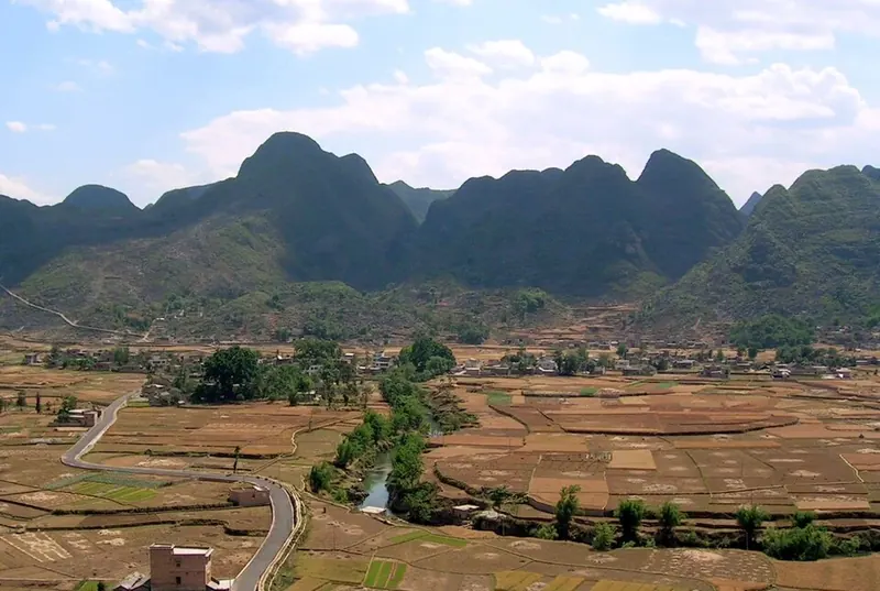
Photo adjustments
Full frame retained; proportionally resized and converted to WebP. No retouching or changes to the photographed subject. Card displays may crop the view.
- Administrative area
- Autonomous prefecture · 自治州
- Part of
- Guizhou
- Chinese name
- 黔西南布依族苗族自治州
- Local areas
- 8 local areas
Area & population
- Area in the source
- 16,804.00 km²
- Population · 2003
- 3,059,400
- Administrative seat
- Xingyi
Source: cited geographic source, as of the dates shown.
Setting and landscape
The Nanpan River (南盘江) runs along the southern border and the Beipan (北盘江) through the east; they meet at Shuangjiangkou (双江口) in Wangmo County (望谟县) to form the Hongshui River (红水河). The land is highest in the west and north, reaching 2,207.2 metres on the Qishe (七舍) and Pengzha (捧乍) plateau in Xingyi, and lowest, 275 metres, beside the Hongshui in Wangmo. Wanfenglin (万峰林), a 5A-rated area in Xingyi, is called by the prefecture the most fully developed example of cone-shaped peak-forest karst in China.
History
Eastern Han tombs at Wantun (万屯) in Xingyi and Jiaole (交乐) in Xingren (兴仁市) have yielded a bronze horse and carriage and "money trees"; both cemeteries are national key cultural relics. In 1652 the Southern Ming Yongli emperor (永历帝) took up residence at Anlong (安笼). Fossils known as Guizhou long (贵州龙), about 240 million years old, were first found in 1957 at Lüyin village (绿荫村) in Xingyi. The 24-bend road at Qinglong (晴隆二十四道拐) carried international aid supplies during the war against Japan; relics such as the "US Army wall" survive, and it became a national key cultural relic in 2006. Buyei bayin (布依八音), sung to eight kinds of instruments at festivals, weddings and house-raisings, joined the national intangible-heritage list the same year.
What to see
Maling River Canyon (马岭河峡谷), a national scenic area in Xingyi, is a gorge 200 to 400 metres wide and deep whose walls are hung with travertine falls; its 1.7-kilometre Tianxing Gallery (天星画廊) holds 13 waterfalls 120 to 200 metres high. Wanfeng Lake (万峰湖), 28 kilometres south of Xingyi on the three-province border, covers 176 square kilometres. In Anlong the Zhaodi (招堤), a stone dyke built in 1694 to protect the town from floods, stands beside a wetland planted with lotus.
Food and local products
Zhenfeng glutinous rice (贞丰糯米饭), known since the Qing Jiaqing reign and on Guizhou's provincial intangible-heritage list since 2014, is soaked glutinous rice steamed twice and fried in lard, topped with thin slices of spiced lean pork fried golden. Anlong's lotus ponds supply lotus-root starch and lotus-leaf tea.
Getting oriented
Xingyi and Xingren are county-level cities; the six counties are Pu'an (普安县), Qinglong (晴隆县), Zhenfeng (贞丰县), Wangmo, Ceheng (册亨县) and Anlong (安龙县). The Shanghai–Kunming and Shantou–Kunming expressways cross the prefecture.
Highlights
- Wanfenglin 万峰林: 5A-rated cone-shaped peak forest in Xingyi, called by the prefecture China's most fully developed example.
- Maling River Canyon 马岭河峡谷: National scenic area in Xingyi: a gorge 200-400 m wide and deep with travertine falls and 13 waterfalls in the Tianxing Gallery.
- Qinglong 24 bends 晴隆二十四道拐: Wartime aid-supply road with the 'US Army wall'; a national key cultural relic since 2006.
- Wanfeng Lake 万峰湖: Lake of 176 km2 on the Guizhou-Yunnan-Guangxi border, 28 km south of Xingyi.
- Zhaodi 招堤: Stone flood dyke of 1694 at Anlong, beside lotus wetland.
- Zhenfeng glutinous rice 贞丰糯米饭: Twice-steamed glutinous rice fried in lard with slices of spiced fried pork; provincial intangible heritage since 2014.
Sources for this guide
万峰林景区简介 - 黔西南州人民政府门户网站 · Qianxinan Buyei and Miao Autonomous Prefecture People's Government
马岭河峡谷:高原地缝,百里画廊 - 黔西南州人民政府门户网站 · Qianxinan Buyei and Miao Autonomous Prefecture People's Government
晴隆二十四道拐 - 黔西南州人民政府门户网站 · Qianxinan Buyei and Miao Autonomous Prefecture People's Government
黔西南布依族苗族自治州 - 维基百科,自由的百科全书 · Chinese Wikipedia · CC BY-SA 4.0
黔西南州安龙招堤旅游景区简介 - 黔西南州人民政府门户网站 · Qianxinan Prefecture Bureau of Culture, Radio, Television and Tourism (on the prefecture government portal)
黔西南州兴义万峰湖景区简介 - 黔西南州人民政府门户网站 · Qianxinan Prefecture Bureau of Culture, Radio, Television and Tourism (on the prefecture government portal)
布依族八音坐唱(国家级) - 黔西南州人民政府门户网站 · Qianxinan Buyei and Miao Autonomous Prefecture People's Government
早餐,开启黔地风味 - 贵州省人民政府 · Guizhou Provincial People's Government
Original English written from the listed sources and checked sentence by sentence against quoted extracts by a separate reviewer. Updated 2026-10-01.
Explore Qianxinan Buyei and Miao Autonomous Prefecture
Core places to explore, with English and Chinese names.
Wanfenglin 万峰林
Nanlong Buyi Ancient Village 南龙布依古寨
Maling River Canyon 马岭河峡谷
Wanfeng Lake 万峰湖
Anlong Zhaodi 安龙招堤
Twenty-Four Bends 二十四道拐
Beipanjiang Grand Canyon 北盘江大峡谷
Shuangru Twin Peaks 双乳峰
Xingyi City 兴义市
Xingren City 兴仁市
Pu'an County 普安县
Qinglong County 晴隆县
Zhenfeng County 贞丰县
Wangmo County 望谟县
Ceheng County 册亨县
Anlong County 安龙县
Places to explore around Qianxinan Buyei and Miao Autonomous Prefecture
 View over Shangnahui village and the peak-forest karst of Wanfenglin, Xingyi · 贵州兴义万峰林上纳灰村及喀斯特峰林远眺 Source-recorded photograph date: 2025-08-30 17:26:57.
Wanfenglin万峰林
Wanfenglin’s karst peaks rise above a lived-in valley of fields, lanes and villages. The paid ridge-road circuit provides elevated views, while the valley floor gives a closer perspective on the agricultural landscape. These are…
Read the place guide → AI illustration · AI 示意图(仅供参考,非该地点实拍)
Nanlong Buyi Ancient Village南龙布依古寨
Nanlong (南龙布依古寨) is a Buyi village on the shore of Wanfeng Lake at Bajie town, Xingyi City, in the Qianxinan Bouyei and Miao Autonomous Prefecture of south-western Guizhou, described as more than 600 years old. Its architectural complex is a provincial-level protected cultural relic unit, and the village has also been entered on the third batch of the China Traditional Village list.
Read the place guide →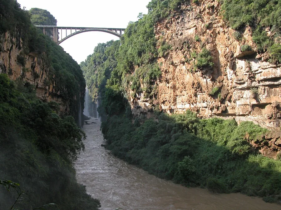 Inside Maling River Canyon, with steep walls, a waterfall and a bridge high above, July 2007.
Maling River Canyon马岭河峡谷
Maling River Canyon cuts deeply into the ground north-east of Xingyi. Waterfalls descend along the gorge walls, with hanging vegetation and connected cave features adding detail to the narrow river landscape. Its main visual…
Read the place guide →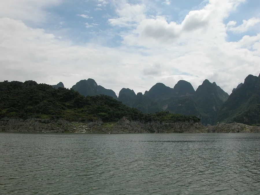 Wanfeng Lake with karst hills beyond its shore, July 2007.
Wanfeng Lake万峰湖
Wanfeng Lake is a reservoir landscape in which limestone peaks rise above long inlets, islands and peninsulas. The Hongchun area gives a useful view of the relationship between the water and the surrounding karst hills. Shore…
Read the place guide →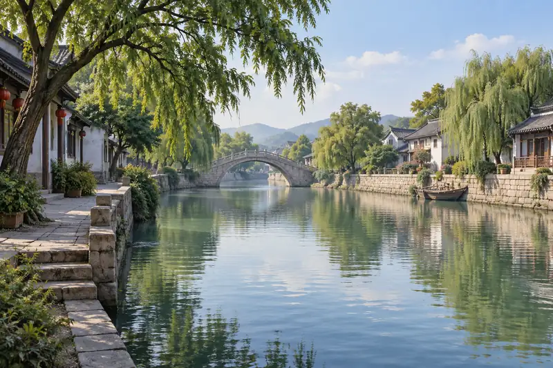 AI illustration · AI 示意图(仅供参考,非该地点实拍)
Anlong Zhaodi安龙招堤
Zhaodi is a waterside landscape in Anlong built around a long embankment, lotus ponds and willow trees. In the flowering season the lotus becomes the focus, but the dike and its views remain the structure of the visit. Banshan…
Read the place guide → A 1944-45 US Army aerial photograph in black and white of a bare, terraced mountainside with a road cut into it as a long ladder of hairpin bends running from the lower right to the upper left, a few vehicles on the bends, and the archival number 191666-S printed at the lower right.
Twenty-Four Bends二十四道拐
The 24 Bends (二十四道拐) is a switchback section of the Dian-Qian (Yunnan-Guizhou) highway south of the county town of Qinglong, in the Qianxinan Bouyei and Miao Autonomous Prefecture of south-western Guizhou, named for its 24 continuous bends. Built on a 60-degree slope, it climbs about 250 metres in vertical height over a straight-line distance of only 350 metres, yet the road itself runs 4 kilometres.
Read the place guide → Beipanjiang Grand Canyon · 北盘江大峡谷
Beipanjiang Grand Canyon北盘江大峡谷
The Beipanjiang Grand Canyon (北盘江大峡谷) is a gorge reach of the Beipan river in Zhenfeng County, in the Qianxinan Bouyei and Miao Autonomous Prefecture of south-western Guizhou, protected as the Beipanjiang Grand Canyon National Wetland Park. The Beipan river runs 449 kilometres in all, of which about 90-odd kilometres lie within Zhenfeng County, where steep mountains on both banks form the gorge.
Read the place guide →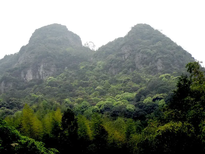 Shuangru Twin Peaks · 双乳峰
Shuangru Twin Peaks双乳峰
Shuangru Feng (双乳峰) is a pair of karst peaks in Shuangfeng sub-district, in the north-west of Zhenfeng County in the Qianxinan Bouyei and Miao Autonomous Prefecture of south-western Guizhou, 10 kilometres from the county town. Round, full and unshaped by any human hand, the peaks were traditionally known locally as Naitou Shan (Nipple Mountain) before being formally named Shuangru Feng (Twin-Breast Peak) after consultation.
Read the place guide →Local life & food
Qianxinan Buyei and Miao Autonomous Prefecture local specialties
黔西南布依族苗族自治州特色美食 · 10 specialties to discover
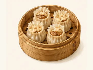 Xingyi shuabatou dumplings 兴义刷把头AI dish illustration / AI 菜品示意图
A tender wrapper encloses a seasoned filling, with a more delicate top than a tightly sealed ordinary dumpling.
Source ↗Read the dish guide → Anlong cold rice-sheet ribbons 安龙凉剪粉AI dish illustration / AI 菜品示意图
The rice ribbons are cool and yielding, while the dressing provides acidity, heat and crunch from any toppings.
Source ↗Read the dish guide →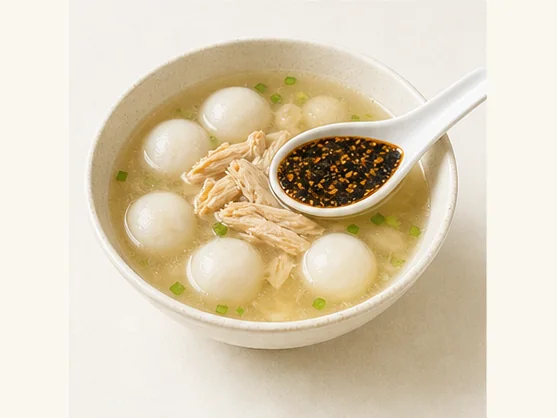 Xingyi chicken-filled rice dumplings 兴义鸡肉汤圆AI dish illustration / AI 菜品示意图
Expect a soft, elastic wrapper around savoury chicken, with a richer soup than the clear sweet liquid used for many dessert tangyuan. Sesame paste adds another layer when included.
Source ↗Read the dish guide →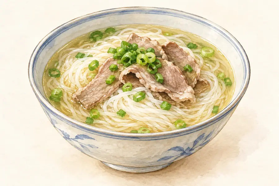 Xingyi Mutton Rice Noodles 兴义羊肉粉AI illustration · AI 示意图(仅供参考,非实拍)
Xingyi Mutton Rice Noodles (兴义羊肉粉) are the mutton rice noodles of Xingyi (兴义), the city in southwestern Guizhou that is the seat of Qianxinan Buyei and Miao Autonomous Prefecture (黔西南布依族苗族自治州).
Read the dish guide → Zhenfeng Sticky Rice 贞丰糯米饭AI illustration · AI 示意图(仅供参考,非实拍)
Zhenfeng Sticky Rice (贞丰糯米饭) pairs locally grown glutinous rice with thin slices of spiced, fried lean meat. The rice is steamed twice and fried with lard before it reaches the bowl.
Read the dish guide → Qinglong Chili Chicken 晴隆辣子鸡AI illustration · AI 示意图(仅供参考,非实拍)
Qinglong Chili Chicken (晴隆辣子鸡) is the chilli chicken of Qinglong (晴隆) county in Qianxinan (黔西南), south-west Guizhou, whose making technique was added to the prefecture's intangible cultural heritage list in 2026.
Read the dish guide → Wangmo Banchen Cake 望谟板陈糕AI illustration · AI 示意图(仅供参考,非实拍)
Wangmo Banchen Cake (望谟板陈糕) is a soft, sweet cake named for Banchen village (板陈村) in Zhexiang (蔗香), Wangmo (望谟). Its white exterior gives way to a layered cut surface dotted with numerous added ingredients.
Read the dish guide →Buyi Five-Color Sticky Rice 布依五色糯米饭AI illustration · AI 示意图(仅供参考,非实拍)
Buyi Five-Color Sticky Rice (布依五色糯米饭) is glutinous rice dyed black, red, yellow, white and purple with plant colourings, a traditional snack of the Buyi (布依族) areas of Guizhou.
Read the dish guide →All dish names · 全部菜名 (10)
- Xingyi shuabatou dumplings · 兴义刷把头
- Anlong cold rice-sheet ribbons · 安龙凉剪粉
- Xingyi chicken-filled rice dumplings · 兴义鸡肉汤圆
- Xingyi Mutton Rice Noodles · 兴义羊肉粉
- Zhenfeng Sticky Rice · 贞丰糯米饭
- Qinglong Chili Chicken · 晴隆辣子鸡
- Wangmo Banchen Cake · 望谟板陈糕
- Buyi Five-Color Sticky Rice · 布依五色糯米饭
- Xingren Pork-Filled Fried Batter Cakes · 兴仁盒子粑
- Pole-Pressed Egg Noodles · 杠子面
More dishes from across Guizhou are in the Guizhou food guide.
Counties & districts in Qianxinan Buyei and Miao Autonomous Prefecture
8 areas belong directly to Qianxinan Buyei and Miao Autonomous Prefecture.
8 areas
Xingyi City 兴义市
Xingyi (simplified Chinese: 兴义; traditional Chinese: 興義; pinyin: Xīngyì) (Bouyei language: Xinyyiq siq) is a county-level city and seat of the Qianxinan Buyei and Miao Autonomous Prefecture, in the southwest…
Explore the area →County-level cityXingren City 兴仁市
Xingren (simplified Chinese: 兴仁市; traditional Chinese: 興仁市; pinyin: Xīngrén Shì) is a county-level city of southwestern Guizhou province, China.
Explore the area →CountyPu'an County 普安县
Pu'an County is a county of the Qianxinan Buyei and Miao Autonomous Prefecture in the southwest of Guizhou province, China.
Explore the area →CountyQinglong County 晴隆县
Qinglong County (simplified Chinese: 晴隆县; traditional Chinese: 晴隆縣; pinyin: Qínglóng Xiàn; lit. 'sunny and grand') is a county in the southwest of Guizhou province, China.
Explore the area →Show fewer areas
Zhenfeng County 贞丰县
Zhenfeng County (simplified Chinese: 贞丰县; traditional Chinese: 貞豐縣; pinyin: Zhēnfēng Xiàn) (Bouyei language: Miangxguz xianq) is a county in the southwest of Guizhou province, China.
Explore the area →CountyWangmo County 望谟县
Wangmo County (simplified Chinese: 望谟县; traditional Chinese: 望謨縣; pinyin: Wàngmó Xiàn) (Bouyei: Weangzmox xianq) is a county in the southwest of Guizhou province, China, bordering Guangxi to the southeast.
Explore the area →CountyCeheng County 册亨县
Ceheng County (simplified Chinese: 册亨县; traditional Chinese: 冊亨縣; pinyin: Cèhēng Xiàn) (Bouyei language: Xeehlauz xianq) is a county in the southwest of Guizhou province, China, bordering Guangxi to the south.
Explore the area →CountyAnlong County 安龙县
Anlong County (simplified Chinese: 安龙县; traditional Chinese: 安龍縣; pinyin: Ānlóng Xiàn) is a county in the southwest of Guizhou province, China, bordering Guangxi to the south.
Explore the area →No areas match this name.
Plan your visit
Getting there
Search for 黔西南布依族苗族自治州 in a map app to find stations and your accommodation.
Where to stay →Build your route
Wanfenglin and Nanlong Buyi Ancient Village are both listed here. The linked place guides have entrance and visit details.
Continue with Guizhou →More in Guizhou
Sources & geographic information
Administrative names and parent areas: Official geographic directory · Reference date 2026-09-06.
Some facts checked against 黔西南布依族苗族自治州 — Wikipedia contributors, CC BY-SA 4.0.
Photo: Wanfenglin · 名字长的让人受不了 · CC BY-SA 4.0. Full frame retained; proportionally resized and converted to WebP. No retouching or changes to the photographed subject. Card displays may crop the view.

Photo: Maling River Canyon · Antigng · CC BY-SA 4.0. Proportionally resized and converted to WebP without cropping, retouching or changing the photographed subject.
.jpg)
Photo: Wanfeng Lake · Antigng · CC BY-SA 4.0. Proportionally resized and converted to WebP without cropping, retouching or changing the photographed subject.

Photo: Twenty-Four Bends · Unknown authorUnknown author or not provided · Public domain. Full frame retained; proportionally resized and converted to WebP. No retouching or changes to the photographed subject. Card displays may crop the view.

Photo: Beipanjiang Grand Canyon · Source photographer · License not provided. EXIF orientation normalized; resized without changing aspect ratio; converted to WebP. No subject edits.
Photo: Shuangru Twin Peaks · 林明波 · CC BY 3.0. EXIF orientation normalized; resized without changing aspect ratio; converted to WebP. No subject edits.

Map data © OpenStreetMap contributors. Pins mark approximate centres, not entrances or boundaries.