


Get to know Youxian
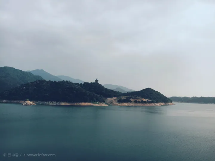
Photo adjustments
Full frame retained; proportionally resized and converted to WebP. No retouching or changes to the photographed subject. Card displays may crop the view.
- Administrative area
- County · 县
- Part of
- Zhuzhou
- Chinese name
- 攸县
- Local areas
- County guide
Setting and landscape
The land rises to the northeast and falls to the southwest; Taihexian (太和仙) is the highest peak. Lianhua County (莲花县) and the urban districts of Pingxiang (萍乡) in Jiangxi border it on the east, Chaling (茶陵县) and Anren (安仁县) on the south, Hengdong (衡东县) on the west and Liling (醴陵市) on the north.
History
The name You first appears in records in 202 BC, when the county belonged to the Changsha Kingdom (长沙国) of the Western Han. Under the Chen dynasty it was called Youshui (攸水县). In the Five Dynasties period the county seat moved from Luojiaping (罗家坪) to the north bank of the Mi River. Early in the Yuan the county was raised to a prefecture, Youzhou (攸州), and in 1369 the Ming turned it back into a county under Changsha. It joined Zhuzhou in July 1983.
What to see
The three Wenming pagodas (文明塔) were listed as a Hunan provincial protected monument in 2011. The upper pagoda at Caihuaping (菜花坪镇), about 1 km from town, is an eight-sided, seven-storey brick tower of 21 metres raised in 1576 at the urging of magistrate Xu Ximing (徐希明). The middle pagoda, a six-sided stone tower of 9.7 metres, stands on a hill on the south bank of the Mi about 5 km west of town; the lower pagoda, 22.35 metres of red stone, rises from the middle of the river with a pier-shaped base built to resist the current.
White Dragon Cave (白龙洞) at Caobo (漕泊乡), part of the Jiubujiang scenic area and national geopark, is a karst cave formed in Carboniferous dolomitic limestone and 1,086.8 metres long. Its features include a 29-metre stone column, and some of its dripstones ring when struck; it opened in 2001 and became a 3A scenic area in 2014. In 2023 Hunan added five Youxian sites to its eleventh provincial list, among them the Lütian (渌田) Northern Expedition battle site and the ancient town of Liwang (里旺古城) at Wangling (网岭).
Highlights
- Wenming Pagodas 文明塔: Three pagodas around the county town, two of them on the Mi River; provincial protected monument since 2011.
- White Dragon Cave 白龙洞: Karst cave in the Jiubujiang geopark, 3A scenic area since 2014.
- Jiubujiang Reservoir 酒埠江水库: The county's largest lake.
- Liwang ancient town 网岭里旺古城: Provincial protected site listed in 2023.
Sources for this guide
攸县人民政府 - 哇!我们身边这些地方被评为省级文物保护单位! · Youxian People's Government
攸县人民政府 - 文明塔 · Youxian People's Government
攸县 - 维基百科,自由的百科全书 · Wikipedia (Chinese) · CC BY-SA 4.0
攸县人民政府 - 白龙洞 · Youxian People's Government
Original English written from the listed sources and checked sentence by sentence against quoted extracts by a separate reviewer. Updated 2026-09-25.
Explore Youxian
Core places to explore, with English and Chinese names.
Places to explore around Youxian
 Xianren Bridge · 仙人桥
Xianren Bridge仙人桥
A narrow natural stone bridge above a stream-filled gorge in You County’s Jiubujiang scenic area.
Read the place guide → Jiubujiang Reservoir (Jiuxian Lake) in You County, Zhuzhou · 株洲市攸县酒埠江水库(酒仙湖) Source-recorded photograph date: 2020-11-09.
Jiubujiang Scenic Area酒埠江
Jiubujiang (酒埠江) is an area in the east of You County, Zhuzhou, Hunan, where a reservoir on the You River, known as Jiuxian Lake, sits at the centre of the 193-square-kilometre Jiubujiang National Geopark.
Read the place guide →Plan your visit
Getting there
Youxian is about 95 km in a straight line from central Zhuzhou. Search for 攸县 in a map app to find stations and your accommodation.
Where to stay →Build your route
Xianren Bridge and Jiubujiang Scenic Area are both listed here. The linked place guides have entrance and visit details.
Continue with Zhuzhou →More in Zhuzhou
Sources & geographic information
Administrative names and parent areas: Official geographic directory · Reference date 2026-09-06.
Some facts checked against 攸县 — Wikipedia contributors, CC BY-SA 4.0.
Photo: Xianren Bridge · Source photographer · License not provided. EXIF orientation normalized; resized without changing aspect ratio; converted to WebP. No subject edits.
Photo: Jiubujiang Scenic Area · Allervous · CC BY-SA 4.0. Full frame retained; proportionally resized and converted to WebP. No retouching or changes to the photographed subject. Card displays may crop the view.

Map data © OpenStreetMap contributors. Pins mark approximate centres, not entrances or boundaries.