


Get to know Ulanqab
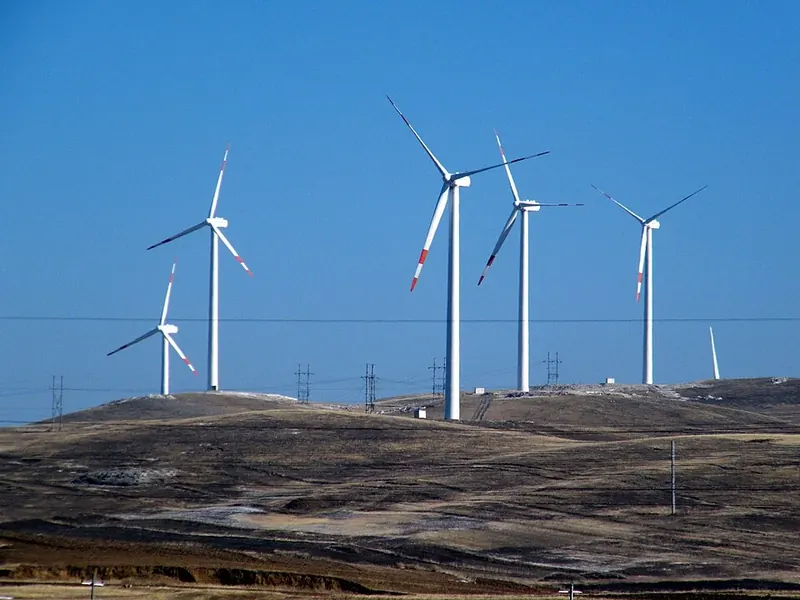
Photo adjustments
Full frame retained; proportionally resized and converted to WebP. No retouching or changes to the photographed subject. Card displays may crop the view.
- Administrative area
- Prefecture-level city · 地级市
- Part of
- Inner Mongolia
- Chinese name
- 乌兰察布市
- Local areas
- 11 local areas
Area & population
- Area in the source
- 54,473.60 km²
- Population · 2020 census
- 1,706,328
- Administrative seat
- Jining District
Source: cited geographic source, as of the dates shown.
Ulaan Chab city has an area of 54,473.6 square kilometres (21,032.4 sq mi). It borders Hohhot to the west, Mongolia to the north, Xilin Gol League to the northeast, Hebei to the east and Shanxi to the south.
Transport
Ulanqab's transportation network is well-developed, connected by several railways and highways. Some of the railways the pass through the prefecture are the Beijing−Baotou, Jining−Erlianhot, and the Jining−Tongliao Railways. Major inter-provincial roads include the G6 Beijing–Lhasa Expressway (京藏高速), China National Highway 110 (Beijing to Yinchuan, Ningxia) and 208 (Erlianhot, Inner Mongolia to Changzhi, Shanxi). The city is also served by Ulanqab Jining Airport.
Explore Ulanqab
Core places to explore, with English and Chinese names.
Daihai Lake 岱海
Huitengxile Grassland 辉腾锡勒草原
Huanghuagou Canyon 黄花沟
Wulanhada Volcanoes 乌兰哈达火山
Jining District 集宁区
Zhuozi County 卓资县
Huade County 化德县
Shangdu County 商都县
Xinghe County 兴和县
Liangcheng County 凉城县
Qahar Right Front Banner 察哈尔右翼前旗
Qahar Right Middle Banner 察哈尔右翼中旗
Qahar Right Rear Banner 察哈尔右翼后旗
Dorbod Banner 四子王旗
Fengzhen 丰镇市
Places to explore around Ulanqab
 Daihai Lake (岱海), Ulanqab. Photograph: "ISS023-E-21320 - View of Lake Dai".
Daihai Lake岱海
Daihai occupies a closed basin in Liangcheng County, with broad shore flats and low surrounding hills. Because the lake has no natural outlet, changes in rainfall and water use strongly affect its level and salinity. This is a…
Read the place guide →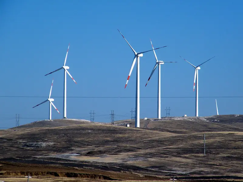 Huitengxile Grassland (辉腾锡勒草原), Qahar Right Middle Banner. Photograph: "风力风电场 - panoramio".
Huitengxile Grassland辉腾锡勒草原
Alpine meadow steppe at about 2,100 m in Ulanqab, known for its wind turbines, volcanic lakes and the Huanghuagou flower grassland.
Read the place guide → AI illustration · AI 示意图(仅供参考,非该地点实拍)
Huanghuagou Canyon黄花沟
Huanghuagou Canyon (黄花沟) is a canyon in the Huitengxile grassland landscape of Qahar Right Middle Banner, where a stream and birch habitat interrupt the open uplands.
Read the place guide →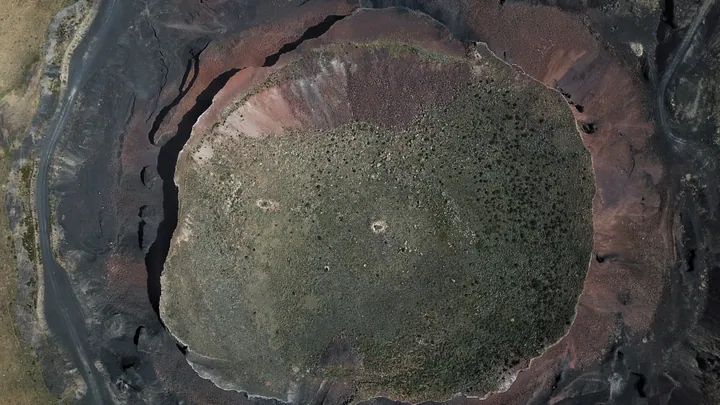 Aerial view straight down into the crater of Ulan Hada Volcano, Chahar Right Middle Banner · 察哈尔右翼中旗乌兰哈达火山群火山口俯视航拍 Source-recorded photograph date: 2019-08-30 12:51:14.
Wulanhada Volcanoes乌兰哈达火山
Wulanhada Volcanoes (乌兰哈达火山) is a volcanic landscape in Qahar Right Rear Banner, with cones and craters rising from open grassland.
Read the place guide →Local life & food
Ulanqab local specialties
乌兰察布市特色美食 · 8 specialties to discover
 Fengzhen mooncake 丰镇月饼AI illustration · AI 示意图
The outside is firm and toasted, while the dense crumb carries a mellow sweetness and grain aroma.
Source ↗Read the dish guide → Zhuozishan smoked chicken 卓资山熏鸡AI illustration · AI 示意图
The skin has a concentrated smoky fragrance, while the meat beneath is tender and savory. Different parts offer leaner or richer bites.
Source ↗Read the dish guide → Naked-Oat Flour Noodles 莜面
Naked-Oat Flour Noodles (莜面) are the foods made from youmian, the flour of the naked oat, a common food across central and western Inner Mongolia and parts of northern China.
Read the dish guide →
Photo adjustments
EXIF orientation normalized; resized without changing aspect ratio; converted to WebP. No subject edits.
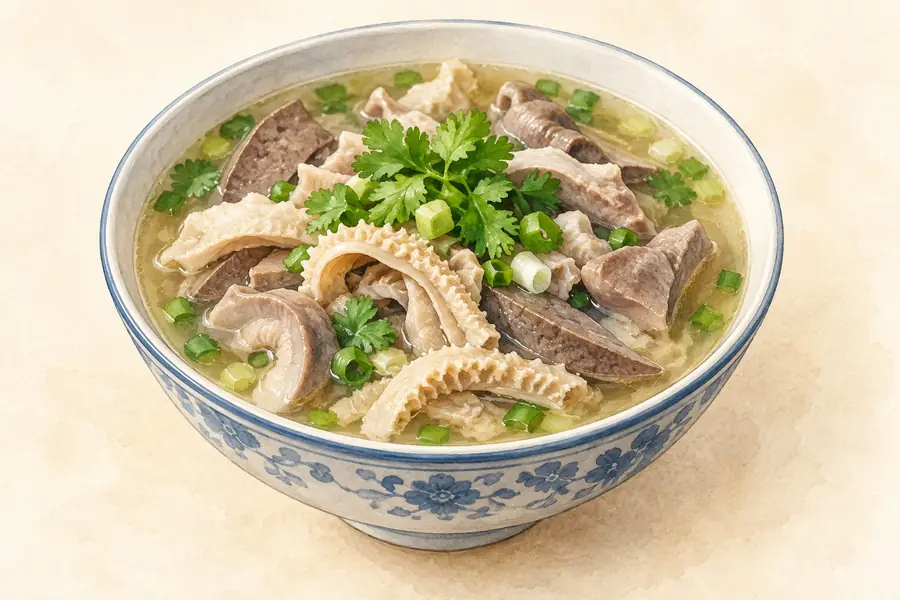 Liangcheng Chopped Sheep Offal 凉城县羊杂碎AI illustration · AI 示意图(仅供参考,非实拍)
Liangcheng Chopped Sheep Offal (凉城县羊杂碎) is listed among the local specialties of Ulanqab, Inner Mongolia. The name includes 羊杂 (sheep offal).
Read the dish guide → Chayouhouqi Red-Braised Lamb 察右后旗红炖羊肉AI illustration · AI 示意图(仅供参考,非实拍)
Chayouhouqi Red-Braised Lamb (察右后旗红炖羊肉) is listed among the local specialties of Ulanqab, Inner Mongolia. The name includes 羊肉 (lamb or mutton). 炖 describes slow simmering.
Read the dish guide → Roast Leg of Lamb 烤羊腿AI illustration · AI 示意图(仅供参考,非实拍)
Roast Leg of Lamb (烤羊腿) is listed among the local specialties of Chifeng, Inner Mongolia. The name includes 羊 (sheep). 烤 describes roasting or grilling.
Read the dish guide → Potato Banquet 土豆宴AI illustration · AI 示意图(仅供参考,非实拍)
Potato Banquet (土豆宴) is a spread of potato dishes served in Ulanqab (乌兰察布), a city that holds the title "China's Potato Capital" (中国薯都).
Read the dish guide →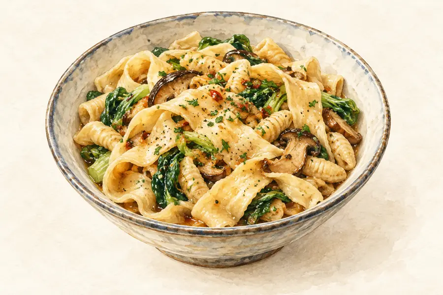 Buckwheat Pressed Noodles 荞面饸饹AI illustration · AI 示意图(仅供参考,非实拍)
Buckwheat Pressed Noodles (荞面饸饹) is listed among the local specialties of Chifeng, Inner Mongolia. The name includes 荞面 (buckwheat flour). The term 面 points to noodles or flour-based food.
Read the dish guide →More dishes from across Inner Mongolia are in the Inner Mongolia food guide.
Counties & districts in Ulanqab
11 areas belong directly to Ulanqab.
11 areas
Jining District 集宁区
Jining District (Mongolian: ᠵᠢᠨᠢᠩ ᠲᠣᠭᠣᠷᠢᠭ; Chinese: 集宁区) is an urban district that serves as the administrative seat of Ulanqab, a region governed as a prefecture-level city in the mid-western part of Inner…
Explore the area →CountyZhuozi County 卓资县
Zhuozi (Mongolian: ᠵᠦᠸᠧᠽᠢ ᠰᠢᠶᠠᠨ; Chinese: 卓资县) is a county of Ulanqab prefecture-level city, which in turn is part of Inner Mongolia, China.
Explore the area →CountyHuade County 化德县
Huade (Mongolian: ᠬᠤᠸᠠᠳᠧ ᠰᠢᠶᠠᠨ; Chinese: 化德县) is a county of central Inner Mongolia, China, bordering Hebei province to the southeast, Xilin Gol League to the northeast, and Shangdu County to the west.
Explore the area →CountyShangdu County 商都县
Shangdu County (Mongolian: ᠱᠠᠩᠳᠤ ᠰᠢᠶᠠᠨ; Chinese: 商都县) is a county of south-central Inner Mongolia, China. It is under the administration of Ulanqab City and has an area of 4,353 square kilometres (1,681 sq…
Explore the area →Show fewer areas
Xinghe County 兴和县
Xinghe County (Mongolian: ᠰᠢᠩ ᠾᠧ ᠰᠢᠶᠠᠨ; Chinese: 兴和县) is a county of south-central Inner Mongolia, China, bordering the provinces of Hebei to the east and Shanxi to the south.
Explore the area →CountyLiangcheng County 凉城县
Liangcheng County (Mongolian: ᠯᠢᠶᠠᠩᠴᠠᠩ ᠰᠢᠶᠠᠨ; Chinese: 凉城县) is a county of south-central Inner Mongolia, China, bounded by Shanxi province to the south.
Explore the area →BannerQahar Right Front Banner 察哈尔右翼前旗
Chahar Right Front Banner or Qahar Right Front Banner (Mongolian: ᠴᠠᠬᠠᠷ ᠪᠠᠷᠠᠭᠤᠨ ᠭᠠᠷᠤᠨ ᠡᠮᠦᠨᠡᠳᠦ ᠬᠣᠰᠢᠭᠤ; Chinese: 察哈尔右翼前旗) is a Banner of Inner Mongolia, China, surrounding Jining District and bordering Xinghe…
Explore the area →BannerQahar Right Middle Banner 察哈尔右翼中旗
Chahar Right Middle Banner (Mongolian: ᠴᠠᠬᠠᠷ ᠪᠠᠷᠠᠭᠤᠨ ᠭᠠᠷᠤᠨ ᠳᠤᠮᠳᠠᠳᠤ ᠬᠣᠰᠢᠭᠤ; Chinese: 察哈尔右翼中旗) is a banner (county equivalent) of Inner Mongolia, China, bordered by Chahar Right Back Banner to the east, Zhuozi…
Explore the area →BannerQahar Right Rear Banner 察哈尔右翼后旗
Chahar Right Rear Banner (Mongolian: ᠴᠠᠬᠠᠷ ᠪᠠᠷᠠᠭᠤᠨ ᠭᠠᠷᠤᠨ ᠬᠣᠶᠢᠲᠤ ᠬᠣᠰᠢᠭᠤ; Chinese: 察哈尔右翼后旗) is a banner of Inner Mongolia, China, bordering Shangdu County to the northeast, Xinghe County to the southeast, Qahar…
Explore the area →BannerDorbod Banner 四子王旗
Dorbod Banner or Siziwang Banner (Mongolian: ᠳᠥᠷᠪᠡᠳ ᠬᠣᠰᠢᠭᠤ; Chinese: 四子王旗) is a banner (county equivalent) in Ulanqab, Inner Mongolia, China, bordering Mongolia's Dornogovi Province to the northwest.
Explore the area →County-level cityFengzhen 丰镇市
Fengzhen (Mongolian: ᠹᠸᠩᠵᠸᠡ ᠬᠣᠲᠠ; Chinese: 丰镇) is a county-level city under the administration of the prefecture-level city of Ulaan Chab, in the central portion of Inner Mongolia, China, bordering Shanxi…
Explore the area →No areas match this name.
Plan your visit
Getting there
Search for 乌兰察布市 in a map app to find stations and your accommodation.
Where to stay →Build your route
Daihai Lake and Huitengxile Grassland are both listed here. The linked place guides have entrance and visit details.
Continue with Inner Mongolia →More in Inner Mongolia
Sources & geographic information
Administrative names and parent areas: Official geographic directory · Reference date 2026-09-06.
Background text adapted from Ulanqab — Wikipedia contributors, under CC BY-SA 4.0. Text has been shortened and reorganized; source revision 1336199077.
Photo: Daihai Lake · Earth Science and Remote Sensing Unit, NASA Johnson Space Center · Public domain. Full frame retained; EXIF orientation normalized, proportionally resized to at most 800 pixels and converted to WebP. No generated pixels or subject changes. Cards may crop the display.

Photo: Huitengxile Grassland · 天王星 · CC BY-SA 3.0. Full frame retained; EXIF orientation normalized, proportionally resized to at most 800 pixels and converted to WebP. No generated pixels or subject changes. Cards may crop the display.

Photo: Wulanhada Volcanoes · Charlie fong · CC BY-SA 4.0. Full frame retained; proportionally resized and converted to WebP. No retouching or changes to the photographed subject. Card displays may crop the view.

Map data © OpenStreetMap contributors. Pins mark approximate centres, not entrances or boundaries.