


Get to know Yuhuatai District
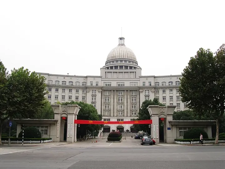
Photo adjustments
Full frame retained; proportionally resized and converted to WebP. No retouching or changes to the photographed subject. Card displays may crop the view.
- Administrative area
- District · 市辖区
- Part of
- Nanjing
- Chinese name
- 雨花台区
- Local areas
- District guide
Area & population
- Area in the source
- 132.39 km²
- Population · 2020
- 608,780
Source: cited geographic source, as of the dates shown.
Setting and landscape
The district government divides the land into three forms. West of the Nanjing–Wuhu railway (宁芜铁路) lies flat polder country built up by silt from the Yangtze and the Qinhuai River (秦淮河). Between the plain and the hills run ridges of loess and gravel; the highest gravel ridges, 50 to 60 metres at the top, hold the Yuhua pebbles (雨花石). Low wooded hills of 60 to 240 metres, led by Hanfu Mountain (韩府山) and Jiangjun Mountain (将军山), fill the south-east. Chinese Wikipedia counts 26 rivers, including the Qinhuai New River (秦淮新河). The plum-rain season runs from late June to mid-July.
History
The hill's name, 'rain of flowers terrace', goes back to 503, when the monk Yunguang (云光) is said to have preached there so movingly that flowers fell like rain. In the Republican period the hill was an execution ground. Most of today's district entered Nanjing city in 1934, and in August 1955 the city's Tenth District was renamed Yuhuatai District. Abolished in 1958 and restored in 1963, it has since 2011 administered the China (Nanjing) Software Valley (中国(南京)软件谷) on behalf of the city.
What to see
The Yuhuatai scenic area takes in the Yuhuatai Martyrs' Cemetery (雨花台烈士陵园), the Yuhua Pebble Museum (雨花石博物馆), the spring known as the Second Spring South of the Yangtze (江南第二泉), the Tomb of Fang Xiaoru (方孝孺墓) and Gaozuo Temple (高座寺).
The Tomb of the King of Boni (浡泥国王墓), in Tiexinqiao (铁心桥) about 5 km south of the Zhonghua Gate, belongs to Manarejiana (麻那惹加那), a king of Boni whose rank Chinese Wikipedia compares with that of today's sultan of Brunei. He reached Nanjing in 1408 and died there that October. The grave was rediscovered in 1958 and became a national key heritage site in 2001. A spirit way of about 150 metres is lined with six pairs of stone figures; the southernmost pair are warriors carved in a Southeast Asian likeness. Chinese Wikipedia also lists Jiangjun Mountain scenic area, Juhuatai Park (菊花台公园), Longquan Temple (龙泉寺) and Banqiao Old Street (板桥老街).
Getting oriented
The district borders Jiangning (江宁) to the east and south, Qinhuai and Jianye (建邺) to the north, and faces Pukou (浦口) across the Yangtze. Nanjing South railway station, served by the Beijing–Shanghai high-speed railway, stands on its boundary with Jiangning, and the Dashengguan Yangtze River Bridge (大胜关长江大桥) and Nanjing Third Yangtze Bridge cross the river from its shore.
Highlights
- Yuhuatai 雨花台: Hill 60 metres above sea level outside the Zhonghua Gate, named after a monk's sermon in 503; now a scenic area with the martyrs' cemetery.
- Tomb of the King of Boni 浡泥国王墓: Grave of King Manarejiana, who died in Nanjing in 1408; national key heritage site since 2001, with six pairs of stone figures.
- Yuhua Pebble Museum 雨花石博物馆: Museum of Yuhua pebbles in the Yuhuatai scenic area; the district's gravel ridges hold the pebbles.
- Yuhua tea 雨花茶: Nanjing speciality tea.
Sources for this guide
雨花台区 · Wikipedia (Chinese) · CC BY-SA 4.0
雨花台 · Wikipedia (Chinese) · CC BY-SA 4.0
历史沿革 · Yuhuatai District People's Government, Nanjing
自然地理 · Yuhuatai District People's Government, Nanjing
浡泥国王墓 · Wikipedia (Chinese) · CC BY-SA 4.0
Original English written from the listed sources and checked sentence by sentence against quoted extracts by a separate reviewer. Updated 2026-09-25.
Explore Yuhuatai District
Core places to explore, with English and Chinese names.
Yuhuatai District 雨花台区
Plan your visit
Getting there
Yuhuatai District is about 15 km in a straight line from central Nanjing. Search for 雨花台区 in a map app to find stations and your accommodation.
Where to stay →More in Nanjing
Sources & geographic information
Administrative names and parent areas: Official geographic directory · Reference date 2026-09-06.
Some facts checked against 雨花台区 — Wikipedia contributors, CC BY-SA 4.0.
Some facts checked against 雨花台 — Wikipedia contributors, CC BY-SA 4.0.
Some facts checked against 浡泥国王墓 — Wikipedia contributors, CC BY-SA 4.0.
Map data © OpenStreetMap contributors. Pins mark approximate centres, not entrances or boundaries.