


Get to know Xuhui District
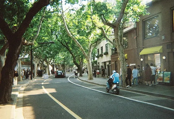
Photo adjustments
Full frame retained; proportionally resized and converted to WebP. No retouching or changes to the photographed subject. Card displays may crop the view.
- Administrative area
- District · 市辖区
- Part of
- Shanghai
- Chinese name
- 徐汇区
- Local areas
- District guide
Area & population
- Area in the source
- 54.76 km²
- Population · 2020
- 1,113,078
Source: cited geographic source, as of the dates shown.
History
Xu Guangqi set up a farm estate where three waterways, the Puhuitang (蒲汇塘), Zhaojiabang (肇嘉浜) and Lizongjing (李漎泾), meet, ran farming experiments there and was buried on the spot. A village grew around his tomb, and in the Kangxi reign of the Qing it took the name Xujiahui (徐家汇), "where the Xu family and the waters gather".
In 1914 the French Concession expanded to take in the land north of today's Zhaojiabang Road (肇嘉浜路) and east of Huashan Road (华山路). A Xujiahui district was formed around the old market town in 1945. Longhua (龙华镇) and Caohejing (漕河泾镇) towns joined the district in 1984, and Longhua township followed in 1992. At the end of the 19th century, the Qing government founded the Nanyang Public School (南洋公学), forerunner of Shanghai Jiao Tong University (上海交通大学), here, and the Catholic Church founded Aurora College (震旦公学).
What to see
Five places in the district are national key protected sites: the Tomb of Xu Guangqi (徐光启墓), Xujiahui Cathedral (徐家汇天主堂), the Former Residence of Soong Ching Ling (上海宋庆龄故居), Longhua Pagoda (龙华塔) and the Longhua Revolutionary Martyrs' Memorial Site (龙华革命烈士纪念地).
Longhua Temple (龙华寺), one of Shanghai's four major Buddhist temples, is traditionally dated to the Three Kingdoms period; its present halls were rebuilt in the Guangxu reign of the Qing. The octagonal seven-storey brick-and-timber pagoda outside it has a Northern Song structure, and later non-Song additions were removed after 1949.
Wukang Road (武康路) runs 1,183 metres from Huashan Road to Middle Huaihai Road (淮海中路), lined mainly with Republican-era garden houses and apartment blocks; it is one of the 64 Shanghai roads that will never be widened. It began as Route Ferguson in 1907. At its southern end stands the Wukang Mansion (武康大楼), the former Normandie Apartments, once home to the actors Zhao Dan (赵丹) and Sun Daolin (孙道临). The Wukang Road–Anfu Road (安福路) quarter was named a municipal tourism and leisure block in September 2021.
Getting oriented
Xujiahui is the city's sub-centre for south-west Shanghai and one of its main shopping districts. The district borders Huangpu District (黄浦区) to the east, Minhang (闵行区) to the west, and Jing'an (静安区) and Changning (长宁区) to the north. Shanghai Jiao Tong University, East China University of Science and Technology (华东理工大学) and the Shanghai Conservatory of Music (上海音乐学院) are based here. On the Huangpu waterfront, the district announced in 2012 a plan to turn former rail freight yards, sand and gravel wharves and coal stockyards into art museums and performance venues under the name West Bund (西岸).
Highlights
- Xujiahui Cathedral 徐家汇天主堂: National key protected site in the area named after Xu Guangqi.
- Longhua Temple 龙华寺: One of Shanghai's four major Buddhist temples; halls rebuilt in the Guangxu reign.
- Longhua Pagoda 龙华塔: Octagonal seven-storey brick-and-timber pagoda with a Northern Song structure, a national key protected site.
- Wukang Mansion 武康大楼: Former Normandie Apartments at the south end of Wukang Road.
- Tomb of Xu Guangqi 徐光启墓: Burial place of the scholar who gave Xujiahui its name; a national key protected site.
Sources for this guide
徐汇区 - 维基百科,自由的百科全书 · Chinese Wikipedia · CC BY-SA 4.0
徐汇打造"西岸文化走廊" 旧工业遗存"变身"当代美术馆_新闻台_中国网络电视台 · CCTV (China Network Television), reprinting Eastday
龙华寺 (上海) - 维基百科,自由的百科全书 · Chinese Wikipedia · CC BY-SA 4.0
武康路 (上海) - 维基百科,自由的百科全书 · Chinese Wikipedia · CC BY-SA 4.0
Original English written from the listed sources and checked sentence by sentence against quoted extracts by a separate reviewer. Updated 2026-09-25.
Explore Xuhui District
Core places to explore, with English and Chinese names.
Places to explore around Xuhui District
 Former French Concession · 原法租界街区
Wukang Road武康路
Wukang Road runs through the western part of Shanghai’s former French Concession in Xuhui. Formerly Route Ferguson, it is lined with historic residential and institutional buildings under plane trees.
Read the place guide →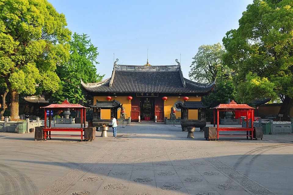 Longhua Temple · 龙华寺. Photo: 2015-04-25 06:43:26.
Longhua Temple龙华寺
Longhua Temple follows the axial arrangement of a Song-period Chan monastery, although most halls are later reconstructions. Maitreya Hall introduces the sequence of worship spaces, followed by the main Mahavira Hall and other…
Read the place guide →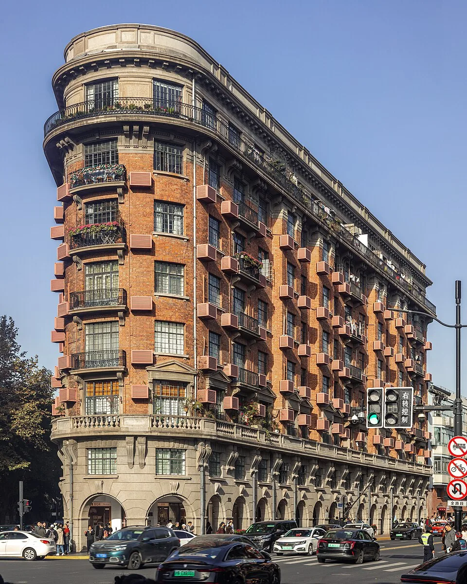 Wukang Mansion · 武康大楼. Photo: 2025-11-28 13:29:03.
Wukang Mansion武康大楼
Wukang Mansion occupies a wedge-shaped corner where Wukang Road meets Middle Huaihai Road. Designed by László Hudec and completed in 1924, it was originally known as the Normandie Apartments.
Read the place guide →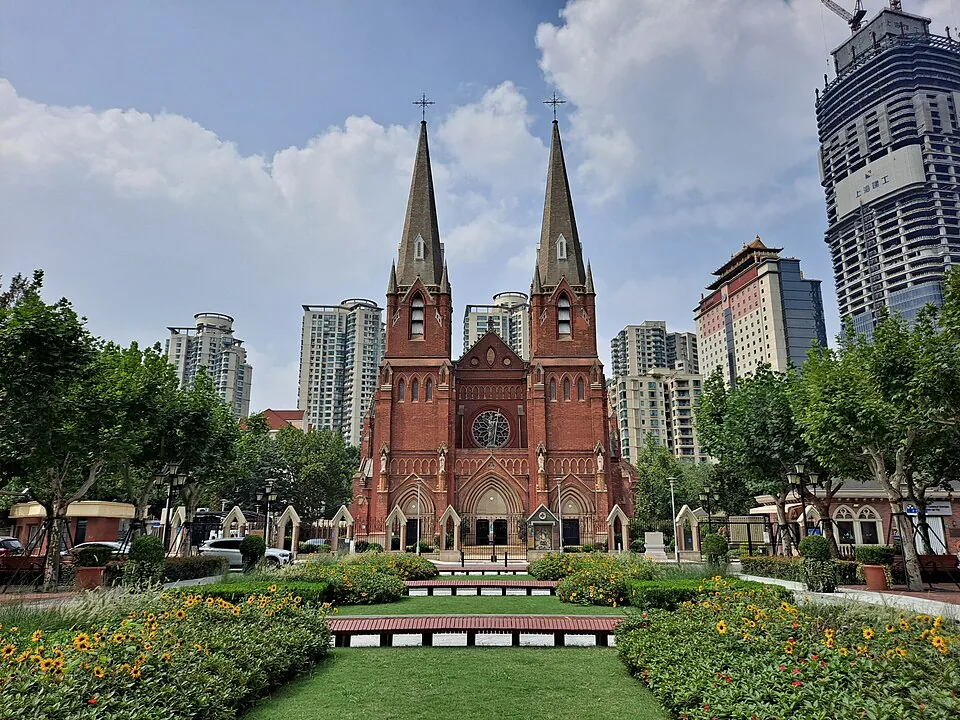 St. Ignatius Cathedral, Shanghai · 徐家汇天主教堂. Photo: 2022-09-17.
St. Ignatius Cathedral, Shanghai徐家汇天主教堂
St. Ignatius Cathedral is the Catholic cathedral in Xujiahui. Its dedication and history reflect the Jesuit presence in this part of Shanghai.
Read the place guide →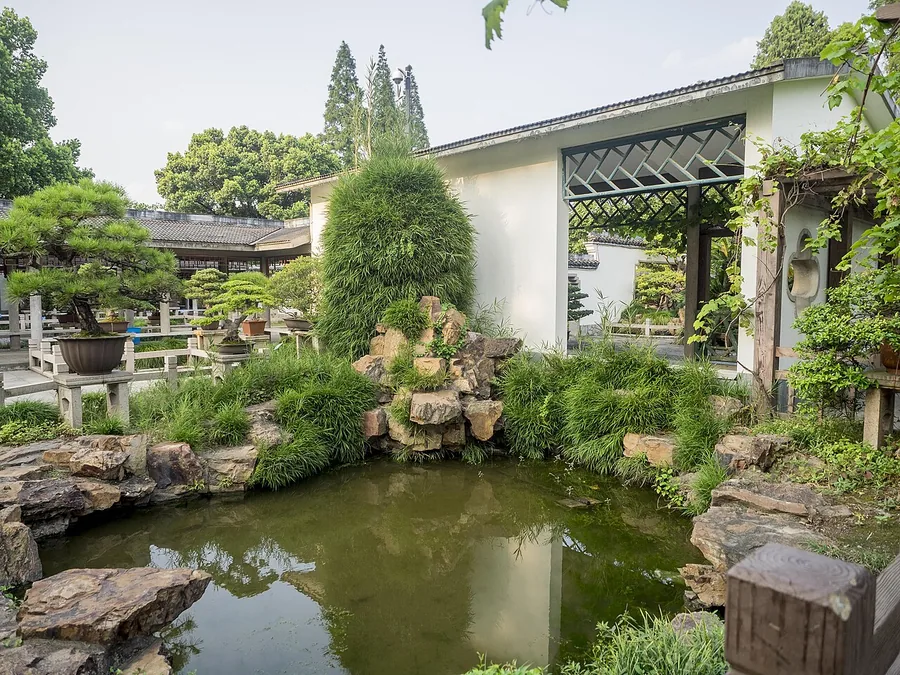 The penjing garden at Shanghai Botanical Garden; 30 August 2015.
Shanghai Botanical Garden上海植物园
Shanghai Botanical Garden lies in the southwestern part of Xuhui. Its collections are divided into specialist planted areas, including penjing, magnolias, peonies, bamboo and other woody and flowering plants.
Read the place guide →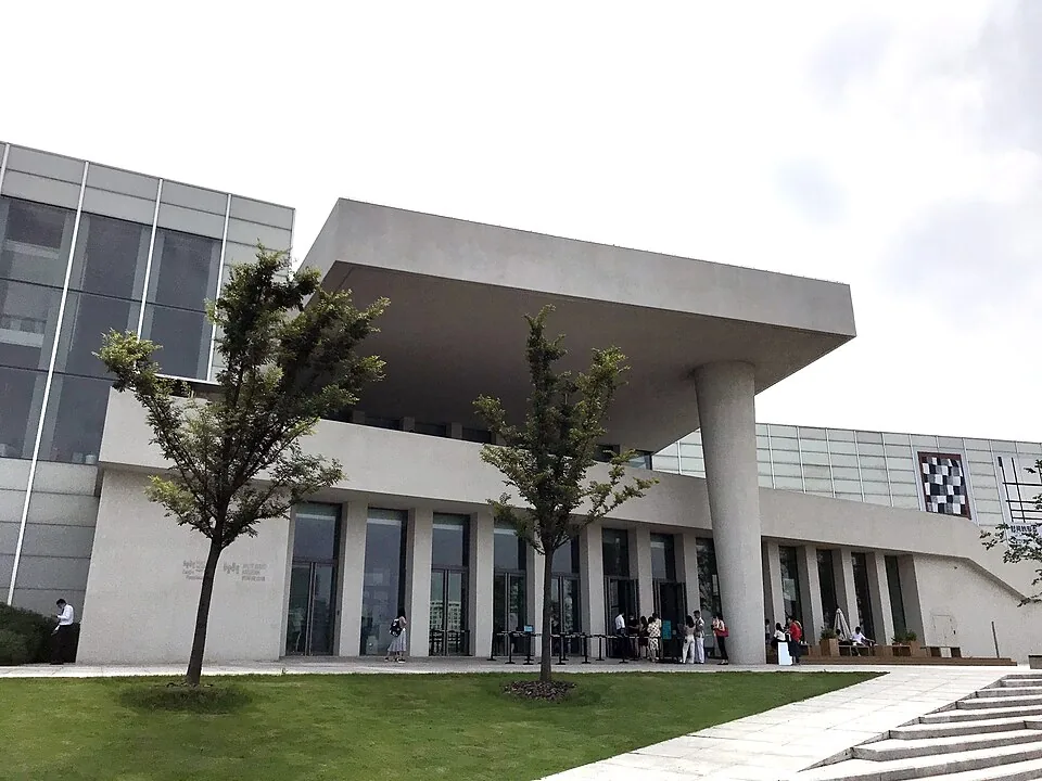 West Bund Museum · 西岸美术馆. Photo: 2020-06-26.
West Bund Museum西岸美术馆
West Bund Museum occupies a triangular riverfront site designed by David Chipperfield. Three main galleries and additional project spaces accommodate changing art exhibitions.
Read the place guide → AI illustration · AI 示意图(仅供参考,非该地点实拍)
Wukang Road and Anfu Road武康路—安福路街区
The Wukang Road–Anfu Road area is a group of streets in Shanghai's Xuhui district where historic residences meet contemporary shops and cafes.
Read the place guide →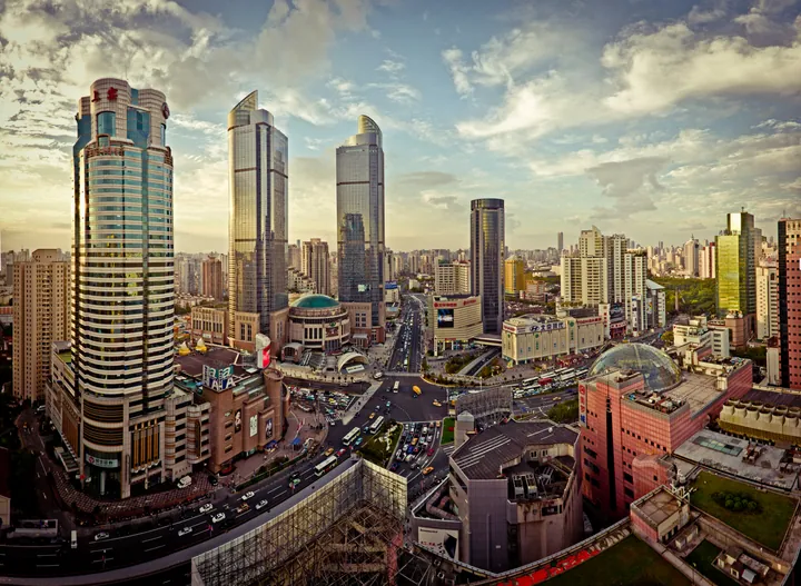 The high-rise skyline of the Xujiahui commercial district, Shanghai · 上海徐家汇商圈高楼天际线 Source-recorded photograph date: Taken on 29 October 2010 17:27.
Xujiahui Origin徐家汇源
Xujiahui Origin (徐家汇源) is a group of cultural and historic sites in Shanghai's Xuhui District.
Read the place guide → West Bund Riverside · 西岸滨江
West Bund Riverside西岸滨江
West Bund Riverside (西岸滨江) is the Xuhui waterfront along Shanghai's Huangpu River.
Read the place guide →Plan your visit
Getting there
Xuhui District is about 6 km in a straight line from central Shanghai. Search for 徐汇区 in a map app to find stations and your accommodation.
Where to stay →Build your route
Wukang Road and Longhua Temple are about 4 km apart in a straight line. The linked place guides have entrance and visit details.
Continue with Shanghai →More in Shanghai
Sources & geographic information
Administrative names and parent areas: Official geographic directory · Reference date 2026-09-06.
Some facts checked against 徐汇区 — Wikipedia contributors, CC BY-SA 4.0.
Some facts checked against 龙华寺 (上海) — Wikipedia contributors, CC BY-SA 4.0.
Some facts checked against 武康路 (上海) — Wikipedia contributors, CC BY-SA 4.0.
Photo: Wukang Road · Shypanda · CC BY-SA 3.0. Wikimedia thumbnail; fitted to the ranking-card frame.

Photo: Longhua Temple · Fayhoo · CC BY-SA 3.0. Converted to WebP and resized without changing the subject or cropping the source frame.

Photo: Wukang Mansion · Supanut Arunoprayote · CC BY 4.0. Converted to WebP and resized without changing the subject or cropping the source frame.

Photo: St. Ignatius Cathedral, Shanghai · 钉钉 · CC BY-SA 4.0. Converted to WebP and resized without changing the subject or cropping the source frame.

Photo: Shanghai Botanical Garden · Esin Üstün from Istanbul, Turkey · CC BY 2.0. Proportionally resized and converted to WebP without cropping, retouching or changing the photographed subject.
.jpg)
Photo: West Bund Museum · Lcsun · CC BY-SA 4.0. Converted to WebP and resized without changing the subject or cropping the source frame.

Photo: Xujiahui Origin · Ricky Qi from Shanghai, China · CC BY 2.0. Full frame retained; proportionally resized and converted to WebP. No retouching or changes to the photographed subject. Card displays may crop the view.

Photo: West Bund Riverside · Source photographer · License not provided. EXIF orientation normalized; resized without changing aspect ratio; converted to WebP. No subject edits.
Map data © OpenStreetMap contributors. Pins mark approximate centres, not entrances or boundaries.