


Get to know Guangze County
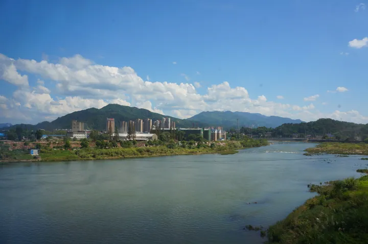
Photo adjustments
Full frame retained; proportionally resized and converted to WebP. No retouching or changes to the photographed subject. Card displays may crop the view.
- Administrative area
- County · 县
- Part of
- Nanping
- Chinese name
- 光泽县
- Local areas
- County guide
Area & population
- Area in the source
- 2,241.00 km²
- Population · 2020 census
- 130,294
Source: cited geographic source, as of the dates shown.
Setting and landscape
The county is a mountain basin, high on all sides and lowest in the middle, where hills, river valleys and plains lie. A local saying runs "each rapid a zhang higher, Guangze is up in the sky" (一滩高一丈,光泽在天上). In the west the Wuyi range is lower, falling quickly to plains linked with the Fu River (抚河) basin of Jiangxi. The county borders seven counties and cities in both provinces, including Wuyishan (武夷山市), Shaowu (邵武) and Lichuan (黎川).
History
People lived here in the Neolithic, four to five thousand years ago. Yangning Town (洋宁镇), set up north of Shaowu in 624 under the Tang, was the forerunner of the county. In 880 the Shanguan Pass (杉关) was set up on the border between Shaowu and Nancheng in Jiangxi, and the Nancheng–Shanguan–Shaowu road became the main route between Jiangxi and Fujian. Guangze County was created in 979 under the Northern Song. It was transferred to Jiangxi in 1934 and returned to Fujian in 1947.
What to see
Wujun Mountain (乌君山), about 20 kilometres east of the county town, adjoins the Wuyishan nature reserve to the north. A rock on its summit shaped like a monkey gives it the nickname Monkey Mountain, and its highest peak reaches 1,477 metres. The Shenshan scenic area (神山风景区), 25 kilometres from town beside National Highway 316, has Dongguang Rock (洞光岩), a mushroom-shaped pillar over 50 metres high pierced from east to west by a cave, the Feiyan waterfall, more than 100 metres high, and the Guanmi yellow pear orchards (管密黄花梨).
Sanjiao opera (三角戏) originated in Guangze and spread through the counties of the Fujian–Jiangxi border; it is sung in the local dialect with young male, young female and clown roles. The tea-lantern dance (茶灯舞) is performed from the third to the fifteenth day of the first lunar month, with eight women singing tea-picking songs for each month of the year. She (畲族) people of the Lei and Lan clans live in more than 20 villages and sing songs in the She language, seven syllables a line and four lines a verse, usually as male–female duets.
Food and local products
Most villagers drink leicha (擂茶), tea leaves ground with a pestle in a special bowl, strained and mixed with warm or spring water. Rice-flower fish (稻花鱼) are raised in spring-fed paddy fields alongside the rice.
Getting oriented
Guangze is the first Fujian county on the Yingtan–Xiamen railway, with a station at Guangze. The Dewu expressway and National Highway 316 cross the county.
Highlights
- Wujun Mountain 乌君山: Monkey-shaped summit rock, peak 1,477 m, about 20 km east of the county town next to the Wuyishan reserve.
- Shenshan scenic area 神山风景区: Dongguang Rock, pierced by a cave, and a waterfall over 100 m high.
- Sanjiao opera 三角戏: Local opera that originated in Guangze, sung in dialect.
Sources for this guide
光泽县建制沿革 - 建制沿革 · Guangze County People's Government
光泽县旅游概况 - 悠久光泽 · Guangze County People's Government
稻花鱼与稻花鱼米 - 土特名产 · Guangze County People's Government
光泽县 - 维基百科,自由的百科全书 · Wikipedia (Chinese) · CC BY-SA 4.0
Original English written from the listed sources and checked sentence by sentence against quoted extracts by a separate reviewer. Updated 2026-09-23.
Explore Guangze County
Core places to explore, with English and Chinese names.
Guangze County 光泽县
Plan your visit
Getting there
Guangze County is about 140 km in a straight line from central Nanping. Search for 光泽县 in a map app to find stations and your accommodation.
Where to stay →More in Nanping
Sources & geographic information
Administrative names and parent areas: Official geographic directory · Reference date 2026-09-06.
Some facts checked against 光泽县 — Wikipedia contributors, CC BY-SA 4.0.
Map data © OpenStreetMap contributors. Pins mark approximate centres, not entrances or boundaries.