


Get to know Pucheng County
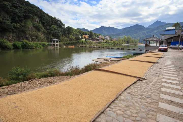
Photo adjustments
Full frame retained; proportionally resized and converted to WebP. No retouching or changes to the photographed subject. Card displays may crop the view.
- Administrative area
- County · 县
- Part of
- Nanping
- Chinese name
- 浦城县
- Local areas
- County guide
Area & population
- Area in the source
- 3,383.00 km²
- Population · 2020 census
- 297,719
Source: cited geographic source, as of the dates shown.
Setting and landscape
The Wuyi Mountains (武夷山脉) and the Xianxia Range (仙霞岭) meet in the north of the county, enclosing a basin that slopes from north to south and opens slightly to the south. The county has 290 peaks above 1,000 metres; the highest, Yingpanjian (营盘尖) in the northeast, reaches 1,664 metres. The main river, the Nanpu Stream (南浦溪), rises at Zheling (柘岭) in the north, is counted as a source of the Min River (闽江), and leaves the county southward to join the Jianxi (建溪). Pucheng is one of the rainier parts of Fujian.
History
The Minyue king Yushan (余善) built a walled town beside the Zhexi (柘溪), today's Nanpu Stream, and called it Pucheng. The county itself was set up as Hanxing (汉兴县) in 196, renamed Wuxing (吴兴) in 260 and Tangxing (唐兴) in 621, became Wuning (武宁) after Wu Zetian took the throne in 691, reverted to Tangxing in 705, and took the name Pucheng in 742. Between 1931 and 1935 the Communist Party set up five county-level soviet governments in the area, and a Pucheng county soviet was established in September 1932.
What to see
The county singles out Kuangshan (匡山), Fugai Mountain (浮盖山) and Jiushidu (九石渡) as its main scenic areas. Guanqian village (观前村) is a provincial historic and cultural village. Provincial protected sites include the Liling Pass (梨岭关), Zhen'an Bridge (镇安桥), the Xishan residence (西山故居), former home of Zhen Dexiu (真德秀), and the ruins of the Hanyang walled town (汉阳城遗址). Mengbi Culture Park (梦笔文化园), at the western foot of Mengbi Hill (梦笔山), holds the Pucheng Art Museum and the Fan Di'an Art Museum (范迪安美术馆).
Food and local products
Osmanthus is the county flower, and the China Economic Forest Association named Pucheng China's home of red osmanthus (丹桂) in January 2007. Gold, silver and red varieties all grow here, and one red osmanthus with nine crowns, called the "osmanthus king of Fujian", has been dated by experts at over 1,100 years old. At harvest, households make osmanthus sugar, honey, tea, cakes and wine. Pucheng osmanthus and Pucheng coix seed (薏米) are Chinese geographical-indication products. Local snacks include dengzhan cakes (灯盏糕), guobianhu (锅边糊), rouyan (肉燕) and tofu balls.
Getting oriented
Pucheng borders Jiangshan, Suichang and Longquan in Zhejiang, Guangfeng in Jiangxi, and Songxi, Jianyang and Wuyishan within Fujian. National highways G205 and G353 pass through the county.
Highlights
- Kuangshan 匡山: Named by the county as one of its main scenic areas.
- Yingpanjian 营盘尖: The county's highest peak, 1,664 metres, in the northeast.
- Guanqian village 观前村: A Fujian provincial historic and cultural village.
- Pucheng osmanthus 浦城桂花: County flower and a Chinese geographical-indication product.
Sources for this guide
浦城概况 · Pucheng County People's Government
建制沿革 · Pucheng County People's Government
地理环境 · Pucheng County People's Government (county Party history and gazetteer office)
浦城桂花 · Pucheng County People's Government
梦笔文化园 · Pucheng County People's Government
浦城县 - 维基百科,自由的百科全书 · Wikipedia (Chinese) · CC BY-SA 4.0
Original English written from the listed sources and checked sentence by sentence against quoted extracts by a separate reviewer. Updated 2026-09-23.
Explore Pucheng County
Core places to explore, with English and Chinese names.
Places to explore around Pucheng County
 AI illustration · AI
 Plan your visit
Getting there
Pucheng County is about 145 km in a straight line from central Nanping. Search for 浦城县 in a map app to find stations and your accommodation.
Where to stay →Build your route
Start with Mount Kuang. The linked place guides have entrance and visit details.
Continue with Nanping →More in Nanping
Sources & geographic information
Administrative names and parent areas: Official geographic directory · Reference date 2026-09-06.
Some facts checked against 浦城县 — Wikipedia contributors, CC BY-SA 4.0.
Map data © OpenStreetMap contributors. Pins mark approximate centres, not entrances or boundaries.