


Get to know Shishi
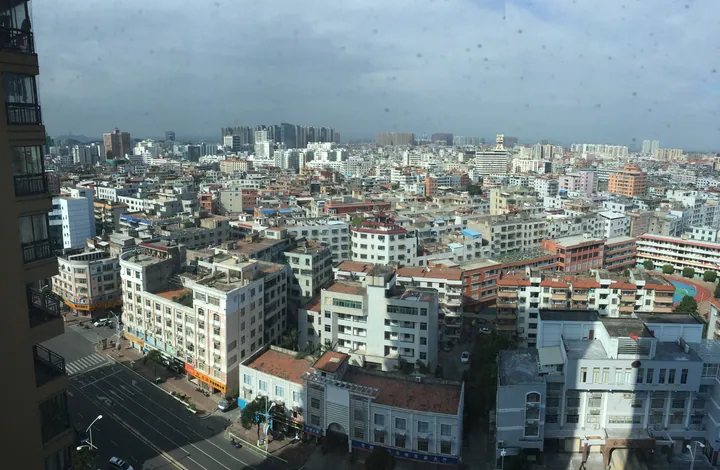
Photo adjustments
Full frame retained; proportionally resized and converted to WebP. No retouching or changes to the photographed subject. Card displays may crop the view.
- Administrative area
- County-level city · 县级市
- Part of
- Quanzhou
- Chinese name
- 石狮市
- Local areas
- County-level city guide
Area & population
- Area in the source
- 160.80 km²
- Population · 2020
- 685,930
Source: cited geographic source, as of the dates shown.
Setting and landscape
Jinjiang (晋江市) wraps around Shishi on the west and south-west, Shenhu Bay (深沪湾) lies to the south, and Quanzhou Bay (泉州湾) separates it from Fengze District (丰泽区) and Hui'an County (惠安县) to the north. The land is mostly terraces and coastal plain, higher in the south and centre; the highest point is Baogai Mountain (宝盖山), at 209.6 metres. The city government describes a dry place with long summers, short winters, strong typhoon influence and ten streams, most of them intermittent and running separately into the sea. The sea surrounds the city on three sides, and Xiangzhi (祥芝) harbour is listed by the city government as one of China's five major fishing ports.
History
The name means "stone lion": people around the Fengli temple (凤里庵) used to meet by a carved stone lion in front of it. From 718 the area belonged to Jinjiang County. In December 1987 the State Council approved a new city made from the Jinjiang towns of Shishi, Hanjiang (蚶江) and Yongning (永宁) and Xiangzhi township (祥芝乡), and the city government opened on 30 September 1988. Its second-hand clothes stalls (故衣摊) numbered more than 310 by February 1982, forming a sizeable clothing market.
What to see
Two pagodas mark the old sea route into Quanzhou Bay. Gusao Pagoda (姑嫂塔), on the top of Baogai Mountain, served as a navigation mark for ships, and the Liusheng Pagoda (六胜塔) at Shihu (石湖) in Hanjiang was another lighthouse for Quanzhou port. With the Linluan ferry (林銮渡) they form a group of national protected sites. Huxiu Temple (虎岫寺) on Baogai Mountain dates from the Zhenguan era (627–649).
Yongning (永宁), on a peninsula in the south-east, was walled as the Yongning Guard (永宁卫) in 1387 to defend the coast against Japanese pirates. The Yongning old garrison town is now a 3A scenic area, and Yongning Old Street (永宁老街) was named a historic and cultural street of China. The town's old southern Fujian houses and overseas Chinese homes from the Ming, Qing and Republican periods have earned it the name "natural museum of southern Fujian architecture".
Highlights
- Gusao Pagoda 姑嫂塔: Hilltop pagoda on Baogai Mountain that served as a navigation mark for ships entering Quanzhou Bay; a national protected site.
- Liusheng Pagoda 六胜塔: Pagoda at Shihu in Hanjiang that acted as a lighthouse for Quanzhou port.
- Yongning old garrison town 永宁古卫城: Walled as the Yongning Guard in 1387 against Japanese pirates; now a 3A scenic area.
Sources for this guide
建制沿革_石狮市人民政府 · Shishi Municipal People's Government
永宁镇概况_永宁镇_乡镇街道概况_石狮市人民政府 · Shishi Municipal People's Government
石狮概况_石狮市人民政府 · Shishi Municipal People's Government
Original English written from the listed sources and checked sentence by sentence against quoted extracts by a separate reviewer. Updated 2026-09-25.
Explore Shishi
Core places to explore, with English and Chinese names.
Places to explore around Shishi
 AI illustration · AI 示意图(仅供参考,非该地点实拍)
Yongning Ancient Garrison Town永宁古卫城
Yongning's former garrison town occupies a peninsula on the northern side of Shenhu Bay in Shishi, where coastal defence and overseas trade shaped the streets.
Read the place guide →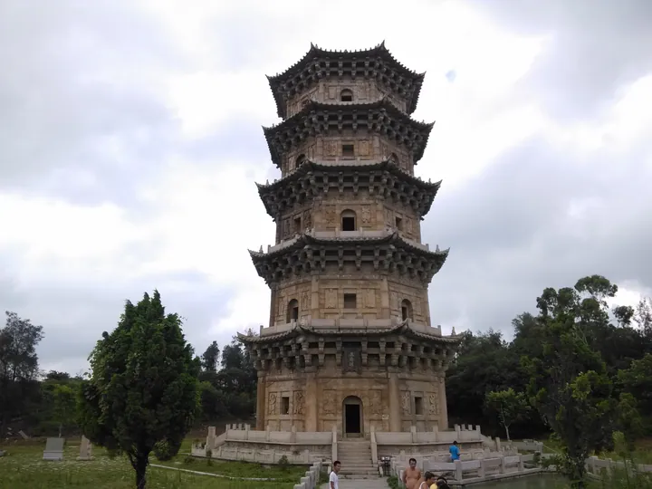 Liusheng Pagoda, a five-tiered stone tower in Shishi · 石狮六胜塔,五层石塔 Source-recorded photograph date: 20150724 1542.
Liusheng Pagoda六胜塔
Octagonal five-storey stone pagoda on Quanzhou Bay in Shishi, first built in 1111 as a landmark for ships; part of the Quanzhou World Heritage site.
Read the place guide →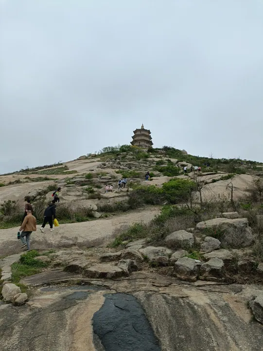 The Wanshou Pagoda, also known as Gusao Pagoda, on its hilltop in Shishi, Fujian · 福建石狮姑嫂塔(万寿塔) Source-recorded photograph date: 2023-06-14.
Gusao Pagoda姑嫂塔
Wanshou Tower, commonly called Gusao Tower, is a Southern Song stone landmark on Shishi's Baogai Mountain that once guided ships toward Quanzhou.
Read the place guide →Plan your visit
Getting there
Shishi is about 20 km in a straight line from central Quanzhou. Search for 石狮市 in a map app to find stations and your accommodation.
Where to stay →Build your route
Yongning Ancient Garrison Town and Liusheng Pagoda are both listed here. The linked place guides have entrance and visit details.
Continue with Quanzhou →More in Quanzhou
Sources & geographic information
Administrative names and parent areas: Official geographic directory · Reference date 2026-09-06.
Photo: Liusheng Pagoda · 董辰兴 · CC BY-SA 4.0. Full frame retained; proportionally resized and converted to WebP. No retouching or changes to the photographed subject. Card displays may crop the view.

Photo: Gusao Pagoda · Perinbaba · CC BY-SA 4.0. Full frame retained; proportionally resized and converted to WebP. No retouching or changes to the photographed subject. Card displays may crop the view.
.jpg)
Map data © OpenStreetMap contributors. Pins mark approximate centres, not entrances or boundaries.