


Get to know Honggang District
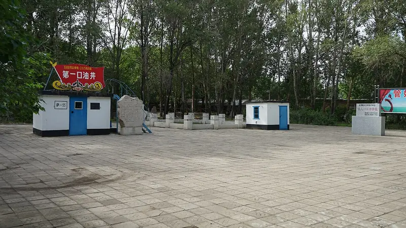
Photo adjustments
Full frame retained; EXIF orientation normalized, proportionally resized to at most 800 pixels and converted to WebP. No generated pixels or subject changes. Cards may crop the display.
- Administrative area
- District · 市辖区
- Part of
- Daqing
- Chinese name
- 红岗区
- Local areas
- District guide
Area & population
- Area in the source
- 812.00 km²
- Population · 2010
- 130,000
Source: cited geographic source, as of the dates shown.
History
The area was once the second district of Anda County (安达县). In November 1949 it became a separate tenth district, renamed Zhongneipao (中内泡) in March 1955, and in 1956 the Xingshugang (杏树岗) township was created. A Xingshugang district under Anda city existed from 1960 to 1965. The provincial government approved the present Honggang District under Daqing on 10 March 1980.
Xingshugang town (杏树岗镇) is home to the Xing 66 well (杏66井), which the Heilongjiang Daily calls a veteran, decorated well of the Daqing oilfield; the paper describes the town as carrying more than sixty years of oilfield memory.
Setting and landscape
The district government gives the area as 623 square kilometres. Four main Daqing oilfield production plants, No. 2, 4, 5 and 9, work here, and the government states that the district yields 40% of the oilfield's oil and 60% of its natural gas. The district also has 83,000 mu of cropland, 48,000 mu of woodland and 330,000 mu of grassland, along with 35,000 mu of water surface at lakes such as Zhongneipao and Swan Lake (天鹅湖).
Getting oriented
The Rangtong railway (让通铁路) has two stations in the district, Yinlang (银浪) and Chuangyezhuang (创业庄). Three trunk roads, the Sada road (萨大路) and the East and West trunk lines, cross it from north to south, the Daguang Expressway (大广高速) has four exits here, and 22 secondary oilfield roads run east to west. Xingshugang is the district's one town; the rest is divided into six subdistricts, among them Babaishang (八百垧) and Jiefang (解放).
Highlights
- Xing 66 well 杏66井: A veteran Daqing oilfield well in Xingshugang town, according to the Heilongjiang Daily.
- Swan Lake 天鹅湖: One of the district's lakes named by the district government, with Zhongneipao.
Sources for this guide
历史沿革 (History) · Honggang District People's Government, Daqing
自然地理 (Physical geography) · Honggang District People's Government, Daqing
走进红岗 (About Honggang) · Honggang District People's Government, Daqing
“油城小镇”新图景 (Heilongjiang Daily, 26 August 2026, page 2) · Heilongjiang Daily
Original English written from the listed sources and checked sentence by sentence against quoted extracts by a separate reviewer. Updated 2026-09-24.
Explore Honggang District
Core places to explore, with English and Chinese names.
Honggang District 红岗区
Plan your visit
Getting there
Honggang District is about 35 km in a straight line from central Daqing. Search for 红岗区 in a map app to find stations and your accommodation.
Where to stay →More in Daqing
Sources & geographic information
Administrative names and parent areas: Official geographic directory · Reference date 2026-09-06.
Map data © OpenStreetMap contributors. Pins mark approximate centres, not entrances or boundaries.