


Get to know Sartu District
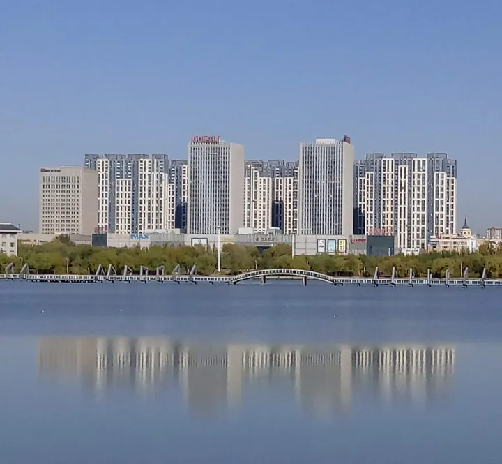
Photo adjustments
Full frame retained; proportionally resized and converted to WebP. No retouching or changes to the photographed subject. Card displays may crop the view.
- Administrative area
- District · 市辖区
- Part of
- Daqing
- Chinese name
- 萨尔图区
- Local areas
- District guide
Area & population
- Area in the source
- 549.00 km²
- Population · 2020 census
- 327,192
- Administrative seat
- Gelin Subdistrict
Source: cited geographic source, as of the dates shown.
Setting and landscape
The ground stands between 145 and 155 metres above sea level and is slightly higher in the east than in the west. There are scattered sand dunes in the south-west and north-west and a good deal of wetland; 27 of the ponds are of some size. The district government describes windy, dry springs, short warm and rainy summers, quick autumn cooling with early frost, and long, cold winters with little snow.
The name is usually traced to a Mongolian word meaning the place where the moon rises. A second explanation, given alongside it by Chinese Wikipedia, reads it as a windy, sandy place, after the spring gales that lift alkali dust and fine sand.
History
The district government dates human settlement here to the early Neolithic, more than 6,000 years ago. Under the Qing the land was pasture of the Dorbod Banner (杜尔伯特旗) in the Jirim League (哲里木盟). The Chinese Eastern Railway opened in July 1903, and Sartu became part of Anda sub-prefecture (安达厅) in 1906. After the Songji No. 3 well (松基三井) struck oil in 1959, a cluster of rammed-earth and adobe courtyards was built north of Sartu railway station on 20 October 1960 as the headquarters of the oilfield campaign. Known as No. 2 Courtyard (二号院), it remained the command centre until the mid-1990s. The old Sartu station has since been renamed Daqing station.
What to see
The Daqing Oilfield History Exhibition Hall (大庆油田历史陈列馆) occupies No. 2 Courtyard and opened on 26 September 2006. Economic Daily calls it China's first memorial on an original site devoted to the oil industry. A path paved in bronze, the Daqing Road (大庆之路), carries 4,000 characters telling the oilfield's story from 26 September 1959. The hall covers 15,900 square metres and holds more than 8,400 objects, arranged in eight sections. It was named a national industrial tourism demonstration base. Chinese Wikipedia lists it at 32 Zhongqi Road (中七路) as a state-owned, third-grade museum.
Chinese Wikipedia describes Huizhan subdistrict (会战街道) as one of the busier parts of Sartu, with a department store among its main buildings.
Highlights
- Daqing Oilfield History Exhibition Hall 大庆油田历史陈列馆: Opened in 2006 in the former oilfield campaign headquarters, No. 2 Courtyard; more than 8,400 objects in eight sections.
- Daqing Road 大庆之路: Bronze-paved path in front of the hall, carrying 4,000 characters on the oilfield's history since 1959.
Sources for this guide
萨尔图区 - 维基百科,自由的百科全书 · Chinese Wikipedia · CC BY-SA 4.0
萨尔图区自然地理 · Sartu District People's Government, Daqing
萨尔图区历史沿革 · Sartu District People's Government, Daqing
黑龙江省博物馆列表 - 维基百科,自由的百科全书 · Chinese Wikipedia · CC BY-SA 4.0
大庆石油开发的见证_中国经济网 · Economic Daily (China Economic Net)
大庆油田历史陈列馆:用好“红色资源”搭建“活的”课堂 · China Youth Daily
Original English written from the listed sources and checked sentence by sentence against quoted extracts by a separate reviewer. Updated 2026-09-24.
Explore Sartu District
Core places to explore, with English and Chinese names.
Places to explore around Sartu District
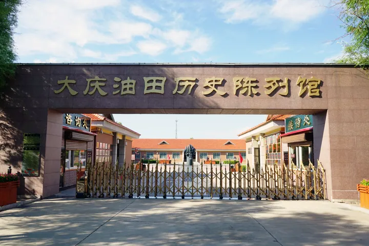 The entrance gate of the Daqing Oilfield History Museum, Sa'ertu District ·
 Plan your visit
Getting there
Sartu District covers the centre of Daqing. Search for 萨尔图区 in a map app to find stations and your accommodation.
Where to stay →Build your route
Start with Daqing Oilfield History Museum. The linked place guides have entrance and visit details.
Continue with Daqing →More in Daqing
Sources & geographic information
Administrative names and parent areas: Official geographic directory · Reference date 2026-09-06.
Some facts checked against 萨尔图区 — Wikipedia contributors, CC BY-SA 4.0.
Some facts checked against 黑龙江省博物馆列表 — Wikipedia contributors, CC BY-SA 4.0.
Photo: Daqing Oilfield History Museum · Amarespeco · CC BY-SA 4.0. Full frame retained; proportionally resized and converted to WebP. No retouching or changes to the photographed subject. Card displays may crop the view.

Map data © OpenStreetMap contributors. Pins mark approximate centres, not entrances or boundaries.