


Get to know Yanshou County
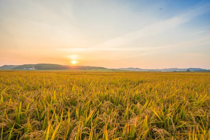
Photo adjustments
Full frame retained; proportionally resized and converted to WebP. No retouching or changes to the photographed subject. Card displays may crop the view.
- Administrative area
- County · 县
- Part of
- Harbin
- Chinese name
- 延寿县
- Local areas
- County guide
Area & population
- Area in the source
- 3,149.60 km²
- Population · 2010
- 242,455
Source: cited geographic source, as of the dates shown.
History
The Mayan River wasteland was opened to farming in 1879. In 1880 a sub-magistrate's post was set up; its first holder moved it to Fushan Tun (福山屯), the site of today's Yanshou Town (延寿镇), because he judged the original site's feng shui unsuitable. The county was created in 1903 as Changshou (长寿, "long life"), with its ten townships named after virtues such as benevolence (仁) and righteousness (义). It was renamed Tongbin (同宾) in 1914 and took its present name in 1929, combining the Mayan River to the south with Changshou Mountain (长寿山) inside the county; the name reads as "prolonging life".
During the war against Japan and the civil war the county was a political centre of the Northern Manchuria base area, and the Chinese People's Liberation Army's 359th Brigade took the town in January 1946. The Songjiang Province Historical Site Exhibition Hall (松江省史迹陈列馆) records the Songjiang provincial Party committee and government; the county describes it as the only such hall in China. A second museum, the Production Team Imprint Hall (生产队印迹馆), marks the county's claim to the first use of the "production team" as a farm unit.
What to see
Changshou Mountain National Forest Park (长寿山国家森林公园), 16 kilometres south-east of the county town, is a national 3A scenic area of 101 square kilometres that takes in Changshou Lake (长寿湖), rock formations called the Stone Forest and Stone Sea (石林石海), Changshou Village and Changshou Mountain Villa (长寿山庄). A cliff there carries a "寿" (longevity) character in the hand of the Qianlong Emperor, which the county calls the finest in the land.
Mayan River National Wetland Park (蚂蜒河国家湿地公园) follows the river bank on the south side of the county town, a river-wetland park with pavilions, arched bridges and a coloured running track.
Food and local products
The county lies in the rice belt around 45 degrees north on a thick black-soil layer, where Yanshou rice (延寿大米) is grown; the county styles itself a home of quality fragrant rice and also China's "capital of black rice". It has been named a historic city of flax textiles, and a local company, Jijia Flax (继嘉亚麻), exports flax products.
Setting and landscape
The county government sums up the terrain as mostly hills and farmland, around 116 peaks, 33 rivers and more than 200 lakes, and has been named a "China Natural Oxygen Bar". The Sanmo road (三莫公路) and the Tieke expressway (铁科高速) cross the county.
Highlights
- Changshou Mountain National Forest Park 长寿山国家森林公园: National 3A scenic area 16 km south-east of the county town, with Changshou Lake and a Qianlong-era longevity inscription.
- Mayan River National Wetland Park 蚂蜒河国家湿地公园: River-wetland park on the south side of the county town.
- Songjiang Province Historical Site Exhibition Hall 松江省史迹陈列馆: Museum on the history of the Songjiang provincial Party committee and government.
- Yanshou rice 延寿大米: Fragrant rice grown on black soil in the 45-degree-north rice belt.
Sources for this guide
延寿概况 · Yanshou County People's Government
历史沿革 · Yanshou County People's Government
长寿山国家森林公园 · Yanshou County People's Government
蚂蜒河国家湿地公园 · Yanshou County People's Government
Original English written from the listed sources and checked sentence by sentence against quoted extracts by a separate reviewer. Updated 2026-09-24.
Explore Yanshou County
Core places to explore, with English and Chinese names.
Yanshou County 延寿县
Plan your visit
Getting there
Yanshou County is about 135 km in a straight line from central Harbin. Search for 延寿县 in a map app to find stations and your accommodation.
Where to stay →More in Harbin
Sources & geographic information
Administrative names and parent areas: Official geographic directory · Reference date 2026-09-06.
Map data © OpenStreetMap contributors. Pins mark approximate centres, not entrances or boundaries.