


Get to know Dong'an District
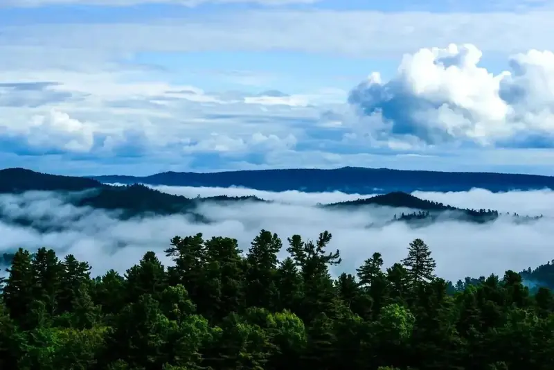
Photo adjustments
EXIF orientation normalized; resized without changing aspect ratio; converted to WebP. No subject edits.
- Administrative area
- District · 市辖区
- Part of
- Mudanjiang
- Chinese name
- 东安区
- Local areas
- District guide
Area & population
- Area in the source
- 294.20 km²
- Population · 2017
- 220,000
- Administrative seat
- No.123, East Chang'an Street (东长安街123号)
Source: cited geographic source, as of the dates shown.
History
The city government traces human settlement here back to about 2000 BC; the Sushen (肃慎), ancestors of the Manchu, and their descendants lived along both banks of the Mudan River, farming, fishing and hunting. Under the Ming, Yehe (乜河), today's Xinglong town (兴隆镇), came under the Nurgan Regional Military Commission (奴尔干都司); by the early Qing it was a relay post on the road from Beijing, Jilin and Ningguta (宁古塔) to Sanxing (三姓, now Yilan).
The modern city began in 1903, when the eastern section of the Chinese Eastern Railway (中东铁路) opened and Mudanjiang station was built on the west side of the district. Streets grew up around it, making this the first part of Mudanjiang to become urban. Japanese troops occupied the city in May 1932. After 1945 the area was split into several districts; one of them, Xin'an (新安), took the name Dong'an in June 1947, and Dong'an District was set up again in January 1958. The city government also notes that the first Communist Youth League group in the Mudanjiang region and the first Communist Party branch in urban Mudanjiang were founded here.
What to see
The Mudanfeng hills are a nature reserve that the city government calls one of the world's closest to a city centre and one of Heilongjiang's better-preserved pieces of old-growth forest. The Mudanfeng tourist road (牡丹峰旅游公路) passes flower fields, paddy-field art, natural springs and a winter ski slope. Dawan (大湾), on the Mudan River, is an AAA scenic area.
In town, the 1946 Cultural and Creative Park (1946文创园) reuses the old Mudanjiang Woodworking Machinery Factory for industrial displays and immersive shows. The Mudanjiang Mass Art Centre (牡丹江群众艺术馆), the painting and calligraphy academy and the Grand Theatre are also in the district, which holds over 90 per cent of the city's large cultural venues. Shaman fishing-and-hunting traditions, Korean culture and northeastern folk customs are found across the district.
Getting oriented
Mudanjiang railway station lies in Dong'an, and most of the planned Jiangnan New Area (江南新区) falls under the district. Besides the riverside commercial core, the district takes in Xinglong town and the Mudanfeng nature reserve.
Highlights
- Mudanfeng Nature Reserve 牡丹峰: Forested hills described by the city government as one of the world's closest nature reserves to a city centre.
- Dawan Scenic Area 大湾: AAA scenic area on the Mudan River.
- 1946 Cultural and Creative Park 1946文创园: Former Mudanjiang Woodworking Machinery Factory turned into an industrial-heritage and immersive-show park.
- Mudanjiang Mass Art Centre 牡丹江群众艺术馆: One of the city's main cultural venues, located in the district.
Sources for this guide
东安区 (牡丹江市) · Chinese Wikipedia · CC BY-SA 4.0
东安区概况 · Mudanjiang Municipal People's Government
Original English written from the listed sources and checked sentence by sentence against quoted extracts by a separate reviewer. Updated 2026-09-24.
Explore Dong'an District
Core places to explore, with English and Chinese names.
Dong'an District 东安区
Plan your visit
Getting there
Dong'an District is about 3 km in a straight line from central Mudanjiang. Search for 东安区 in a map app to find stations and your accommodation.
Where to stay →More in Mudanjiang
Sources & geographic information
Administrative names and parent areas: Official geographic directory · Reference date 2026-09-06.
Some facts checked against 东安区 (牡丹江市) — Wikipedia contributors, CC BY-SA 4.0.
Map data © OpenStreetMap contributors. Pins mark approximate centres, not entrances or boundaries.