


Get to know Ning'an
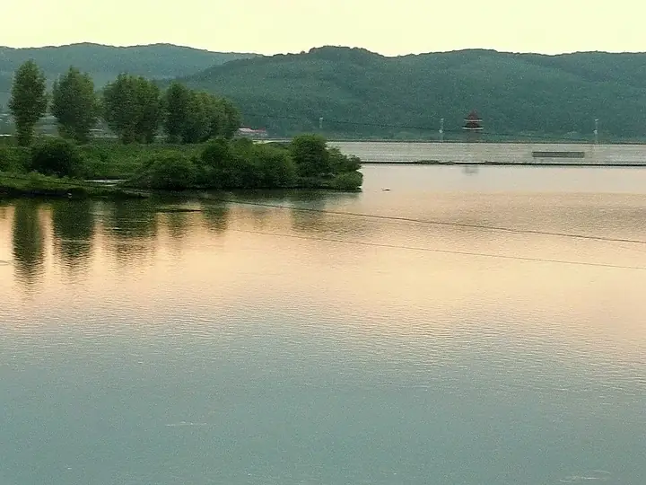
Photo adjustments
Full frame retained; resized proportionally to a maximum dimension of 960 pixels and converted to WebP quality 88. No crop, retouch, generated elements, or subject alteration. Final website rendition: full frame retained, proportionally resized to at most 720 pixels and converted to WebP. No additional retouching or subject alteration. Card displays may crop the view.
- Administrative area
- County-level city · 县级市
- Part of
- Mudanjiang
- Chinese name
- 宁安市
- Local areas
- County-level city guide
Area & population
- Area in the source
- 7,870.00 km²
- Population · 2003
- 440,000
Source: cited geographic source, as of the dates shown.
Setting and landscape
The land is mostly low mountains and hills on the lava plateau of the Changbai Mountains, in the uplift belt of the Zhangguangcai (张广才岭) and Laoye (老爷岭) ranges; the Mudanjiang city government describes it as "seven parts mountain, one part water, two parts farmland". Ancient volcanic eruptions left fertile black soil, two major fault zones cross the area, and it has both hot and cold springs. The climate is temperate continental monsoon, with an average temperature of 4.5°C and a frost-free season of 130 to 135 days.
History
The Neolithic Yinggeling culture (莺歌岭文化) took shape here more than 4,000 years ago. In the Tang era the Bohai kingdom (渤海国) built its capital, Shangjing Longquanfu (上京龙泉府), in today's Bohai town. The Qing set up a military command at Ningguta in 1653, and in 1666 Ningguta was moved from its old town to a new one on the site of today's Ning'an town. Officials, officers and scholars from the south exiled to Ningguta left what the Mudanjiang city government calls an "exile culture" (流人文化). The name Ning'an, taken from Ningguta, dates from 1910; the county became a county-level city in 1993.
What to see
Jingpo Lake is a national scenic area, a 5A tourist site and a world geopark; the Mudanjiang city government calls it the world's largest volcanic barrier lake. Ning'an also has the Crater Underground Forest (火山口地下森林), a national forest park, and Xiaobeihu (小北湖), a national nature reserve. The Site of Shangjing Longquanfu of the Bohai kingdom (渤海国上京龙泉府遗址) was in the first batch of national key protected sites and is a 4A tourist site. Other sights include Yuanyang Lake (鸳鸯湖), Zuanxin Lake (钻心湖), Ziling Lake (紫菱湖) and the 3A Jingpo Gorge (镜泊峡谷).
Food and local products
Xiangshui rice (响水大米), grown on volcanic rock in Bohai town, was tribute rice for the Tang-era and Qing courts and is now a national geographical-indication product. Other well-known products are Langang watermelons (兰岗西瓜), northeastern black pigs and cold-water fish from Jingpo Lake.
Getting oriented
Ning'an borders Muling to the east, Hailin to the west, Wangqing County (汪清县) and Dunhua (敦化) in Jilin to the south, and urban Mudanjiang to the north. The Mudanjiang city government gives distances of 23 kilometres to Mudanjiang, 320 kilometres to Harbin and 19 kilometres to Mudanjiang airport. The Hegang–Dalian highway and the Mudanjiang–Tumen railway run through the city.
Highlights
- Jingpo Lake 镜泊湖: Volcanic barrier lake; national scenic area, 5A tourist site and world geopark.
- Site of Shangjing Longquanfu of the Bohai kingdom 渤海国上京龙泉府遗址: Bohai capital ruins in Bohai town; first-batch national key protected site.
- Crater Underground Forest 火山口地下森林: National forest park.
- Xiangshui rice 响水大米: Rice grown on volcanic rock, former tribute rice and a geographical-indication product.
Explore Ning'an
Core places to explore, with English and Chinese names.
Places to explore around Ning'an
 AI illustration · AI 示意图(仅供参考,非该地点实拍)
Bohai Shangjing Longquanfu Site渤海上京龙泉府遗址
The Shangjing Longquanfu site in Ning’an preserves archaeological remains of a capital of the Bohai kingdom.
Read the place guide → Jingpo Lake and its wooded rocky shore in Jingpohu Global Geopark, September 2014.
Jingpo Lake镜泊湖
Jingpo Lake owes its long, winding shape to lava flows that blocked the Mudan River. The northern end gives a compact introduction to that volcanic landscape: Diaoshuilou Waterfall drops over dark rock, while the lakeside…
Read the place guide →Plan your visit
Getting there
Ning'an is about 25 km in a straight line from central Mudanjiang. Search for 宁安市 in a map app to find stations and your accommodation.
Where to stay →Build your route
Bohai Shangjing Longquanfu Site and Jingpo Lake are both listed here. The linked place guides have entrance and visit details.
Continue with Mudanjiang →More in Mudanjiang
Sources & geographic information
Administrative names and parent areas: Official geographic directory · Reference date 2026-09-06.
Some facts checked against 宁安市 — Wikipedia contributors, CC BY-SA 4.0.
Photo: Jingpo Lake · William L. Farr · CC BY-SA 4.0. Proportionally resized and converted to WebP without cropping, retouching or changing the photographed subject.
.jpg)
Map data © OpenStreetMap contributors. Pins mark approximate centres, not entrances or boundaries.