


Get to know Gannan County
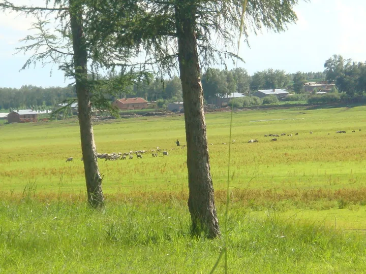
Photo adjustments
Full frame retained; proportionally resized and converted to WebP. No retouching or changes to the photographed subject. Card displays may crop the view.
- Administrative area
- County · 县
- Part of
- Qiqihar
- Chinese name
- 甘南县
- Local areas
- County guide
Area & population
- Area in the source
- 4,384.00 km²
- Population · 2010
- 368,734
Source: cited geographic source, as of the dates shown.
Setting and landscape
Rolling hills fill the west and north of the county, and the land drops gently to open plain in the south and south-east, between 160 and 380 metres above sea level. Its rivers are the Nen and three others, the Yin (音河), the Alun (阿伦河) and the Nomin (诺敏河), and there are 14 reservoirs, including the Yinhe reservoir (音河水库). Recorded temperature extremes are 39°C and −35.4°C. Siberian and red-crowned cranes live in the reed marshes of Changjigang (长吉岗).
History
In 1684 Daur and Evenki people moved down to the Nen and Nomin rivers, and the area became a hunting ground of the Butha Eight Banners (布特哈八旗). The Qing opened it to settlers in 1904. In March 1906 a land-reclamation bureau was set up at Old Ganjingzi (老甘井子), now Yongqing village (永青村) in Changshan township (长山乡), and in 1907 the bureau moved to Erzhan (二站), named as the second station on the old post road from Qiqihar to Hulunbuir, where the county town was laid out. In 1926 the local office was raised to the Gannan administrative bureau (甘南设治局) and Erzhan was renamed Gannan town (甘南镇); in 1933, after Japanese forces occupied Gannan, it became a county.
Food and local products
Soybeans, wheat, rice and maize are the main grains, and the county was named China's "home of sunflowers" in 2000. Gannan sunflower seeds (甘南葵花籽) are a Chinese geographical-indication product. The county government also lists white and black melons (白瓜, 黑瓜), flax and kidney beans as cash crops, medicinal herbs such as licorice and fangfeng (防风), and more than 30 kinds of wild vegetables, of which daylilies are exported.
Getting oriented
The county seat is Gannan town. The Suifenhe–Manzhouli expressway (绥满高速) runs through the county from north to south and provincial road S309 from east to west. The county government places it on the tourist route between Heilongjiang, Inner Mongolia and Russia.
Highlights
- Gannan sunflower seeds 甘南葵花籽: Chinese geographical-indication product; the county was named a home of sunflowers in 2000.
- Changjigang reed marshes 长吉岗: Home to Siberian and red-crowned cranes.
- Yinhe reservoir 音河水库: One of the county's 14 reservoirs.
Sources for this guide
甘南概况 — 甘南县人民政府 · Gannan County People's Government, Qiqihar
自然资源 — 甘南县人民政府 · Gannan County People's Government, Qiqihar
历史沿革 — 甘南县人民政府 · Gannan County People's Government, Qiqihar
甘南县 — 维基百科 · Wikipedia (Chinese) · CC BY-SA 4.0
Original English written from the listed sources and checked sentence by sentence against quoted extracts by a separate reviewer. Updated 2026-09-24.
Explore Gannan County
Core places to explore, with English and Chinese names.
Gannan County 甘南县
Plan your visit
Getting there
Gannan County is about 70 km in a straight line from central Qiqihar. Search for 甘南县 in a map app to find stations and your accommodation.
Where to stay →More in Qiqihar
Sources & geographic information
Administrative names and parent areas: Official geographic directory · Reference date 2026-09-06.
Some facts checked against 甘南县 — Wikipedia contributors, CC BY-SA 4.0.
Map data © OpenStreetMap contributors. Pins mark approximate centres, not entrances or boundaries.