


Get to know Tailai County
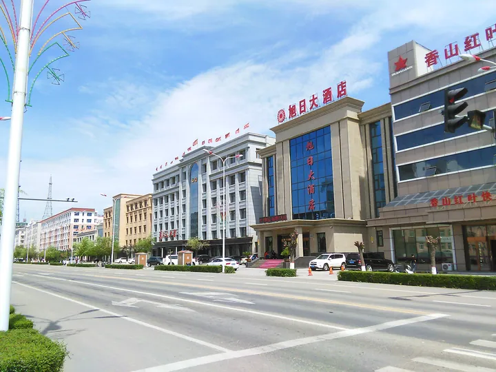
Photo adjustments
Full frame retained; proportionally resized and converted to WebP. No retouching or changes to the photographed subject. Card displays may crop the view.
- Administrative area
- County · 县
- Part of
- Qiqihar
- Chinese name
- 泰来县
- Local areas
- County guide
Area & population
- Area in the source
- 4,061.00 km²
- Population · 2010
- 302,027
Source: cited geographic source, as of the dates shown.
Setting and landscape
Qiqihar (齐齐哈尔) lies to the north, Jalaid Banner (扎赉特旗) of Inner Mongolia to the west and Zhenlai County (镇赉县) in Jilin to the south; across the Nen River to the east is the Dorbod Mongol county (杜蒙县) of Daqing (大庆). The ground drops gently from northwest to southeast, from an alluvial-fan plain in the west to a mixed wind-blown and alluvial plain in the east, broken by sand hills, seven of them sizeable.
The Nen flows for 140 kilometres through the county, and five other rivers also cross it. Average annual precipitation is 392.6 mm and the frost-free season averages 145 days; the county calls itself the "Jiangnan beyond the frontier" (塞北江南).
History
Under the Liao the area belonged to Taizhou (泰州) in the Supreme Capital circuit, and the Jin kept that arrangement. It was part of the fief of Temüge Otchigin (斡赤斤), youngest brother of Genghis Khan, and in the early Qing it was pasture of the Jalaid banner of the Khorchin Mongols. A Tailai administrative bureau was set up on 19 November 1913, and it became a county in January 1917. On 12 February 1946 the 22nd Regiment of the New Fourth Army's 8th Brigade, 3rd Division took the county town.
What to see
The Tazicheng ancient city site (塔子城古城遗址), from the Liao and Jin, is a national key protected site that the county government counts among the three major surviving ancient city sites in Heilongjiang. The Jiangqiao resistance site (江桥抗战遗址), linked to Ma Zhanshan (马占山), is a provincial protected site, and the Jiangqiao Resistance Memorial Hall (江桥抗战纪念馆) was named a national demonstration base for patriotic education in September 2019. The county also has the Stone Age site at Hongsheng (宏升东翁根山遗址), a site from the 1998 flood fight and Taihu National Wetland Park (泰湖国家级湿地公园).
Food and local products
Tailai rice, mainly medium- and long-grain japonica, has national geographical indication protection, and Tailai peanuts and Tailai mung beans carry agricultural geographical indications; the county is named China's home of mung beans and of Silihong peanuts (四粒红). The Nen yields river fish such as the "three hua and five luo" (三花五罗). The coarse-grain market at Tazicheng is one of the known coarse-grain trading centres of the northeast and eastern Inner Mongolia.
Highlights
- Tazicheng ancient city site 塔子城古城遗址: Liao-Jin city ruins; a national key protected site.
- Jiangqiao resistance site 江桥抗战遗址: Provincial protected site linked to Ma Zhanshan; the Jiangqiao Resistance Memorial Hall was named a national patriotic-education base in 2019.
- Taihu National Wetland Park 泰湖国家级湿地公园: National-level wetland park in the county.
- Tailai rice 泰来大米: Japonica rice with national geographical indication protection.
- Tailai mung beans 泰来绿豆: Agricultural geographical indication; the county is called China's home of mung beans.
Sources for this guide
泰来概况_泰来县人民政府 · Tailai County People's Government
自然地理_泰来县人民政府 · Tailai County People's Government
历史沿革_泰来县人民政府 · Tailai County People's Government
Original English written from the listed sources and checked sentence by sentence against quoted extracts by a separate reviewer. Updated 2026-09-24.
Explore Tailai County
Core places to explore, with English and Chinese names.
Tailai County 泰来县
Plan your visit
Getting there
Tailai County is about 115 km in a straight line from central Qiqihar. Search for 泰来县 in a map app to find stations and your accommodation.
Where to stay →More in Qiqihar
Sources & geographic information
Administrative names and parent areas: Official geographic directory · Reference date 2026-09-06.
Map data © OpenStreetMap contributors. Pins mark approximate centres, not entrances or boundaries.