


Get to know Xingyang
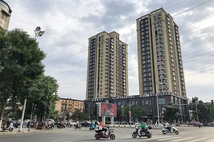
Photo adjustments
Full frame retained; proportionally resized and converted to WebP. No retouching or changes to the photographed subject. Card displays may crop the view.
- Administrative area
- County-level city · 县级市
- Part of
- Zhengzhou
- Chinese name
- 荥阳市
- Local areas
- County-level city guide
Area & population
- Area in the source
- 955.00 km²
- Population · 2019
- 648,700
Source: cited geographic source, as of the dates shown.
Setting and landscape
Xingyang sits where the loess hills of western Henan meet the eastern plain, and the ground falls from southwest to northeast. Three ridges running west to east split it into mountain, hill, plain and Yellow River floodland. The Yellow River flows about 45 kilometres past the city; the Sishui (汜水河) and Kuhe (枯河) drain to it, while the Suohe (索河) and Sihe (寺河) belong to the Huai River system. Across the Yellow River lie Wen (温县) and Wuzhi (武陟县) counties of Jiaozuo.
History
The name goes back to the Xing (荥) waters, which pooled into an ancient marsh, Xingze (荥泽), at the foot of the Mang Hills (邙岭); in the Warring States period the state of Han built a walled town on the north bank of the Xing stream and called it Xingyang. In 360 BC the state of Wei cut the Honggou canal (鸿沟) from here, leading Yellow River water southeast, and after conquering Han in 230 BC the Qin built the Ao Granary (敖仓) below the Guangwu Hills. During the Chu–Han war Liu Bang (刘邦) and Xiang Yu (项羽) fought over Xingyang repeatedly before dividing the realm along the Honggou. The Western Han finance minister Sang Hongyang (桑弘羊) counted it among the empire's famous cities. At the Hulao Pass the Tang prince Li Shimin (李世民) defeated Dou Jiande (窦建德) in the Battle of Hulao. Xingze and Heyin merged in 1931 and joined Sishui in 1948 as Chenggao County, which was folded into Xingyang in 1954; Xingyang became a city in 1994.
What to see
Xingyang counts 181 heritage sites, 12 of them national key protected sites. The Twin Cities of the Han and Chu Kings (汉霸二王城) are linked by legend to the 'Chu river, Han boundary' across the middle of the Chinese chessboard. Hulao Pass, in Sishui (汜水镇), is famous as the setting of the story of three heroes fighting Lü Bu (吕布). Taohuayu (桃花峪), in the northeast of Guangwu (广武镇), marks the dividing point between the middle and lower Yellow River. Changjia boxing (苌家拳) is on the national intangible heritage list.
Food and local products
Heyin pomegranates (河阴石榴) are a national geographical-indication product, grown here since the Han dynasty. Guangwu scallions (广武大葱) and Xingyang persimmons (荥阳柿子) also carry geographical indications. Yellow River carp (黄河鲤鱼), once a tribute to the imperial court and prized for tender flesh, became a geographical-indication product in 2012.
Highlights
- Hulao Pass 虎牢关: Pass in Sishui town, setting of the three heroes' fight with Lü Bu and of Li Shimin's Battle of Hulao.
- Twin Cities of the Han and Chu Kings 汉霸二王城: Chu–Han war site linked by legend to the 'Chu river, Han boundary' on the Chinese chessboard.
- Taohuayu 桃花峪: Scenic area in Guangwu at the dividing point between the middle and lower Yellow River.
- Heyin pomegranates 河阴石榴: National geographical-indication product, grown here since the Han dynasty.
- Changjia boxing 苌家拳: Martial art on the national intangible cultural heritage list.
Sources for this guide
荥阳市 - 维基百科 · Chinese Wikipedia · CC BY-SA 4.0
历史文化 - 荥阳市人民政府 · Xingyang Municipal People's Government
荥阳市旅游介绍 - 荥阳市人民政府 · Xingyang Municipal People's Government
Original English written from the listed sources and checked sentence by sentence against quoted extracts by a separate reviewer. Updated 2026-09-24.
Explore Xingyang
Core places to explore, with English and Chinese names.
Plan your visit
Getting there
Xingyang is about 30 km in a straight line from central Zhengzhou. Search for 荥阳市 in a map app to find stations and your accommodation.
Where to stay →More in Zhengzhou
Sources & geographic information
Administrative names and parent areas: Official geographic directory · Reference date 2026-09-06.
Some facts checked against 荥阳市 — Wikipedia contributors, CC BY-SA 4.0.
Map data © OpenStreetMap contributors. Pins mark approximate centres, not entrances or boundaries.