


Get to know Gongyi
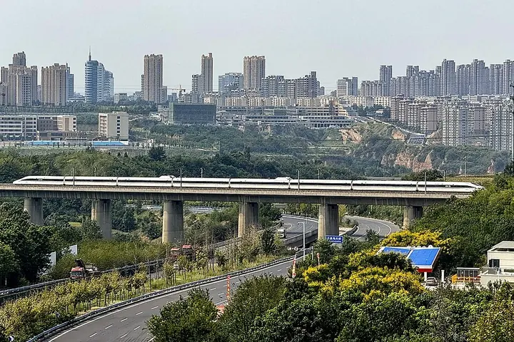
Photo adjustments
Full frame retained; proportionally resized and converted to WebP. No retouching or changes to the photographed subject. Card displays may crop the view.
- Administrative area
- County-level city · 县级市
- Part of
- Zhengzhou
- Chinese name
- 巩义市
- Local areas
- County-level city guide
Area & population
- Area in the source
- 1,041.00 km²
- Population · 2019
- 843,900
Source: cited geographic source, as of the dates shown.
Setting and landscape
The land drops in steps from south to north: from the Mount Song and Wuzhiling (五指岭) uplands at the southern edge, where Yuzhu Peak (玉柱峰) reaches 1,487 metres, through low mountains and loess hills down to river valleys. The Luo River (洛河) enters from the west and flows northeast into the Yellow River. The meeting of the two rivers, called Luorui (洛汭), is where the city government places the legends of the dragon-horse bearing the River Chart and Fu Xi (伏羲) drawing the eight trigrams. Fuxi Mountain (浮戏山) has karst scenery with more than 100 caves, among them Xuehua Cave (雪花洞) with a 173-metre "snowflake gallery".
History
Gong County was set up in the Qin dynasty and named for the phrase "guarded on four sides by mountains and rivers, firm and unshakable"; it became Gongyi city in 1991. The Shuanghuaishu site (双槐树遗址), which specialists have proposed calling the "Heluo ancient state" (河洛古国), is described by the city government as the highest-ranking central settlement of the middle and late Yangshao culture yet found in the Yellow River basin. The Tieshenggou (铁生沟) Han ironworks is the earliest known site of iron smelted with coal, and the Huangye (黄冶) kilns are the earliest and largest known Tang sancai kiln site.
What to see
The Northern Song imperial tombs (北宋皇陵) spread over the city and the towns of Xicun, Zhitian and Huiguo, holding eight Song emperors and the father of the dynasty's founder among queens' and ministers' tombs over 156 square kilometres; they became a national key protected site in 1982. The Gongxian Cave Temple (巩县石窟寺), under Dali Mountain in Heluo town 5 kilometres north of the city, was begun by the Northern Wei court, and later dynasties down to the Song added niches and statues; the city singles out its flying apsaras and reliefs of the emperor and empress worshipping the Buddha.
Du Fu's birthplace (杜甫故里), at Nanyaowan village in Zhanjie town, lies below Bijia Hill and includes the cave dwelling where he was born, while his tomb is on the Mang ridge (邙岭) at Kangdian. The Kang Baiwan Manor (康百万庄园), begun in the late Ming and early Qing, records the fortunes of the Kang family over 13 generations and more than 400 years; its residential quarter, warehouses, south compound and ancestral hall survive with stone, wood and brick carving.
Highlights
- Northern Song imperial tombs 北宋皇陵: Tombs of eight Song emperors over 156 square kilometres; national key protected site since 1982.
- Gongxian Cave Temple 巩县石窟寺: Northern Wei imperial cave temple 5 km north of the city, known for its flying apsaras.
- Kang Baiwan Manor 康百万庄园: Late Ming–early Qing manor of the Kang family, whose fortunes it traces over 13 generations; national 4A scenic area.
- Du Fu's birthplace 杜甫故里: Village below Bijia Hill where the Tang poet was born and grew up.
- Xuehua Cave 雪花洞: Karst cave on Fuxi Mountain with a 173-metre "snowflake gallery".
Sources for this guide
巩义市 - 维基百科,自由的百科全书 · Wikipedia (Chinese) · CC BY-SA 4.0
巩义概况 - 巩义市人民政府 · Gongyi Municipal People's Government
康百万庄园(国家AAAA级旅游景区、全国重点文物保护单位) - 巩义市人民政府 · Gongyi Municipal People's Government
杜甫故里(国家AAAA级旅游景区、河南省文物保护单位) - 巩义市人民政府 · Gongyi Municipal People's Government
Original English written from the listed sources and checked sentence by sentence against quoted extracts by a separate reviewer. Updated 2026-09-25.
Explore Gongyi
Core places to explore, with English and Chinese names.
Places to explore around Gongyi
 Aerial view of the Yongzhao Mausoleum, part of the Northern Song Imperial Tombs, Gongyi · 巩义北宋皇陵之永昭陵航拍 Source-recorded photograph date: 2023-02-16 16:22:36.
Northern Song Imperial Tombs北宋皇陵
The Northern Song imperial tombs (北宋皇陵) are the burial ground of seven Song emperors and close to a thousand of their relatives and officials, spread across the urban area of Gongyi and the townships of Zhitian, Xicun and Huiguo in Zhengzhou, Henan.
Read the place guide → Gongyi Grotto Temple (巩义石窟寺), Gongyi. Photograph: "20250614 Gongxian Grottoes - Cave 1 01".
Gongyi Grotto Temple巩义石窟寺
Gongyi Shikusi (巩义石窟寺), registered as the Gongxian Grottoes, is a Buddhist cave temple about ten kilometres north-east of Gongyi in Zhengzhou, Henan, cut into the foot of Dali Mountain on the north bank of the Yiluo River.
Read the place guide → A courtyard within Kang Baiwan’s Mansion in Gongyi, September 2025.
Kang Baiwan's Mansion康百万庄园
Kang Baiwan’s Mansion stands in Kangdian, Gongyi, between Mangshan and the Luo River. The estate developed over generations from the late Ming and early Qing periods.
Read the place guide →Plan your visit
Getting there
Gongyi is about 65 km in a straight line from central Zhengzhou. Search for 巩义市 in a map app to find stations and your accommodation.
Where to stay →Build your route
Northern Song Imperial Tombs and Gongyi Grotto Temple are both listed here. The linked place guides have entrance and visit details.
Continue with Zhengzhou →More in Zhengzhou
Sources & geographic information
Administrative names and parent areas: Official geographic directory · Reference date 2026-09-06.
Some facts checked against 巩义市 — Wikipedia contributors, CC BY-SA 4.0.
Photo: Northern Song Imperial Tombs · Windmemories · CC BY-SA 4.0. Full frame retained; proportionally resized and converted to WebP. No retouching or changes to the photographed subject. Card displays may crop the view.

Photo: Gongyi Grotto Temple · Windmemories · CC BY-SA 4.0. Full frame retained; EXIF orientation normalized, proportionally resized to at most 800 pixels and converted to WebP. No generated pixels or subject changes. Cards may crop the display.

Photo: Kang Baiwan's Mansion · Windmemories · CC BY-SA 4.0. Proportionally resized and converted to WebP without cropping, retouching or changing the photographed subject.

Map data © OpenStreetMap contributors. Pins mark approximate centres, not entrances or boundaries.