


Get to know Guangxin District
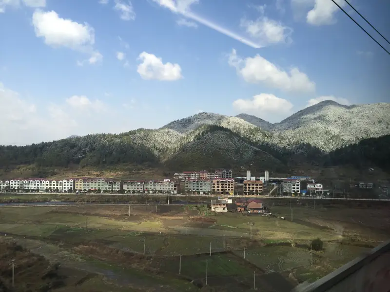
Photo adjustments
EXIF orientation normalized; resized without changing aspect ratio; converted to WebP. No subject edits.
- Administrative area
- District · 市辖区
- Part of
- Shangrao
- Chinese name
- 广信区
- Local areas
- District guide
Area & population
- Area in the source
- 2,240.00 km²
- Population · 2017
- 848,144
Source: cited geographic source, as of the dates shown.
Setting and landscape
The district runs 132 kilometres north to south but only 45 kilometres east to west. The Fengxi River (丰溪) separates it from Xinzhou District (信州区) and Guangfeng (广丰) to the east; Dexing (德兴) lies to the north, Yanshan (铅山) and Hengfeng (横峰) to the west, and Pucheng (浦城) and Wuyishan (武夷山) in Fujian to the south. The land falls in steps from both ends to the Xin River valley, a saddle shape. Its highest point is Wufu Peak (五府岗, 1,891.4 metres) in the south. The central hills are mostly Danxia landforms with caves such as Yueyan (月岩), Nanyan (南岩) and Qifengyan (七峰岩), while the low mountains around Shanglu (上泸) and Sishiba (四十八镇) show karst features, with solution caves and underground rivers.
History
Shangrao County was first created by the state of Wu in the early Jian'an years (196–204); the name was explained as a place of rare mountain products and great fertility. From 758 it was the seat of Xinzhou (信州), and from 1370 of Guangxin Prefecture (广信府). In May 1949 its seat town was split off to form the city of Shangrao, and in July 2019 the county was abolished and replaced by Guangxin District.
What to see
Lingshan (灵山), also called Lingying Mountain (灵应山), is a branch of the Huaiyu range with 72 peaks, the highest at 1,496 metres. It is counted as the 33rd of the Taoist "blessed lands" (福地), and the Taoists Hu Zhao (胡昭) and Ge Hong (葛洪) are said to have taught there; the Song poet Xin Qiji (辛弃疾) wrote a poem about it. The mountain is a ring-shaped granite-complex structure with an area of about 160 square kilometres, and large terraced fields lie at the foot of Shuijingshan (水晶山). It became a national scenic area on 26 January 2010.
Wangxian Valley (望仙谷), in Wangxian township (望仙乡), is a gorge resort with a planned area of 6.1 square kilometres; it has old north-east Jiangxi houses, local crafts and performances. It was rated national 4A in 2019 and named a provincial scenic area of note by the Jiangxi culture and tourism department in 2024. Qifengyan is where Ye Ting (叶挺), commander of the New Fourth Army, was held in the Southern Anhui Incident (皖南事变).
Highlights
- Lingshan 灵山: 72-peak granite ring mountain, a Taoist blessed land; national scenic area since 2010.
- Wangxian Valley 望仙谷: Gorge resort in Wangxian township with old local houses; planned area 6.1 km²; national 4A since 2019.
- Qifengyan 七峰岩: Danxia cave site where Ye Ting was held in the Southern Anhui Incident.
Sources for this guide
广信区 - 维基百科,自由的百科全书 · Chinese Wikipedia · CC BY-SA 4.0
灵山 (上饶) - 维基百科,自由的百科全书 · Chinese Wikipedia · CC BY-SA 4.0
+5+5+5+5!江西“风景独好”旅游名单上新! · Dajiang News (jxnews.com.cn), Jiangxi Fengjing Duhao account
Original English written from the listed sources and checked sentence by sentence against quoted extracts by a separate reviewer. Updated 2026-09-25.
Explore Guangxin District
Core places to explore, with English and Chinese names.
Places to explore around Guangxin District
 AI illustration; an interpretive view, not a photograph. AI 示意图,非景点实拍。
Wangxian Valley望仙谷
Wangxian Valley is a modern visitor landscape built around a restored former stone-production area in the Lingshan foothills. Its most striking buildings cling to the cliffs above the valley, while traditional-style lanes and…
Read the place guide → Hikers on the cliffside boardwalk beneath the granite peaks of Lingshan, Shangrao · 上饶灵山,花岗岩峰下的栈道与游人 Source-recorded photograph date: Taken on 6 April 2014.
Lingshan Mountains灵山
Lingshan (灵山) is a granite mountain range in the north of Guangxin District, Shangrao, Jiangxi, protected as a national scenic area and known locally as the Sleeping Beauty for the shape of its skyline.
Read the place guide →Plan your visit
Getting there
Guangxin District is about 3 km in a straight line from central Shangrao. Search for 广信区 in a map app to find stations and your accommodation.
Where to stay →Build your route
Wangxian Valley and Lingshan Mountains are both listed here. The linked place guides have entrance and visit details.
Continue with Shangrao →More in Shangrao
Sources & geographic information
Administrative names and parent areas: Official geographic directory · Reference date 2026-09-06.
Some facts checked against 广信区 — Wikipedia contributors, CC BY-SA 4.0.
Some facts checked against 灵山 (上饶) — Wikipedia contributors, CC BY-SA 4.0.
Photo: Lingshan Mountains · 江上清风1961 · CC BY 3.0. Full frame retained; proportionally resized and converted to WebP. No retouching or changes to the photographed subject. Card displays may crop the view.
.jpg)
Map data © OpenStreetMap contributors. Pins mark approximate centres, not entrances or boundaries.