


Get to know Hengfeng County
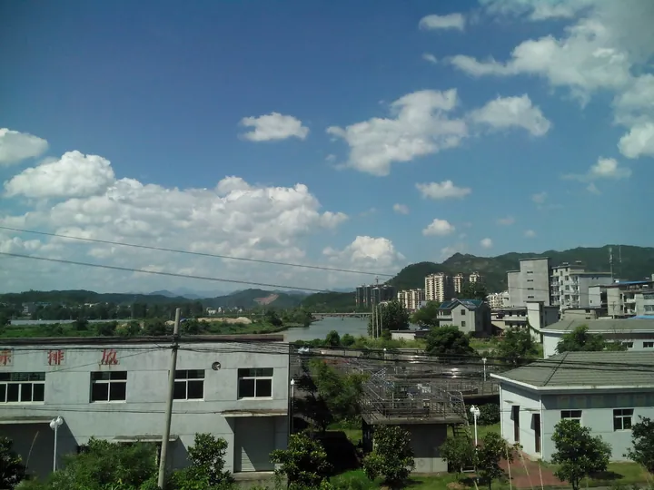
Photo adjustments
Full frame retained; proportionally resized and converted to WebP. No retouching or changes to the photographed subject. Card displays may crop the view.
- Administrative area
- County · 县
- Part of
- Shangrao
- Chinese name
- 横峰县
- Local areas
- County guide
Area & population
- Area in the source
- 655.00 km²
- Population · 2018
- 228,900
Source: cited geographic source, as of the dates shown.
Setting and landscape
Hengfeng lies 35 kilometres from Shangrao city, with Guangxin (广信区) to the east, Yanshan (铅山) to the south, Yiyang (弋阳) to the west and Dexing (德兴) to the north. The county seat is Cenyang town (岑阳镇). A local saying sums up the land as seven parts mountain, half a part water and two parts fields. The Shanghai–Kunming railway and expressway and the Hengfeng–Fuzhou railway (峰福铁路) pass through.
History
The county was cut out of Yiyang in 1560, under the Ming, as Xing'an County (兴安县). Because Guangxi also had a Xing'an, it was renamed in 1914 after Hengfeng Mountain in the north of the county. Hengfeng kilns made imitation Longquan celadon that sold widely across Jiangnan (江南), south of the lower Yangtze, from the Song to the early Republic, at their height in the Yuan and Ming. In December 1927 Fang Zhimin, Shao Shiping (邵式平) and Huang Dao (黄道) led the Yiyang–Hengfeng uprising; the base government later settled at Geyuan, took the name Fujian–Zhejiang–Jiangxi Provincial Soviet Government on 19 November 1932, and in January 1934 was named a "model Soviet province".
What to see
Geyuan is a national historic and cultural town. In Fenglin village (枫林村) the former provincial Soviet government compound is a 664-square-metre house entered through a splayed gateway, and it still holds its old silver vault. Also in Fenglin village are the former provincial Party committee and military headquarters and the Red Army parade ground, a 10,500-square-metre square ringed by 168 tall maple and chinquapin trees where Fang Zhimin held his last rally before marching north on 24 November 1934. These sites became national key cultural relics in 1996. Censhan National Forest Park (岑山国家森林公园), listed in 2008, covers 955 hectares of forest, rock peaks, streams, an old temple and Danxia landforms.
Food and local products
Hengfeng kudzu (横峰葛) is a Chinese geographical-indication product. Hengfeng string-puppet theatre, locally called "peace plays" (平安戏), keeps more than 80 traditional pieces such as the Mulian story and Journey to the West; it joined Jiangxi's provincial intangible-heritage list in May 2008.
Highlights
- Former Fujian–Zhejiang–Jiangxi Provincial Soviet Government 闽浙赣省苏维埃政府旧址: 664-square-metre compound in Fenglin village, Geyuan; national key cultural relic since 1996.
- Red Army parade ground 红军操场旧址: Tree-ringed square where Fang Zhimin held his farewell rally on 24 November 1934.
- Censhan National Forest Park 岑山国家森林公园: 955-hectare park of rock peaks, streams and Danxia landforms, listed in 2008.
- Hengfeng puppet theatre 横峰木偶戏: String-puppet plays with more than 80 traditional pieces; provincial intangible heritage since 2008.
Sources for this guide
横峰县 - 维基百科,自由的百科全书 · Chinese Wikipedia · CC BY-SA 4.0
【“百件革命文物说江西”之革命旧址篇】中共闽浙赣省机关旧址-江西党史学习教育-大江网(中国江西网) · Dajiang Net (jxnews.com.cn)
Original English written from the listed sources and checked sentence by sentence against quoted extracts by a separate reviewer. Updated 2026-09-25.
Explore Hengfeng County
Core places to explore, with English and Chinese names.
Places to explore around Hengfeng County
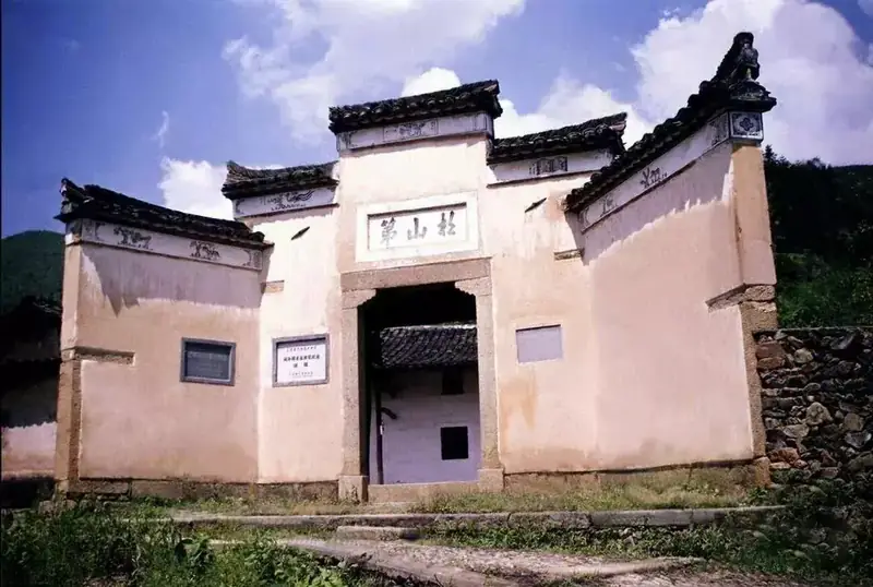 Geyuan Fujian-Zhejiang-Jiangxi Revolutionary Sites ·
 Plan your visit
Getting there
Hengfeng County is about 35 km in a straight line from central Shangrao. Search for 横峰县 in a map app to find stations and your accommodation.
Where to stay →Build your route
Start with Geyuan Fujian-Zhejiang-Jiangxi Revolutionary Sites. The linked place guides have entrance and visit details.
Continue with Shangrao →More in Shangrao
Sources & geographic information
Administrative names and parent areas: Official geographic directory · Reference date 2026-09-06.
Some facts checked against 横峰县 — Wikipedia contributors, CC BY-SA 4.0.
Photo: Geyuan Fujian-Zhejiang-Jiangxi Revolutionary Sites · Source photographer · License not provided. EXIF orientation normalized; resized without changing aspect ratio; converted to WebP. No subject edits.
Map data © OpenStreetMap contributors. Pins mark approximate centres, not entrances or boundaries.