


Get to know Guangfeng District
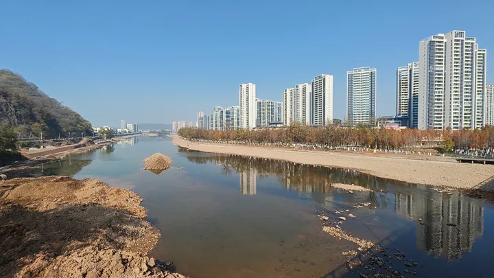
Photo adjustments
Full frame retained; proportionally resized and converted to WebP. No retouching or changes to the photographed subject. Card displays may crop the view.
- Administrative area
- District · 市辖区
- Part of
- Shangrao
- Chinese name
- 广丰区
- Local areas
- District guide
Area & population
- Area in the source
- 1,377.79 km²
- Population · 2017
- 974,367
- Administrative seat
- Yongfeng
Source: cited geographic source, as of the dates shown.
Setting and landscape
Jiangshan (江山) in Zhejiang lies to the east, Pucheng (浦城) in Fujian to the south and Yushan (玉山) to the north. Middle-height mountains rise in the south and east and lower ones in the west and north, around a basin of about 35 by 30 kilometres that opens westward. Its highest point, Tongbo Peak (铜钹山尖, 1,534.6 metres), stands on the Pucheng border. The Fengxi forms where its two headstreams meet at Shatian (沙田镇); it runs 87 of its 117 kilometres through the district and joins the Yushan River at Shangrao to become the Xin River (信江). The climate is subtropical monsoon, averaging 17.9°C with about 1,660 millimetres of rain a year.
History
The Sheshantou site (社山头遗址) at Wudu (五都镇), a Neolithic settlement, is a national key cultural relic. Yongfeng town (永丰镇) was set up in 621, named after Yongfeng Mountain to its north, and became a county in 758. From the Ming it was told apart from the Yongfeng County of Ji'an (吉安) as "Guang-Yongfeng"; in 1732 it was renamed Guangfeng, and in 2015 it became a district of Shangrao. As an old border zone of Wu and Chu, it is called the "head of Wu and tail of Chu" (吴头楚尾). The local Guangfeng dialect belongs to Wu Chinese, and several towns keep Southern Min speech brought by Qing-era migrants from Fujian.
What to see
The south has Danxia landforms around Hengshan (横山镇) and Tongboshan town, including Juntan Reservoir (军潭水库), Baihuayan (白花岩) and Jiuxian Mountain (九仙山), whose hilltop fortress (九仙山城堡), the site of an uprising led by Yang Wen (杨文), is provincially protected. Tongboshan (铜钹山) became a national forest park in October 2002 and covers 19,500 hectares; China National Radio recounts that the area was closed off from settlement for close to a thousand years, from the late Tang to the Ming and Qing. Karst landscape lies mainly in the north, most widely around Paishan (排山镇); Tiangui Rock (天桂岩) is a natural karst cave whose rock inscriptions are provincially protected. Shidu village (十都村) keeps many Ming and Qing buildings, the best known being the Qianlong-era Shidu Great House (十都大屋), with 5,197 square metres of surviving floor space, and Longxi village (龙溪村) has a group of old buildings whose Zhu ancestral hall (祝氏宗祠) is a national key cultural relic.
Food and local products
Guangfeng Majia pomelo (广丰马家柚) and the Guangfeng white-eared yellow chicken (广丰白耳黄鸡) are both Chinese geographical-indication products.
Highlights
- Tongboshan National Forest Park 铜钹山国家森林公园: 19,500-hectare mountain area on the Fujian border, a national forest park since 2002.
- Tiangui Rock 天桂岩: Natural karst cave whose rock inscriptions are provincially protected.
- Shidu Great House 十都大屋: Qianlong-era mansion of 5,197 square metres in Shidu village.
- Zhu ancestral hall, Longxi 龙溪祝氏宗祠: National key cultural relic in the Longxi village building group.
- Guangfeng Majia pomelo 广丰马家柚: Chinese geographical-indication product.
Sources for this guide
广丰区 - 维基百科,自由的百科全书 · Chinese Wikipedia · CC BY-SA 4.0
似梦人间 铜钹山_央广网 · China National Radio (cnr.cn), Jiangxi channel
Original English written from the listed sources and checked sentence by sentence against quoted extracts by a separate reviewer. Updated 2026-09-25.
Explore Guangfeng District
Core places to explore, with English and Chinese names.
Guangfeng District 广丰区
Plan your visit
Getting there
Guangfeng District is about 25 km in a straight line from central Shangrao. Search for 广丰区 in a map app to find stations and your accommodation.
Where to stay →More in Shangrao
Sources & geographic information
Administrative names and parent areas: Official geographic directory · Reference date 2026-09-06.
Some facts checked against 广丰区 — Wikipedia contributors, CC BY-SA 4.0.
Map data © OpenStreetMap contributors. Pins mark approximate centres, not entrances or boundaries.