


Get to know Fuxin Mongol Autonomous County
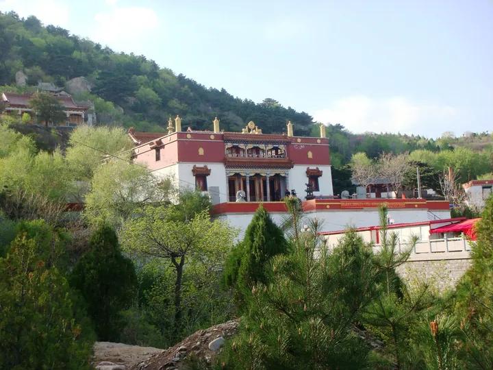
Photo adjustments
Full frame retained; proportionally resized and converted to WebP. No retouching or changes to the photographed subject. Card displays may crop the view.
- Administrative area
- Autonomous county · 自治县
- Part of
- Fuxin
- Chinese name
- 阜新蒙古族自治县
- Local areas
- Autonomous county guide
Area & population
- Area in the source
- 6,217.89 km²
- Population · 2020 census
- 545,749
- Administrative seat
- Fuxin Town
Source: cited geographic source, as of the dates shown.
History
The Qing set up the Tumed Left Banner (土默特左翼旗) here in 1637. Most local Mongols descend from more than 30,000 people of the Mongoljin tribe who moved here from the Hetao region (河套地区) in the early Qing, which is why the area is still called Mongoljin. In 1903 a county was split off from Chaoyang (朝阳县); its name, Fuxin, was taken from a phrase meaning 'goods abundant, all made new', and banner and county ran side by side under separate Mongol and Han administrations. The State Council approved the autonomous county in October 1957, and it was formally founded on 7 April 1958.
By county rules, official seals and signboards are made in both Mongolian and Chinese, and important meetings and documents use both scripts.
What to see
Ruiying Temple (瑞应寺), in Fosi village of Fosi town (佛寺镇), is a Gelug Tibetan Buddhist monastery that Chinese Wikipedia describes as the largest in Northeast China. Mongols call it Gegen Sume (葛根苏木). Building began in 1669, and in 1703 the Kangxi Emperor granted the name Ruiying on a vertical board written in Manchu, Mongolian, Tibetan and Chinese.
Haitang Mountain (海棠山) in Daban town (大板镇) has a lama temple and cliff carvings. In a document on protecting the carvings, the Liaoning culture and tourism department gives the scenic area as 30 square kilometres and counts 270 cliff figures of different sizes, some incised, some in low relief and some with inscriptions; it also names the figures and inscriptions of Pu'an Temple (普安寺) on the mountain.
Two Liao brick pagodas are national protected sites, both listed in 2013. The Dongtashan Pagoda (东塔山塔) in Hongmaozi (红帽子) is an eight-sided, eleven-storey hollow pagoda about 24.4 metres tall. The Tayingzi Pagoda (塔营子塔) is a 32-metre, thirteen-storey pagoda standing a little west of the centre of an old town site that was once Yizhou (懿州) under the Liao.
Highlights
- Ruiying Temple 瑞应寺: Gelug monastery begun in 1669, named by the Kangxi Emperor in 1703.
- Haitang Mountain 海棠山: Lama temple and 270 cliff figures in Daban town.
- Tayingzi Pagoda 塔营子塔: 32-metre Liao pagoda inside the ruins of Yizhou, a national protected site since 2013.
- Dongtashan Pagoda 东塔山塔: Eleven-storey Liao brick pagoda, a national protected site since 2013.
Sources for this guide
阜新蒙古族自治县 - 维基百科,自由的百科全书 · Wikipedia (Chinese) · CC BY-SA 4.0
瑞应寺 - 维基百科,自由的百科全书 · Wikipedia (Chinese) · CC BY-SA 4.0
东塔山塔 - 维基百科,自由的百科全书 · Wikipedia (Chinese) · CC BY-SA 4.0
塔营子塔 - 维基百科,自由的百科全书 · Wikipedia (Chinese) · CC BY-SA 4.0
关于海棠山摩崖造像数字化保护设计方案的意见 · Liaoning Provincial Department of Culture and Tourism
Original English written from the listed sources and checked sentence by sentence against quoted extracts by a separate reviewer. Updated 2026-09-25.
Explore Fuxin Mongol Autonomous County
Core places to explore, with English and Chinese names.
Places to explore around Fuxin Mongol Autonomous County
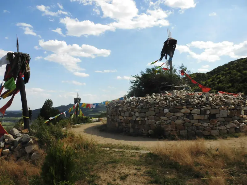 Haitang Mountain ·
 Plan your visit
Getting there
Fuxin Mongol Autonomous County is about 8 km in a straight line from central Fuxin. Search for 阜新蒙古族自治县 in a map app to find stations and your accommodation.
Where to stay →Build your route
Start with Haitang Mountain. The linked place guides have entrance and visit details.
Continue with Fuxin →More in Fuxin
Sources & geographic information
Administrative names and parent areas: Official geographic directory · Reference date 2026-09-06.
Some facts checked against 阜新蒙古族自治县 — Wikipedia contributors, CC BY-SA 4.0.
Some facts checked against 瑞应寺 — Wikipedia contributors, CC BY-SA 4.0.
Some facts checked against 东塔山塔 — Wikipedia contributors, CC BY-SA 4.0.
Some facts checked against 塔营子塔 — Wikipedia contributors, CC BY-SA 4.0.
Photo: Haitang Mountain · Source photographer · License not provided. EXIF orientation normalized; resized without changing aspect ratio; converted to WebP. No subject edits.
Map data © OpenStreetMap contributors. Pins mark approximate centres, not entrances or boundaries.