


Get to know Xinqiu District
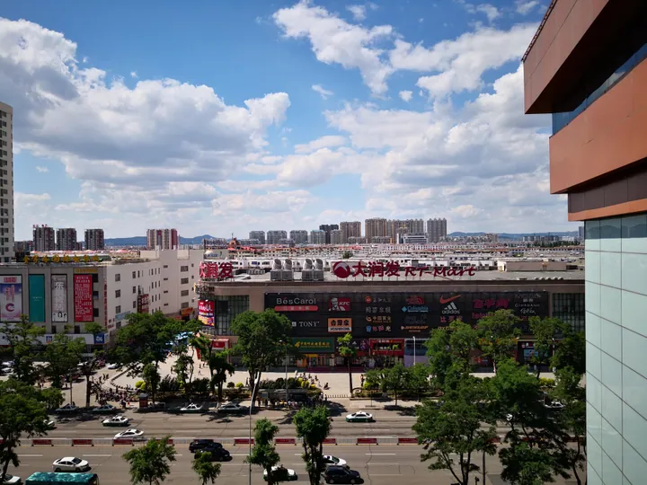
Photo adjustments
Full frame retained; proportionally resized and converted to WebP. No retouching or changes to the photographed subject. Card displays may crop the view.
- Administrative area
- District · 市辖区
- Part of
- Fuxin
- Chinese name
- 新邱区
- Local areas
- District guide
Area & population
- Area in the source
- 122.40 km²
- Population · 2020 census
- 66,769
Source: cited geographic source, as of the dates shown.
Setting and landscape
The autonomous county encircles Xinqiu on all sides except the south-west, where it meets Taiping District (太平区). The district covers 141.7 square kilometres, split between the subdistricts of Jieji (街基街道) and Xinfatun (新发屯街道) and the town of Changyingzi (长营子镇). Fuxin's tourism bureau counts Xinqiu as the eastern end of a geothermal belt that runs west to Qinghemen (清河门区).
History
In 1915 a Japanese engineer investigating the Fuxin coalfield was killed, and Japan obtained mining rights to the Xinqiu field as compensation from the Beiyang government. Under Japanese control, Xinglonggou (兴隆沟) at Xinqiu became one of the four large burial grounds for dead miners. In 1940 a camp for captured Eighth Route Army soldiers and civilians sent as forced labourers was set up at Xiacaiyuanzi (下菜园子) near the Xinqiu mine; on 2 September 1942 about 300 prisoners there staged a revolt, and only a few dozen escaped.
The area became Fuxin's Third District in 1958 and took the name Xinqiu in 1959. In 2002 the State Council moved Changyingzi from Xihe District (细河区) to Xinqiu.
What to see
In January 2019 a 1.3-kilometre off-road track was built inside one of the district's open-pit mines, and in June that year it hosted a round of the China Auto Off-Road Championship. The district government now promotes Xinqiu as a "racing-track city" (赛道城), has held an off-road experience race and has served as a location for short drama series. Qijiazi (七家子村) in Changyingzi is listed by the Fuxin tourism bureau as a provincial key village for rural tourism.
Highlights
- Xinqiu open-pit off-road circuit 新邱区露天矿越野车赛道: 1.3 km track built in a mine pit in 2019; hosted a China Auto Off-Road Championship round that June.
- Qijiazi Village 七家子村: Provincial key village for rural tourism in Changyingzi.
Sources for this guide
新邱区 - 维基百科,自由的百科全书 · Chinese Wikipedia · CC BY-SA 4.0
走进新邱 · Xinqiu District People's Government, Fuxin
阜新万人坑 - 维基百科,自由的百科全书 · Chinese Wikipedia · CC BY-SA 4.0
阜新市旅游资源简介 · Fuxin Municipal Bureau of Culture, Tourism, Radio and Television
2025年政府工作报告 · Xinqiu District People's Government, Fuxin
阜新·自然资源 · Fuxin Municipal People's Government
Original English written from the listed sources and checked sentence by sentence against quoted extracts by a separate reviewer. Updated 2026-09-26.
Explore Xinqiu District
Core places to explore, with English and Chinese names.
Xinqiu District 新邱区
Plan your visit
Getting there
Xinqiu District is about 10 km in a straight line from central Fuxin. Search for 新邱区 in a map app to find stations and your accommodation.
Where to stay →More in Fuxin
Sources & geographic information
Administrative names and parent areas: Official geographic directory · Reference date 2026-09-06.
Some facts checked against 新邱区 — Wikipedia contributors, CC BY-SA 4.0.
Some facts checked against 阜新万人坑 — Wikipedia contributors, CC BY-SA 4.0.
Map data © OpenStreetMap contributors. Pins mark approximate centres, not entrances or boundaries.