


Get to know Zhangwu County
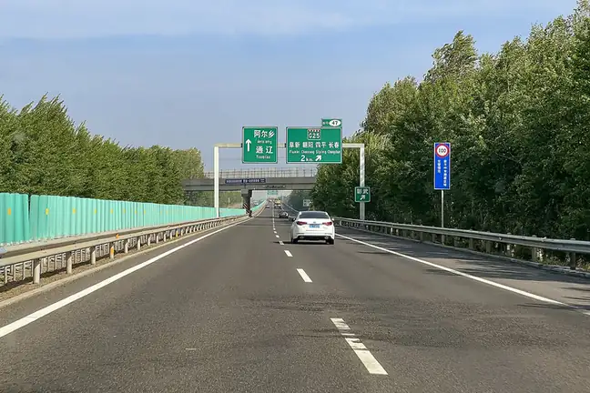
Photo adjustments
EXIF orientation normalized; resized without changing aspect ratio; converted to WebP. No subject edits.
- Administrative area
- County · 县
- Part of
- Fuxin
- Chinese name
- 彰武县
- Local areas
- County guide
Area & population
- Area in the source
- 3,635.00 km²
- Population · 2020 census
- 333,643
- Administrative seat
- Zhangwu Town (彰武镇)
Source: cited geographic source, as of the dates shown.
Setting and landscape
Hure Banner (库伦旗) and Horqin Left Rear Banner (科尔沁左翼后旗) of Inner Mongolia lie to the north; Kangping (康平) and Faku (法库) counties of Shenyang lie to the east. The Qing-era Willow Palisade (柳条边) marks the south-eastern boundary with Xinmin (新民), and across the Raoyang River (绕阳河) to the west is the Fuxin Mongol Autonomous County (阜新蒙古族自治县). The county government puts Fuxin 78 kilometres to the south-west and the provincial capital, Shenyang (沈阳), 93 kilometres to the south-east. Fuxin's tourism bureau describes a landscape of cut gorges, sand lakes and forest, and calls Zhangwu the last area of sand-land scenery in Liaoning. The Yangximu River (养息牧河) flows through the county.
History
The name is said to come from the Mongolian zangutü, "place with cocklebur". In 1645 the Qing court set up an official pasture here called Yangchengmu (杨柽木牧场); it was renamed Yangximu (养息牧牧场) in 1692, and Zhangwu County was created on the pasture land in 1902. The county was placed under Fuxin in January 1959. The tourism bureau dates Zhangwu's sand-control campaign to the 1950s, remembered in the saying "Zhanggutai turned green, and the young men's hair turned white" (绿了章古台,白了少年头).
What to see
Zhanggutai and Sihecheng (四合城) lie in the north of the county, and Fuxin city lists protected areas named after both: the Zhanggutai National Nature Reserve (章古台国家级自然保护区), the Zhanggutai Sand Land National Forest Park (章古台沙地国家级森林公园) and the Sihecheng National Desert Park (四合城国家沙漠公园). Delgerer Grassland (德力格尔草原风景区) in Dade (大德镇) combines hills, water, forest, fields, lakes, grassland and sand, with a grassland scenic road running through it; the tourism bureau lists it as a national study-travel base. Dade village (大德村) is one of Fuxin's three national key villages for rural tourism.
Highlights
- Zhanggutai Sand Land National Forest Park 章古台沙地国家级森林公园: Protected forest on the sand land, linked to the sand-control effort begun in the 1950s.
- Delgerer Grassland 德力格尔草原风景区: Grassland scenic area in Dade with a scenic road; national study-travel base.
- Dade Village 大德村: National key village for rural tourism.
Sources for this guide
彰武县 - 维基百科,自由的百科全书 · Chinese Wikipedia · CC BY-SA 4.0
辽宁·彰武 · Zhangwu County People's Government
阜新市旅游资源简介 · Fuxin Municipal Bureau of Culture, Tourism, Radio and Television
国家AAAA级景区:德力格尔草原风景区 · Fuxin Municipal Bureau of Culture, Tourism, Radio and Television
阜新·自然资源 · Fuxin Municipal People's Government
阜新·历史沿革 · Fuxin Municipal People's Government
Original English written from the listed sources and checked sentence by sentence against quoted extracts by a separate reviewer. Updated 2026-09-26.
Explore Zhangwu County
Core places to explore, with English and Chinese names.
Zhangwu County 彰武县
Plan your visit
Getting there
Zhangwu County is about 80 km in a straight line from central Fuxin. Search for 彰武县 in a map app to find stations and your accommodation.
Where to stay →More in Fuxin
Sources & geographic information
Administrative names and parent areas: Official geographic directory · Reference date 2026-09-06.
Some facts checked against 彰武县 — Wikipedia contributors, CC BY-SA 4.0.
Map data © OpenStreetMap contributors. Pins mark approximate centres, not entrances or boundaries.