


Get to know Mei County
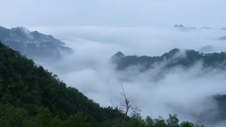
Photo adjustments
Full frame retained; proportionally resized and converted to WebP. No retouching or changes to the photographed subject. Card displays may crop the view.
- Administrative area
- County · 县
- Part of
- Baoji
- Chinese name
- 眉县
- Local areas
- County guide
Area & population
- Area in the source
- 863.00 km²
- Population · 2019
- 324,608
Source: cited geographic source, as of the dates shown.
Setting and landscape
The county covers 863 square kilometres. Mount Taibai stands where Mei, Taibai (太白县) and Zhouzhi (周至县) counties meet; its summit, Baxian Terrace (拔仙台), reaches 3,767.2 metres and divides the Han River and Wei River basins. The high slopes keep Quaternary glacial landforms such as cirques, horns and moraines, and Taibai Mountain National Forest Park lies in the Tangyu (汤峪) forest farm of Mei County.
History
The county government counts Mei among the cradles of the Western Zhou, when it and neighbouring Fufeng formed the Tai (邰国) state. In 794 BC Duke Zhuang of Qin built a town here and named it Meiyi (郿邑) because the terrain looked like an eyebrow. At the end of the Eastern Han the warlord Dong Zhuo (董卓) built his fortress, Meiwu (郿坞), in the county. The county seat moved to its present site in 618, and in 1961 the old character for Mei (郿) was replaced by a simpler one (眉).
Local figures named by the county government include the Qin general Bai Qi (白起), the Tang physician Wang Tao (王焘) and Zhang Zai, founder of the Guan school (关学) and author of the "four aims" (四为).
What to see
Mount Taibai is graded a 5A scenic area, and its tourist zone is a national tourism resort also promoted for hot springs. The Hongheguo (红河谷) forest park and the Fumei Campaign Memorial (扶眉战役纪念馆), a listed Red Tourism site, are 4A areas, and the Zhang Zai Shrine (张载祠) is a 3A area. The county has also built the Longyuan National Wetland Park (龙源国家湿地公园) and a lotus pond of a thousand mu.
Food and local products
Mei County calls itself China's home of the kiwifruit (猕猴桃), and kiwifruit is its leading crop; the county has a national-level kiwifruit wholesale market. Local performing traditions named by the county include Weifeng war drums (威风战鼓), stilt performances and Meihu (眉户) opera.
Getting oriented
The county government places Mei 100 kilometres west of Xi'an and 50 kilometres east of Baoji. The Longhai Railway, the Xuzhou-Lanzhou high-speed railway and the Lianhuo Expressway all cross the county.
Highlights
- Mount Taibai 太白山: Main peak of the Qinling at 3,767.2 metres, with Quaternary glacial landforms; a 5A scenic area.
- Hongheguo 红河谷: Forest park graded a 4A scenic area.
- Fumei Campaign Memorial 扶眉战役纪念馆: 4A area on the national list of classic Red Tourism sites.
- Zhang Zai Shrine 张载祠: 3A area honouring the Song philosopher born in the county.
- Mei County kiwifruit 眉县猕猴桃: The county's leading crop, with a national-level kiwifruit wholesale market.
Sources for this guide
眉县概况 眉县人民政府 · Mei County People's Government
眉县的历史沿革与行政区划 眉县人民政府 · Mei County People's Government
太白山 - 维基百科 · Wikipedia (Chinese) · CC BY-SA 4.0
Original English written from the listed sources and checked sentence by sentence against quoted extracts by a separate reviewer. Updated 2026-09-26.
Explore Mei County
Core places to explore, with English and Chinese names.
Places to explore around Mei County
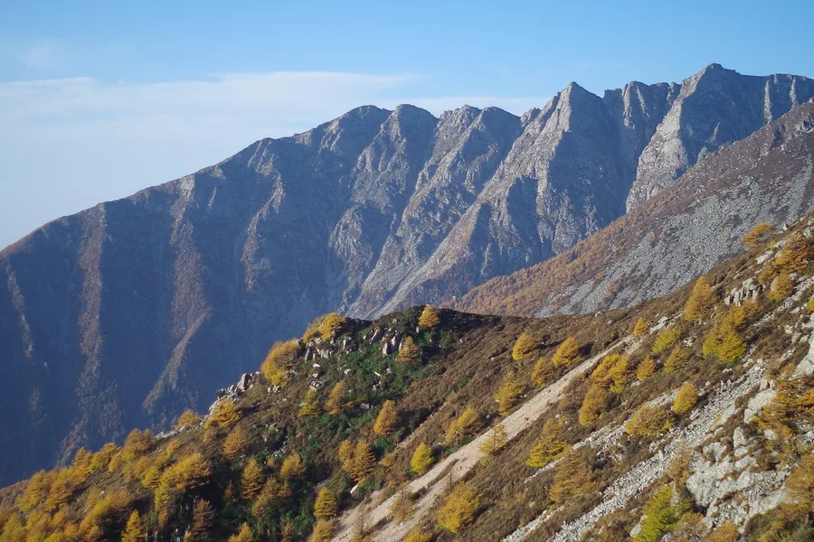 Rocky ridges and autumn-coloured slopes in Mount Taibai National Forest Park, Shaanxi; 4 October 2013.
Mount Taibai太白山
Mount Taibai rises through several vegetation zones to the high Qinling summit of Baxiantai. The mountain’s character changes markedly with elevation: wooded lower slopes give way to colder high-country habitats and landforms…
Read the place guide →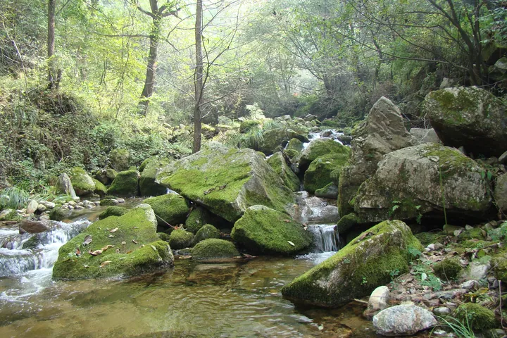 A mountain stream in a wooded valley: clear water flowing over pale gravel and around large moss-covered boulders in the centre and right, a small cascade between two of them, dry leaf litter and stones along the near bank at the left, and dense green woodland rising on both sides with bare trunks among the leaves.
Honghe Valley红河谷
Honghe Valley (红河谷) is a 4A scenic area in Yingtou town, Mei County, Baoji, Shaanxi, a mountain forest park on the Honghe river on the north slope of the Qinling, below the Taibai massif. The provincial news portal gives it three areas and more than thirty named spots.
Read the place guide →Plan your visit
Getting there
Mei County is about 50 km in a straight line from central Baoji. Search for 眉县 in a map app to find stations and your accommodation.
Where to stay →Build your route
Mount Taibai and Honghe Valley are both listed here. The linked place guides have entrance and visit details.
Continue with Baoji →More in Baoji
Sources & geographic information
Administrative names and parent areas: Official geographic directory (dmfw.mca.gov.cn) · Reference date 2026-09-06.
Some facts checked against 太白山 — Wikipedia contributors, CC BY-SA 4.0.
Photo: Mount Taibai · Danielinblue · CC BY-SA 3.0. Proportionally resized and converted to WebP without cropping, retouching or changing the photographed subject.

Photo: Honghe Valley · 山海风 · CC BY-SA 3.0. Full frame retained; proportionally resized and converted to WebP. No retouching or changes to the photographed subject. Card displays may crop the view.

Map data © OpenStreetMap contributors. Pins mark approximate centres, not entrances or boundaries.