


Get to know Ganluo County
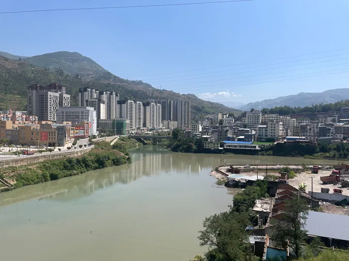
Photo adjustments
Full frame retained; proportionally resized and converted to WebP. No retouching or changes to the photographed subject. Card displays may crop the view.
- Administrative area
- County · 县
- Part of
- Liangshan Yi Autonomous Prefecture
- Chinese name
- 甘洛县
- Local areas
- County guide
Area & population
- Area in the source
- 2,156.00 km²
- Population · 2020
- 205,991
- Administrative seat
- Xinshiba
Source: cited geographic source, as of the dates shown.
What to see
Niujiaohai (牛角海) is a high-altitude lake formed by glacial erosion. Jiuhuandi (九环地) has extensive mountain meadows, while Haitang Ancient Town (海棠古镇) adds a settlement to the landscape itinerary. The Qingxixia Ancient Road (清溪峡古道) entered the seventh national list of protected cultural heritage sites in March 2013.
History
The historic route ran south from Pingba (坪坝) towards Baishagou (白沙沟) in Liaoping (蓼坪). Ming- and Qing-period stations and passes included Haitang Pass (海棠关) and Jianchaping (尖茶坪). A county-government stone marker at the gorge road’s southern entrance defines a protection zone that includes water sources, vegetation and bluestone paving between Shuangshibao (双石包) and Hengyanzi (横岩子).
Sources for this guide
图片新闻 · Economic Daily
探幽甘洛清溪峡古道:贯穿千年历史 古意犹存(组图)_央广网 · CNR, republishing West China Metropolis Daily
Original English written from the listed sources and checked sentence by sentence against quoted extracts by a separate reviewer. Updated 2026-09-27.
Explore Ganluo County
Core places to explore, with English and Chinese names.
Ganluo County 甘洛县
Plan your visit
Getting there
Ganluo County is about 135 km in a straight line from central Liangshan Yi Autonomous Prefecture. Search for 甘洛县 in a map app to find stations and your accommodation.
Where to stay →More in Liangshan Yi Autonomous Prefecture
Sources & geographic information
Administrative names and parent areas: Official geographic directory · Reference date 2026-09-06.
Map data © OpenStreetMap contributors. Pins mark approximate centres, not entrances or boundaries.