


Get to know Jinyang County
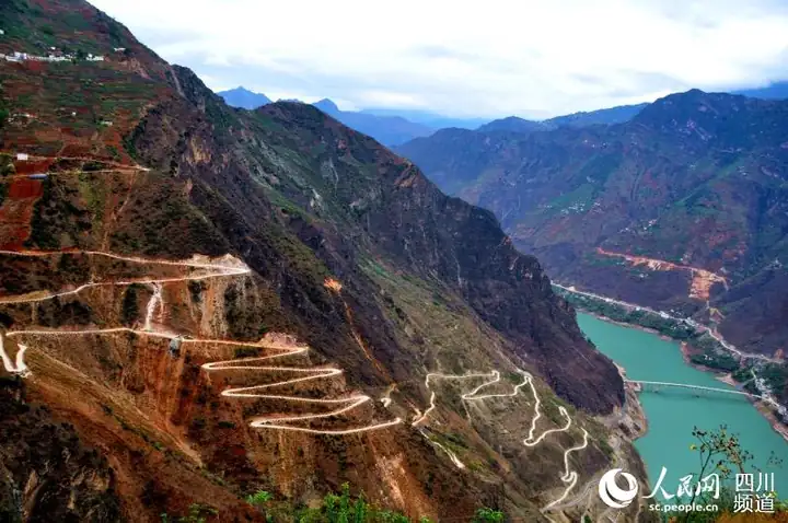
Photo adjustments
EXIF orientation normalized; resized without changing aspect ratio; converted to WebP. No subject edits.
- Administrative area
- County · 县
- Part of
- Liangshan Yi Autonomous Prefecture
- Chinese name
- 金阳县
- Local areas
- County guide
Area & population
- Area in the source
- 1,587.00 km²
- Population · 2020
- 170,063
- Administrative seat
- Tiandiba
Source: cited geographic source, as of the dates shown.
What to see
Boluo Mountain (波洛山), northwest of the county seat, carries wild rhododendrons known locally as suoma flowers (索玛花). Red, white and pink blossoms spread through the mountain woodland and rock crevices. Baicaopo (百草坡) offers broad, rolling meadows; the wider scenic area also includes Longwo Yanzi Cave (龙窝燕子洞) and the Yi village of Bingyidi (丙乙底).
Village culture and food
In Rekejue Village (热柯觉村), a square displays Yi-language inscriptions of legends, proverbs and the Yi solar calendar. Houses have grey tiles, yellow walls and window surrounds decorated in black, red and yellow. Liangshan Daily describes village meals including cured pork, sausages, tuotuorou (坨坨肉), buckwheat cakes and chicken soup with pickled greens.
Sources for this guide
金阳:文旅花开竞芬芳 · Liangshan Government, republishing Liangshan Daily
C视频丨探寻索玛胜境 520到凉山金阳看索玛花_四川在线 · Sichuan Online
520陪你看花海 凉山金阳盛开10万亩索玛花_四川在线 · Sichuan Online
Original English written from the listed sources and checked sentence by sentence against quoted extracts by a separate reviewer. Updated 2026-09-27.
Explore Jinyang County
Core places to explore, with English and Chinese names.
Jinyang County 金阳县
Plan your visit
Getting there
Jinyang County is about 100 km in a straight line from central Liangshan Yi Autonomous Prefecture. Search for 金阳县 in a map app to find stations and your accommodation.
Where to stay →More in Liangshan Yi Autonomous Prefecture
Sources & geographic information
Administrative names and parent areas: Official geographic directory · Reference date 2026-09-06.
Map data © OpenStreetMap contributors. Pins mark approximate centres, not entrances or boundaries.