


Get to know Beidou Township
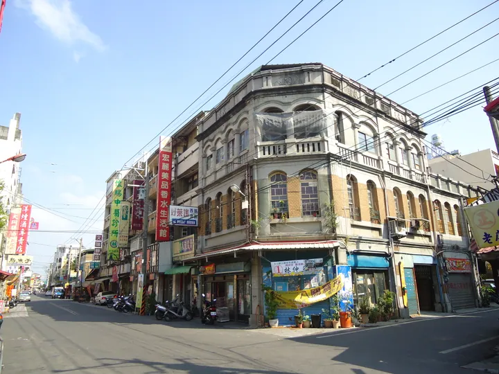
Photo adjustments
Full frame retained; proportionally resized and converted to WebP. No retouching or changes to the photographed subject. Card displays may crop the view.
- Administrative area
- Township · 鎮
- Part of
- Changhua County
- Chinese name
- 北斗鎮
- Local areas
- Township guide
Area & population
- Area in the source
- 19.00 km²
Source: cited geographic source, as of the dates shown.
Records of the town’s beginnings
Dian’an Temple (奠安宮) is dedicated to Mazu (媽祖), the Heavenly Holy Mother. Two stone inscriptions, dated 1808 and 1822, record the establishment of Beidou’s streets. The later inscription explains the temple’s name and a decision to honour six early organisers of the settlement.
Houses and commercial streets
Gongqian Street (宮前街) was a commercial street in both the Qing dynasty and Japanese period, with hotels, rice shops and oil presses. Jinjin Hall (金錦堂), a Lin family residence built in 1924 on Sanmin Street (三民街), combines timber and stone. Its front eaves include carved mythical fish and wooden melon-shaped supports above stone columns.
Sources for this guide
北斗鎮文史觀察 · National Yunlin University of Science and Technology; Chen Guoqing, supervised by Yang Yufu
Original English written from the listed sources and checked sentence by sentence against quoted extracts by a separate reviewer. Updated 2026-09-27.
Explore Beidou Township
Core places to explore, with English and Chinese names.
Beidou Township 北斗鎮
Plan your visit
Getting there
Beidou Township is about 7 km in a straight line from central Changhua County. Search for 北斗鎮 in a map app to find stations and your accommodation.
Where to stay →More in Changhua County
Sources & geographic information
Administrative names and parent areas: Official geographic directory · Reference date 2026-09-06.
Map data © OpenStreetMap contributors. Pins mark approximate centres, not entrances or boundaries.