


Get to know Xiushui Township
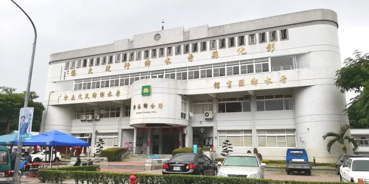
Photo adjustments
Full frame retained; proportionally resized and converted to WebP. No retouching or changes to the photographed subject. Card displays may crop the view.
- Administrative area
- Rural township · 鄉
- Part of
- Changhua County
- Chinese name
- 秀水鄉
- Local areas
- Rural township guide
Area & population
- Area in the source
- 29.34 km²
Source: cited geographic source, as of the dates shown.
Rooms arranged around courtyards
Built in 1846 after the Chen family prospered through trade, the mansion has three rows of principal buildings, side wings and two entrance structures. Courtyards surround the independent main hall. Timber halls have central posts; partitions create private interiors, while connected side-wing rooms included shared kitchens and storage.
Inscriptions and village surroundings
A pair of flagpole bases and a Wenkui plaque (文魁匾額) commemorate a family member’s examination achievement. Calligraphy and painted decoration from the Japanese period survive inside. Elsewhere, Democracy Street (民主街) has a green tunnel of lanren trees (小葉欖仁). Shaanxi Heritage Museum (陝西文物館) displays documents, paintings, historical records and inscribed plaques associated with the village’s Shaanxi connections.
Sources for this guide
國定古蹟環景導覽 - 馬興陳宅(益源大厝) · Taiwan Ministry of Culture Bureau of Cultural Heritage
秀水鄉 (台灣) - 维基百科,自由的百科全书 · Wikipedia contributors · CC BY-SA 4.0
Original English written from the listed sources and checked sentence by sentence against quoted extracts by a separate reviewer. Updated 2026-09-30.
Explore Xiushui Township
Core places to explore, with English and Chinese names.
Xiushui Township 秀水鄉
Plan your visit
Getting there
Xiushui Township is about 10 km in a straight line from central Changhua County. Search for 秀水鄉 in a map app to find stations and your accommodation.
Where to stay →More in Changhua County
Sources & geographic information
Administrative names and parent areas: Official geographic directory · Reference date 2026-09-06.
Some facts checked against 秀水鄉 (台灣) — Wikipedia contributors, CC BY-SA 4.0.
Map data © OpenStreetMap contributors. Pins mark approximate centres, not entrances or boundaries.