


Get to know Fuxing Township
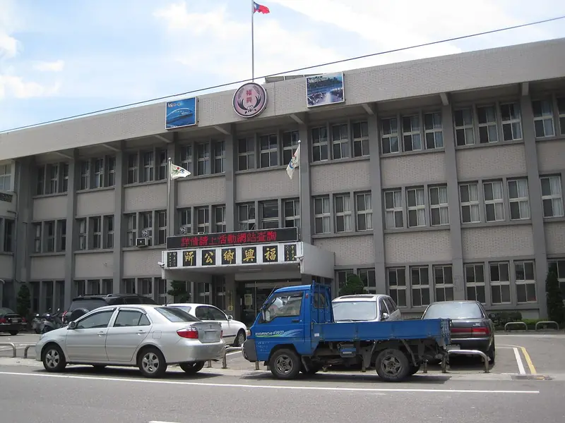
Photo adjustments
EXIF orientation normalized; resized without changing aspect ratio; converted to WebP. No subject edits.
- Administrative area
- Rural township · 鄉
- Part of
- Changhua County
- Chinese name
- 福興鄉
- Local areas
- Rural township guide
Area & population
- Area in the source
- 50.00 km²
Source: cited geographic source, as of the dates shown.
Rice storage with ventilated roofs
Fuxing Granary (福興穀倉), built around 1935, collected rice from surrounding areas. Its distinctive roof “tiger windows” provide ventilation and release heat. The county’s account also describes walls made using rice husks, straw and clay, preserving the material construction of a Japanese-period farming building.
Wetlands and village art
Fubao Wetland (福寶溼地) occupies saline coastal land and supports waterbirds beside oyster-growing shallows. Fubao village’s house walls have painted dairy-cow designs. The Shell Temple (三清三元宮貝殼廟) was created from 1970 by Huang Qichun (黃奇春), using shells as its main decoration. Former Waipu airfield defence towers survive in Panpo (番婆) and Waipu (外埔) villages.
Sources for this guide
福興穀倉-遊憩景點-彰化旅遊資訊網 · Changhua County Government
福興鄉 (台灣) - 维基百科,自由的百科全书 · Wikipedia contributors · CC BY-SA 4.0
Fuxing, Changhua · Wikipedia contributors · CC BY-SA 4.0
Original English written from the listed sources and checked sentence by sentence against quoted extracts by a separate reviewer. Updated 2026-09-30.
Explore Fuxing Township
Core places to explore, with English and Chinese names.
Fuxing Township 福興鄉
Plan your visit
Getting there
Fuxing Township is about 15 km in a straight line from central Changhua County. Search for 福興鄉 in a map app to find stations and your accommodation.
Where to stay →More in Changhua County
Sources & geographic information
Administrative names and parent areas: Official geographic directory · Reference date 2026-09-06.
Some facts checked against 福興鄉 (台灣) — Wikipedia contributors, CC BY-SA 4.0.
Some facts checked against Fuxing, Changhua — Wikipedia contributors, CC BY-SA 4.0.
Map data © OpenStreetMap contributors. Pins mark approximate centres, not entrances or boundaries.